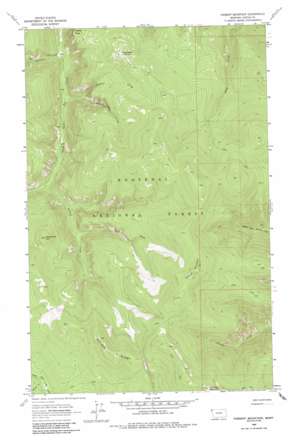
Parsnip Mountain Topo Map Montana
To zoom in, hover over the map of Parsnip Mountain
USGS Topo Quad 48115f4 - 1:24,000 scale
| Topo Map Name: | Parsnip Mountain |
| USGS Topo Quad ID: | 48115f4 |
| Print Size: | ca. 21 1/4" wide x 27" high |
| Southeast Coordinates: | 48.625° N latitude / 115.375° W longitude |
| Map Center Coordinates: | 48.6875° N latitude / 115.4375° W longitude |
| U.S. State: | MT |
| Filename: | o48115f4.jpg |
| Download Map JPG Image: | Parsnip Mountain topo map 1:24,000 scale |
| Map Type: | Topographic |
| Topo Series: | 7.5´ |
| Map Scale: | 1:24,000 |
| Source of Map Images: | United States Geological Survey (USGS) |
| Alternate Map Versions: |
Parsnip Mountain MT 1963, updated 1966 Download PDF Buy paper map Parsnip Mountain MT 1963, updated 1984 Download PDF Buy paper map Parsnip Mountain MT 1997, updated 2000 Download PDF Buy paper map Parsnip Mountain MT 2011 Download PDF Buy paper map Parsnip Mountain MT 2014 Download PDF Buy paper map |
| FStopo: | US Forest Service topo Parsnip Mountain is available: Download FStopo PDF Download FStopo TIF |
1:24,000 Topo Quads surrounding Parsnip Mountain
> Back to 48115e1 at 1:100,000 scale
> Back to 48114a1 at 1:250,000 scale
> Back to U.S. Topo Maps home
Parsnip Mountain topo map: Gazetteer
Parsnip Mountain: Streams
Bruin Creek elevation 1320m 4330′Charlie Creek elevation 1088m 3569′
Copeland Creek elevation 983m 3225′
East Fork Lookout Creek elevation 1196m 3923′
Lookout Creek elevation 1095m 3592′
Maxine Creek elevation 1017m 3336′
Parsnip Mountain: Summits
Garden Ridge elevation 1797m 5895′Lawrence Mountain elevation 1880m 6167′
Maxine Point elevation 1429m 4688′
Parsnip Mountain elevation 1865m 6118′
Pinto Point elevation 1610m 5282′
South Fork Hill elevation 1640m 5380′
Parsnip Mountain digital topo map on disk
Buy this Parsnip Mountain topo map showing relief, roads, GPS coordinates and other geographical features, as a high-resolution digital map file on DVD:


