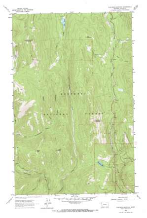
Flatiron Mountain Topo Map Montana
To zoom in, hover over the map of Flatiron Mountain
USGS Topo Quad 48115f6 - 1:24,000 scale
| Topo Map Name: | Flatiron Mountain |
| USGS Topo Quad ID: | 48115f6 |
| Print Size: | ca. 21 1/4" wide x 27" high |
| Southeast Coordinates: | 48.625° N latitude / 115.625° W longitude |
| Map Center Coordinates: | 48.6875° N latitude / 115.6875° W longitude |
| U.S. State: | MT |
| Filename: | o48115f6.jpg |
| Download Map JPG Image: | Flatiron Mountain topo map 1:24,000 scale |
| Map Type: | Topographic |
| Topo Series: | 7.5´ |
| Map Scale: | 1:24,000 |
| Source of Map Images: | United States Geological Survey (USGS) |
| Alternate Map Versions: |
Flatiron Mountain MT 1963, updated 1966 Download PDF Buy paper map Flatiron Mountain MT 1997, updated 2000 Download PDF Buy paper map Flatiron Mountain MT 2011 Download PDF Buy paper map Flatiron Mountain MT 2014 Download PDF Buy paper map |
| FStopo: | US Forest Service topo Flatiron Mountain is available: Download FStopo PDF Download FStopo TIF |
1:24,000 Topo Quads surrounding Flatiron Mountain
> Back to 48115e1 at 1:100,000 scale
> Back to 48114a1 at 1:250,000 scale
> Back to U.S. Topo Maps home
Flatiron Mountain topo map: Gazetteer
Flatiron Mountain: Dams
Lake Rene Dam elevation 1150m 3772′Flatiron Mountain: Lakes
Lake Rene elevation 1152m 3779′Rainbow Lake elevation 1278m 4192′
Flatiron Mountain: Streams
Can Creek elevation 1072m 3517′Hemlock Creek elevation 980m 3215′
Mule Creek elevation 975m 3198′
Papoose Creek elevation 1196m 3923′
Sheepherder Creek elevation 1197m 3927′
Smoot Creek elevation 1138m 3733′
Zulu Creek elevation 1120m 3674′
Flatiron Mountain: Summits
Chief Peak elevation 1536m 5039′Clay Mountain elevation 1521m 4990′
Flatiron Mountain elevation 1764m 5787′
Indian Peak elevation 1523m 4996′
Sheepherder Mountain elevation 1935m 6348′
Flatiron Mountain digital topo map on disk
Buy this Flatiron Mountain topo map showing relief, roads, GPS coordinates and other geographical features, as a high-resolution digital map file on DVD:


