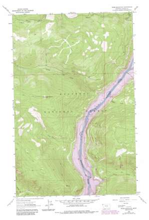
Webb Mountain Topo Map Montana
To zoom in, hover over the map of Webb Mountain
USGS Topo Quad 48115g3 - 1:24,000 scale
| Topo Map Name: | Webb Mountain |
| USGS Topo Quad ID: | 48115g3 |
| Print Size: | ca. 21 1/4" wide x 27" high |
| Southeast Coordinates: | 48.75° N latitude / 115.25° W longitude |
| Map Center Coordinates: | 48.8125° N latitude / 115.3125° W longitude |
| U.S. State: | MT |
| Filename: | o48115g3.jpg |
| Download Map JPG Image: | Webb Mountain topo map 1:24,000 scale |
| Map Type: | Topographic |
| Topo Series: | 7.5´ |
| Map Scale: | 1:24,000 |
| Source of Map Images: | United States Geological Survey (USGS) |
| Alternate Map Versions: |
Webb Mountain MT 1963, updated 1966 Download PDF Buy paper map Webb Mountain MT 1963, updated 1984 Download PDF Buy paper map Webb Mountain MT 1997, updated 2000 Download PDF Buy paper map Webb Mountain MT 2011 Download PDF Buy paper map Webb Mountain MT 2014 Download PDF Buy paper map |
| FStopo: | US Forest Service topo Webb Mountain is available: Download FStopo PDF Download FStopo TIF |
1:24,000 Topo Quads surrounding Webb Mountain
> Back to 48115e1 at 1:100,000 scale
> Back to 48114a1 at 1:250,000 scale
> Back to U.S. Topo Maps home
Webb Mountain topo map: Gazetteer
Webb Mountain: Bridges
Koocanusa Bridge elevation 751m 2463′Webb Mountain: Cliffs
Stone Hill elevation 1063m 3487′Webb Mountain: Falls
Sutton Creek Falls elevation 1101m 3612′Webb Mountain: Streams
Boulder Creek elevation 751m 2463′Burro Creek elevation 1157m 3795′
Falls Creek elevation 833m 2732′
Fan Creek elevation 1245m 4084′
Gold Creek elevation 751m 2463′
Little North Fork elevation 813m 2667′
Pinkham Creek elevation 751m 2463′
Sutton Creek elevation 751m 2463′
Webb Mountain: Summits
Cliff Point elevation 1379m 4524′Scalp Mountain elevation 1749m 5738′
Webb Mountain elevation 1825m 5987′
Webb Mountain: Valleys
Holdup Gulch elevation 751m 2463′Simons Draw elevation 875m 2870′
Webb Mountain digital topo map on disk
Buy this Webb Mountain topo map showing relief, roads, GPS coordinates and other geographical features, as a high-resolution digital map file on DVD:


