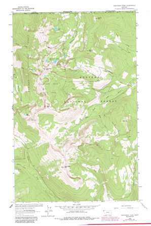
Northwest Peak Topo Map Montana
To zoom in, hover over the map of Northwest Peak
USGS Topo Quad 48115h8 - 1:24,000 scale
| Topo Map Name: | Northwest Peak |
| USGS Topo Quad ID: | 48115h8 |
| Print Size: | ca. 21 1/4" wide x 27" high |
| Southeast Coordinates: | 48.875° N latitude / 115.875° W longitude |
| Map Center Coordinates: | 48.9375° N latitude / 115.9375° W longitude |
| U.S. State: | MT |
| Filename: | o48115h8.jpg |
| Download Map JPG Image: | Northwest Peak topo map 1:24,000 scale |
| Map Type: | Topographic |
| Topo Series: | 7.5´ |
| Map Scale: | 1:24,000 |
| Source of Map Images: | United States Geological Survey (USGS) |
| Alternate Map Versions: |
Northwest Peak MT 1963, updated 1966 Download PDF Buy paper map Northwest Peak MT 1963, updated 1984 Download PDF Buy paper map Northwest Peak MT 1997, updated 2000 Download PDF Buy paper map Northwest Peak MT 2011 Download PDF Buy paper map Northwest Peak MT 2014 Download PDF Buy paper map |
| FStopo: | US Forest Service topo Northwest Peak is available: Download FStopo PDF Download FStopo TIF |
1:24,000 Topo Quads surrounding Northwest Peak
Eastport |
Canuck Peak |
Northwest Peak |
Garver Mountain |
Bonnet Top |
Meadow Creek |
Line Point |
Mount Baldy |
Clark Mountain |
Yaak |
Moyie Springs |
Curley Creek |
Newton Mountain |
Sylvanite |
Flatiron Mountain |
> Back to 48115e1 at 1:100,000 scale
> Back to 48114a1 at 1:250,000 scale
> Back to U.S. Topo Maps home
Northwest Peak topo map: Gazetteer
Northwest Peak: Lakes
Hawkins Lakes elevation 2006m 6581′Lake Florence elevation 1914m 6279′
Northwest Peak: Parks
Northwest Peak Scenic Area elevation 1938m 6358′Northwest Peak: Ranges
Purcell Mountains elevation 2349m 7706′Northwest Peak: Streams
Aster Creek elevation 1452m 4763′Davis Creek elevation 1420m 4658′
Hidden Creek elevation 1429m 4688′
Honey Creek elevation 1470m 4822′
Midge Creek elevation 1483m 4865′
Winkum Creek elevation 1401m 4596′
Northwest Peak: Summits
Black Top elevation 1977m 6486′Cooney Peak elevation 2026m 6646′
Davis Mountain elevation 2309m 7575′
Marmot Mountain elevation 2112m 6929′
Northwest Peak elevation 2347m 7700′
Rock Candy Mountain elevation 2198m 7211′
Northwest Peak digital topo map on disk
Buy this Northwest Peak topo map showing relief, roads, GPS coordinates and other geographical features, as a high-resolution digital map file on DVD:


