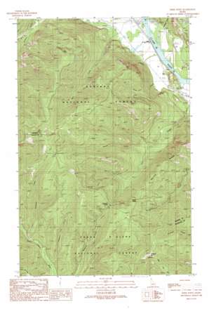
Derr Point Topo Map Idaho
To zoom in, hover over the map of Derr Point
USGS Topo Quad 48116a2 - 1:24,000 scale
| Topo Map Name: | Derr Point |
| USGS Topo Quad ID: | 48116a2 |
| Print Size: | ca. 21 1/4" wide x 27" high |
| Southeast Coordinates: | 48° N latitude / 116.125° W longitude |
| Map Center Coordinates: | 48.0625° N latitude / 116.1875° W longitude |
| U.S. State: | ID |
| Filename: | o48116a2.jpg |
| Download Map JPG Image: | Derr Point topo map 1:24,000 scale |
| Map Type: | Topographic |
| Topo Series: | 7.5´ |
| Map Scale: | 1:24,000 |
| Source of Map Images: | United States Geological Survey (USGS) |
| Alternate Map Versions: |
Derr Point ID 1989, updated 1989 Download PDF Buy paper map Derr Point ID 1996, updated 1999 Download PDF Buy paper map Derr Point ID 2011 Download PDF Buy paper map Derr Point ID 2013 Download PDF Buy paper map |
| FStopo: | US Forest Service topo Derr Point is available: Download FStopo PDF Download FStopo TIF |
1:24,000 Topo Quads surrounding Derr Point
> Back to 48116a1 at 1:100,000 scale
> Back to 48116a1 at 1:250,000 scale
> Back to U.S. Topo Maps home
Derr Point topo map: Gazetteer
Derr Point: Gaps
Buckskin Saddle elevation 1352m 4435′Derr Point: Ridges
Delyle Ridge elevation 1320m 4330′Derr Point: Streams
Dahlman Creek elevation 1062m 3484′Delyle Creek elevation 791m 2595′
Mosquito Creek elevation 1165m 3822′
North Fork Delyle Creek elevation 774m 2539′
North Fork Twin Creek elevation 770m 2526′
Ruen Creek elevation 658m 2158′
Twin Creek elevation 634m 2080′
West Johnson Creek elevation 820m 2690′
Derr Point: Summits
Derr Point elevation 1572m 5157′Whitetail Peak elevation 1675m 5495′
Derr Point: Valleys
McQuade Gulch elevation 636m 2086′Derr Point digital topo map on disk
Buy this Derr Point topo map showing relief, roads, GPS coordinates and other geographical features, as a high-resolution digital map file on DVD:


