Cocolalla Topo Map Idaho
To zoom in, hover over the map of Cocolalla
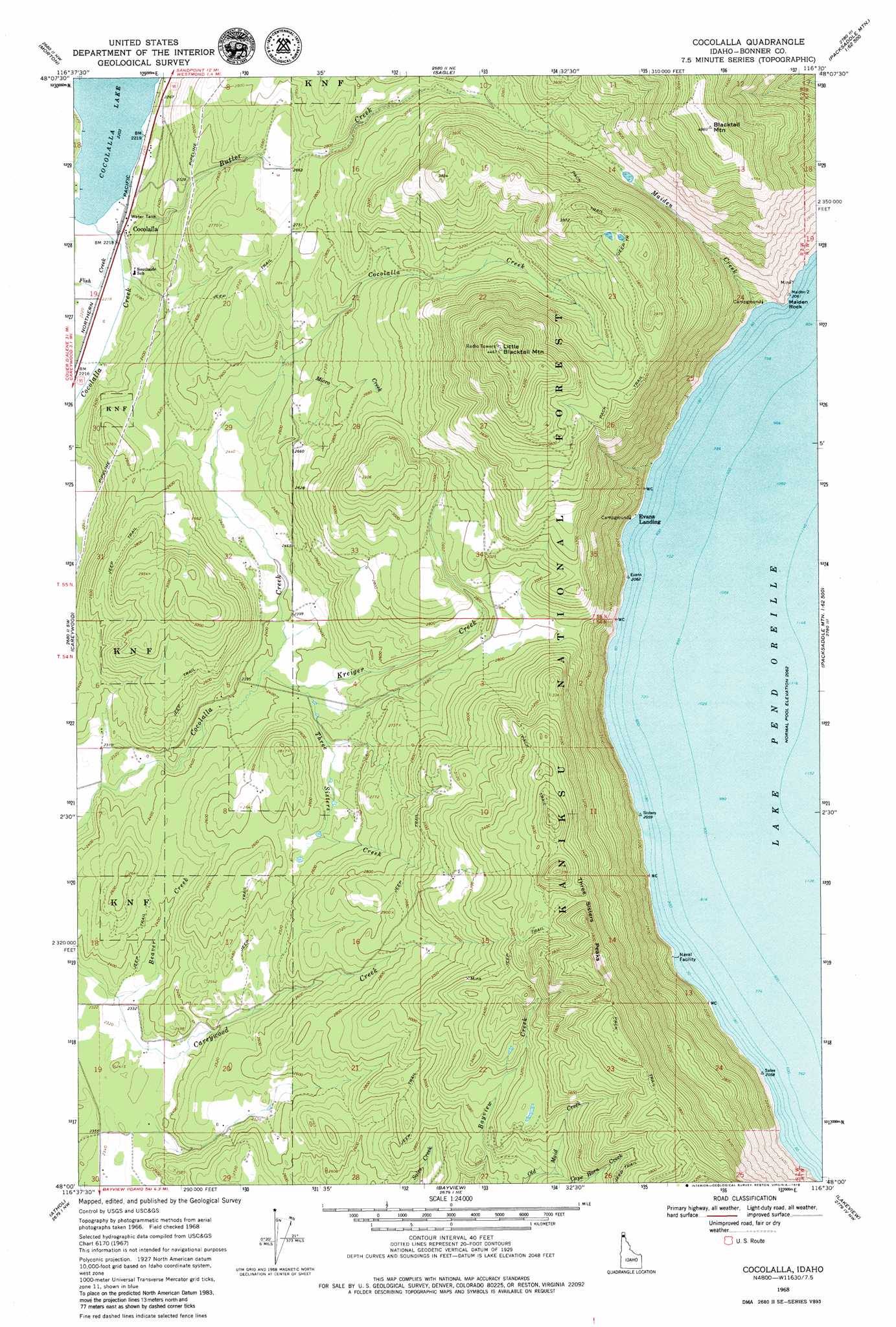
USGS Topo Quad 48116a5 - 1:24,000 scale
| Topo Map Name: | Cocolalla |
| USGS Topo Quad ID: | 48116a5 |
| Print Size: | ca. 21 1/4" wide x 27" high |
| Southeast Coordinates: | 48° N latitude / 116.5° W longitude |
| Map Center Coordinates: | 48.0625° N latitude / 116.5625° W longitude |
| U.S. State: | ID |
| Filename: | o48116a5.jpg |
| Download Map JPG Image: | Cocolalla topo map 1:24,000 scale |
| Map Type: | Topographic |
| Topo Series: | 7.5´ |
| Map Scale: | 1:24,000 |
| Source of Map Images: | United States Geological Survey (USGS) |
| Alternate Map Versions: |
Cocolalla ID 1968, updated 1971 Download PDF Buy paper map Cocolalla ID 1996, updated 1999 Download PDF Buy paper map Cocolalla ID 2011 Download PDF Buy paper map Cocolalla ID 2013 Download PDF Buy paper map |
| FStopo: | US Forest Service topo Cocolalla is available: Download FStopo PDF Download FStopo TIF |
1:24,000 Topo Quads surrounding Cocolalla
Prater Mountain |
Happy Fork Gap |
Sandpoint |
Oden Bay |
Trout Peak |
Laclede |
Morton |
Sagle |
Talache |
Hope |
Edgemere |
Careywood |
Cocolalla |
Minerva Peak |
Packsaddle Mountain |
Spirit Lake East |
Athol |
Bayview |
Lakeview |
Faset Peak |
Hayden |
Hayden Lake |
Spades Mountain |
Cataract Peak |
Lamb Peak |
> Back to 48116a1 at 1:100,000 scale
> Back to 48116a1 at 1:250,000 scale
> Back to U.S. Topo Maps home
Cocolalla topo map: Gazetteer
Cocolalla: Capes
Maiden Rock elevation 684m 2244′Cocolalla: Populated Places
Cocolalla elevation 677m 2221′Evans Landing elevation 641m 2103′
Cocolalla: Streams
Beaver Creek elevation 708m 2322′Butler Creek elevation 710m 2329′
Cape Horn Creek elevation 942m 3090′
Fish Creek elevation 676m 2217′
Kreiger Creek elevation 726m 2381′
Maiden Creek elevation 633m 2076′
Micro Creek elevation 779m 2555′
Three Sisters Creek elevation 732m 2401′
Cocolalla: Summits
Blacktail Mountain elevation 1512m 4960′Little Blacktail Mountain elevation 1350m 4429′
Three Sisters Peaks elevation 1212m 3976′
Cocolalla digital topo map on disk
Buy this Cocolalla topo map showing relief, roads, GPS coordinates and other geographical features, as a high-resolution digital map file on DVD: