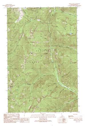
Trestle Peak Topo Map Idaho
To zoom in, hover over the map of Trestle Peak
USGS Topo Quad 48116c2 - 1:24,000 scale
| Topo Map Name: | Trestle Peak |
| USGS Topo Quad ID: | 48116c2 |
| Print Size: | ca. 21 1/4" wide x 27" high |
| Southeast Coordinates: | 48.25° N latitude / 116.125° W longitude |
| Map Center Coordinates: | 48.3125° N latitude / 116.1875° W longitude |
| U.S. State: | ID |
| Filename: | o48116c2.jpg |
| Download Map JPG Image: | Trestle Peak topo map 1:24,000 scale |
| Map Type: | Topographic |
| Topo Series: | 7.5´ |
| Map Scale: | 1:24,000 |
| Source of Map Images: | United States Geological Survey (USGS) |
| Alternate Map Versions: |
Trestle Peak ID 1989, updated 1989 Download PDF Buy paper map Trestle Peak ID 1996, updated 1999 Download PDF Buy paper map Trestle Peak ID 2011 Download PDF Buy paper map Trestle Peak ID 2013 Download PDF Buy paper map |
| FStopo: | US Forest Service topo Trestle Peak is available: Download FStopo PDF Download FStopo TIF |
1:24,000 Topo Quads surrounding Trestle Peak
> Back to 48116a1 at 1:100,000 scale
> Back to 48116a1 at 1:250,000 scale
> Back to U.S. Topo Maps home
Trestle Peak topo map: Gazetteer
Trestle Peak: Basins
Auxor Basin elevation 1499m 4917′Trestle Peak: Falls
Char Falls elevation 1263m 4143′Trestle Peak: Lakes
Blacktail Lake elevation 1689m 5541′Trestle Peak: Mines
Auxor Mine elevation 1673m 5488′Trestle Peak: Ridges
Trestle Ridge elevation 1849m 6066′Trestle Peak: Streams
Bear Creek elevation 1058m 3471′Cedar Creek elevation 930m 3051′
Deer Creek elevation 1220m 4002′
Fall Creek elevation 1130m 3707′
Jost Creek elevation 942m 3090′
Lunch Creek elevation 1302m 4271′
Mink Creek elevation 1002m 3287′
Moose Creek elevation 1322m 4337′
Mud Creek elevation 957m 3139′
Nosebag Creek elevation 1370m 4494′
Quartz Creek elevation 1206m 3956′
Rattle Creek elevation 1092m 3582′
Sheep Creek elevation 1073m 3520′
Silvertip Creek elevation 885m 2903′
Smorgasbord Creek elevation 1414m 4639′
South Fork Porcupine Creek elevation 1059m 3474′
South Fork Wellington Creek elevation 1178m 3864′
Steep Creek elevation 978m 3208′
Wellington Creek elevation 963m 3159′
Trestle Peak: Summits
Lunch Peak elevation 1922m 6305′Round Top Mountain elevation 1840m 6036′
Trestle Peak elevation 1908m 6259′
Trestle Peak: Trails
Shertz Trail elevation 1800m 5905′Trestle Peak digital topo map on disk
Buy this Trestle Peak topo map showing relief, roads, GPS coordinates and other geographical features, as a high-resolution digital map file on DVD:


