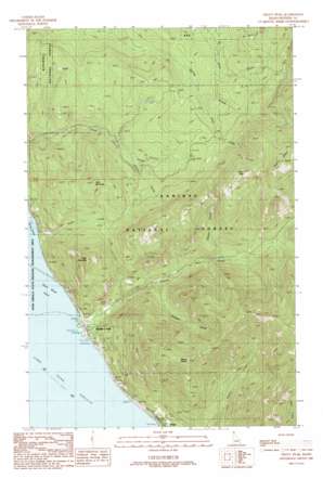
Trout Peak Topo Map Idaho
To zoom in, hover over the map of Trout Peak
USGS Topo Quad 48116c3 - 1:24,000 scale
| Topo Map Name: | Trout Peak |
| USGS Topo Quad ID: | 48116c3 |
| Print Size: | ca. 21 1/4" wide x 27" high |
| Southeast Coordinates: | 48.25° N latitude / 116.25° W longitude |
| Map Center Coordinates: | 48.3125° N latitude / 116.3125° W longitude |
| U.S. State: | ID |
| Filename: | o48116c3.jpg |
| Download Map JPG Image: | Trout Peak topo map 1:24,000 scale |
| Map Type: | Topographic |
| Topo Series: | 7.5´ |
| Map Scale: | 1:24,000 |
| Source of Map Images: | United States Geological Survey (USGS) |
| Alternate Map Versions: |
Trout Peak ID 1989, updated 1989 Download PDF Buy paper map Trout Peak ID 1996, updated 1999 Download PDF Buy paper map Trout Peak ID 2011 Download PDF Buy paper map Trout Peak ID 2013 Download PDF Buy paper map |
| FStopo: | US Forest Service topo Trout Peak is available: Download FStopo PDF Download FStopo TIF |
1:24,000 Topo Quads surrounding Trout Peak
> Back to 48116a1 at 1:100,000 scale
> Back to 48116a1 at 1:250,000 scale
> Back to U.S. Topo Maps home
Trout Peak topo map: Gazetteer
Trout Peak: Populated Places
Trestle Creek elevation 636m 2086′Trout Peak: Streams
Angel Creek elevation 630m 2066′Char Creek elevation 954m 3129′
Cochran Creek elevation 729m 2391′
Glazier Creek elevation 838m 2749′
Kirby Creek elevation 633m 2076′
Pack River elevation 630m 2066′
Shertz Creek elevation 839m 2752′
State Creek elevation 923m 3028′
Trestle Creek elevation 630m 2066′
Trout Peak: Summits
Grief Mountain elevation 1326m 4350′Kirby Mountain elevation 1236m 4055′
Mount Eagen elevation 1601m 5252′
Mount Marion elevation 1582m 5190′
Trout Peak elevation 1591m 5219′
Trout Peak: Valleys
Cochran Draw elevation 729m 2391′Trout Peak digital topo map on disk
Buy this Trout Peak topo map showing relief, roads, GPS coordinates and other geographical features, as a high-resolution digital map file on DVD:


