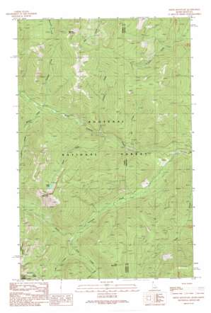
Smith Mountain Topo Map Idaho
To zoom in, hover over the map of Smith Mountain
USGS Topo Quad 48116d1 - 1:24,000 scale
| Topo Map Name: | Smith Mountain |
| USGS Topo Quad ID: | 48116d1 |
| Print Size: | ca. 21 1/4" wide x 27" high |
| Southeast Coordinates: | 48.375° N latitude / 116° W longitude |
| Map Center Coordinates: | 48.4375° N latitude / 116.0625° W longitude |
| U.S. States: | ID, MT |
| Filename: | o48116d1.jpg |
| Download Map JPG Image: | Smith Mountain topo map 1:24,000 scale |
| Map Type: | Topographic |
| Topo Series: | 7.5´ |
| Map Scale: | 1:24,000 |
| Source of Map Images: | United States Geological Survey (USGS) |
| Alternate Map Versions: |
Smith Mountain ID 1989, updated 1989 Download PDF Buy paper map Smith Mountain ID 1997, updated 2000 Download PDF Buy paper map Smith Mountain ID 2011 Download PDF Buy paper map Smith Mountain ID 2013 Download PDF Buy paper map |
| FStopo: | US Forest Service topo Smith Mountain is available: Download FStopo PDF Download FStopo TIF |
1:24,000 Topo Quads surrounding Smith Mountain
> Back to 48116a1 at 1:100,000 scale
> Back to 48116a1 at 1:250,000 scale
> Back to U.S. Topo Maps home
Smith Mountain topo map: Gazetteer
Smith Mountain: Lakes
Lake Estelle elevation 1758m 5767′Smith Lake elevation 1736m 5695′
Smith Mountain: Streams
Camp Creek elevation 1304m 4278′Caribou Creek elevation 1182m 3877′
Frezkat Creek elevation 942m 3090′
Glad Creek elevation 1078m 3536′
Jill Creek elevation 912m 2992′
Lost Creek elevation 1147m 3763′
North Callahan Creek elevation 818m 2683′
Smith Creek elevation 937m 3074′
South Callahan Creek elevation 818m 2683′
Sweasey Creek elevation 1086m 3562′
Willard Creek elevation 1074m 3523′
Smith Mountain: Summits
Long Mountain elevation 1859m 6099′Roberts Mountain elevation 2038m 6686′
Smith Mountain elevation 1963m 6440′
Smith Mountain digital topo map on disk
Buy this Smith Mountain topo map showing relief, roads, GPS coordinates and other geographical features, as a high-resolution digital map file on DVD:


