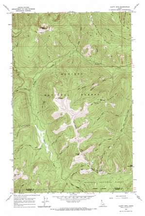
Clifty Mountain Topo Map Idaho
To zoom in, hover over the map of Clifty Mountain
USGS Topo Quad 48116e2 - 1:24,000 scale
| Topo Map Name: | Clifty Mountain |
| USGS Topo Quad ID: | 48116e2 |
| Print Size: | ca. 21 1/4" wide x 27" high |
| Southeast Coordinates: | 48.5° N latitude / 116.125° W longitude |
| Map Center Coordinates: | 48.5625° N latitude / 116.1875° W longitude |
| U.S. State: | ID |
| Filename: | o48116e2.jpg |
| Download Map JPG Image: | Clifty Mountain topo map 1:24,000 scale |
| Map Type: | Topographic |
| Topo Series: | 7.5´ |
| Map Scale: | 1:24,000 |
| Source of Map Images: | United States Geological Survey (USGS) |
| Alternate Map Versions: |
Clifty Mtn ID 1965, updated 1967 Download PDF Buy paper map Clifty Mountain ID 1996, updated 1999 Download PDF Buy paper map Clifty Mountain ID 2011 Download PDF Buy paper map Clifty Mountain ID 2013 Download PDF Buy paper map |
| FStopo: | US Forest Service topo Clifty Mountain is available: Download FStopo PDF Download FStopo TIF |
1:24,000 Topo Quads surrounding Clifty Mountain
> Back to 48116e1 at 1:100,000 scale
> Back to 48116a1 at 1:250,000 scale
> Back to U.S. Topo Maps home
Clifty Mountain topo map: Gazetteer
Clifty Mountain: Lakes
Divide Lake elevation 1774m 5820′Clifty Mountain: Mines
Boulder Mine elevation 1417m 4648′Clifty Mountain: Parks
Hunt Girl Creek Research Natural Area elevation 1444m 4737′Clifty Mountain: Ridges
McGinty Ridge elevation 1623m 5324′Slate Ridge elevation 1617m 5305′
Clifty Mountain: Streams
Black Creek elevation 1369m 4491′Cabin Creek elevation 1169m 3835′
Clifty Creek elevation 1029m 3375′
Found Girl Creek elevation 1026m 3366′
Gin Creek elevation 1286m 4219′
Hunt Girl Creek elevation 1140m 3740′
Middle Fork Boulder Creek elevation 1735m 5692′
Pinochle Creek elevation 1214m 3982′
Poker Creek elevation 1244m 4081′
Pouch Creek elevation 1096m 3595′
Pulp Creek elevation 1056m 3464′
Rummy Creek elevation 1246m 4087′
Treble Creek elevation 1293m 4242′
Clifty Mountain: Summits
Boulder Mountain elevation 1920m 6299′Buck Mountain elevation 1732m 5682′
Clifty Mountain elevation 2041m 6696′
Iron Mountain elevation 1948m 6391′
Middle Mountain elevation 1898m 6227′
Clifty Mountain: Trails
Buck Mountain Trail elevation 1714m 5623′Dobson Creek Trail elevation 1757m 5764′
East Fork Boulder Creek Trail elevation 1296m 4251′
Gable Creek Trail elevation 1448m 4750′
Iron Mountain Trail elevation 1843m 6046′
Katka Peak Trail elevation 1912m 6272′
Kelly Pass Trail elevation 1416m 4645′
Smythe Trail elevation 1487m 4878′
Clifty Mountain digital topo map on disk
Buy this Clifty Mountain topo map showing relief, roads, GPS coordinates and other geographical features, as a high-resolution digital map file on DVD:


