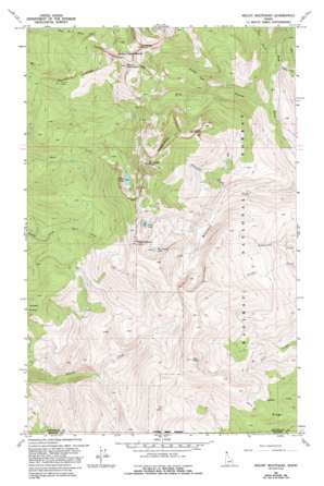
Mount Roothaan Topo Map Idaho
To zoom in, hover over the map of Mount Roothaan
USGS Topo Quad 48116e6 - 1:24,000 scale
| Topo Map Name: | Mount Roothaan |
| USGS Topo Quad ID: | 48116e6 |
| Print Size: | ca. 21 1/4" wide x 27" high |
| Southeast Coordinates: | 48.5° N latitude / 116.625° W longitude |
| Map Center Coordinates: | 48.5625° N latitude / 116.6875° W longitude |
| U.S. State: | ID |
| Filename: | o48116e6.jpg |
| Download Map JPG Image: | Mount Roothaan topo map 1:24,000 scale |
| Map Type: | Topographic |
| Topo Series: | 7.5´ |
| Map Scale: | 1:24,000 |
| Source of Map Images: | United States Geological Survey (USGS) |
| Alternate Map Versions: |
Mount Roothaan ID 1967, updated 1971 Download PDF Buy paper map Mount Roothaan ID 1967, updated 1993 Download PDF Buy paper map Mount Roothaan ID 1996, updated 1999 Download PDF Buy paper map Mount Roothaan ID 2011 Download PDF Buy paper map Mount Roothaan ID 2013 Download PDF Buy paper map |
| FStopo: | US Forest Service topo Mount Roothaan is available: Download FStopo PDF Download FStopo TIF |
1:24,000 Topo Quads surrounding Mount Roothaan
> Back to 48116e1 at 1:100,000 scale
> Back to 48116a1 at 1:250,000 scale
> Back to U.S. Topo Maps home
Mount Roothaan topo map: Gazetteer
Mount Roothaan: Lakes
Fault Lake elevation 1824m 5984′Hunt Lake elevation 1773m 5816′
McCormick Lake elevation 1848m 6062′
Mount Roothaan: Ridges
Horton Ridge elevation 1859m 6099′Jeru Ridge elevation 1371m 4498′
McCormick Ridge elevation 1936m 6351′
Mount Roothaan: Streams
Chimney Creek elevation 1378m 4520′Gunsight Creek elevation 1278m 4192′
Thor Creek elevation 1110m 3641′
West Branch Pack River elevation 1028m 3372′
Zuni Creek elevation 1110m 3641′
Mount Roothaan: Summits
Chimney Rock Middle Cairn elevation 2092m 6863′Hunt Peak elevation 2119m 6952′
Jeru Park elevation 1941m 6368′
Mount Roothaan elevation 2123m 6965′
Mount Roothaan digital topo map on disk
Buy this Mount Roothaan topo map showing relief, roads, GPS coordinates and other geographical features, as a high-resolution digital map file on DVD:


