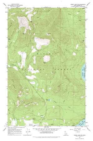
Priest Lake Nw Topo Map Idaho
To zoom in, hover over the map of Priest Lake Nw
USGS Topo Quad 48116f8 - 1:24,000 scale
| Topo Map Name: | Priest Lake Nw |
| USGS Topo Quad ID: | 48116f8 |
| Print Size: | ca. 21 1/4" wide x 27" high |
| Southeast Coordinates: | 48.625° N latitude / 116.875° W longitude |
| Map Center Coordinates: | 48.6875° N latitude / 116.9375° W longitude |
| U.S. State: | ID |
| Filename: | o48116f8.jpg |
| Download Map JPG Image: | Priest Lake Nw topo map 1:24,000 scale |
| Map Type: | Topographic |
| Topo Series: | 7.5´ |
| Map Scale: | 1:24,000 |
| Source of Map Images: | United States Geological Survey (USGS) |
| Alternate Map Versions: |
Priest Lake NW ID 1967, updated 1971 Download PDF Buy paper map Priest Lake NW ID 1967, updated 1978 Download PDF Buy paper map Priest Lake NW ID 1996, updated 1999 Download PDF Buy paper map Priest Lake NW ID 2011 Download PDF Buy paper map Priest Lake NW ID 2013 Download PDF Buy paper map |
| FStopo: | US Forest Service topo Priest Lake NW is available: Download FStopo PDF Download FStopo TIF |
1:24,000 Topo Quads surrounding Priest Lake Nw
> Back to 48116e1 at 1:100,000 scale
> Back to 48116a1 at 1:250,000 scale
> Back to U.S. Topo Maps home
Priest Lake Nw topo map: Gazetteer
Priest Lake Nw: Gaps
Beaver Pass elevation 1376m 4514′Priest Lake Nw: Lakes
Bottle Lake elevation 873m 2864′Kerr Lake elevation 803m 2634′
Priest Lake Nw: Parks
Bottle Lake Research Natural Area elevation 879m 2883′Priest Lake Nw: Populated Places
Nordman elevation 801m 2627′Priest Lake Nw: Reservoirs
Reeder Lake elevation 891m 2923′Priest Lake Nw: Streams
Blacktail Creek elevation 854m 2801′Dusty Creek elevation 877m 2877′
Fedar Creek elevation 815m 2673′
Indian Creek elevation 875m 2870′
Jost Creek elevation 920m 3018′
Media Creek elevation 781m 2562′
West Fork Packer Creek elevation 1103m 3618′
Priest Lake Nw: Summits
Blacktail Mountain elevation 1646m 5400′Dusty Peak elevation 1473m 4832′
Granite Mountain elevation 1420m 4658′
Nickelplate Mountain elevation 1179m 3868′
Reeder Mountain elevation 1444m 4737′
Watson Mountain elevation 1210m 3969′
Priest Lake Nw digital topo map on disk
Buy this Priest Lake Nw topo map showing relief, roads, GPS coordinates and other geographical features, as a high-resolution digital map file on DVD:


