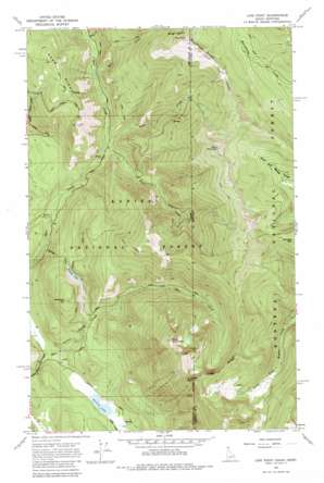
Line Point Topo Map Idaho
To zoom in, hover over the map of Line Point
USGS Topo Quad 48116g1 - 1:24,000 scale
| Topo Map Name: | Line Point |
| USGS Topo Quad ID: | 48116g1 |
| Print Size: | ca. 21 1/4" wide x 27" high |
| Southeast Coordinates: | 48.75° N latitude / 116° W longitude |
| Map Center Coordinates: | 48.8125° N latitude / 116.0625° W longitude |
| U.S. States: | ID, MT |
| Filename: | o48116g1.jpg |
| Download Map JPG Image: | Line Point topo map 1:24,000 scale |
| Map Type: | Topographic |
| Topo Series: | 7.5´ |
| Map Scale: | 1:24,000 |
| Source of Map Images: | United States Geological Survey (USGS) |
| Alternate Map Versions: |
Line Point ID 1965, updated 1967 Download PDF Buy paper map Line Point ID 1965, updated 1981 Download PDF Buy paper map Line Point ID 1996, updated 1999 Download PDF Buy paper map Line Point ID 2011 Download PDF Buy paper map Line Point ID 2013 Download PDF Buy paper map |
| FStopo: | US Forest Service topo Line Point is available: Download FStopo PDF Download FStopo TIF |
1:24,000 Topo Quads surrounding Line Point
> Back to 48116e1 at 1:100,000 scale
> Back to 48116a1 at 1:250,000 scale
> Back to U.S. Topo Maps home
Line Point topo map: Gazetteer
Line Point: Lakes
Perkins Lake elevation 803m 2634′Solomon Lake elevation 1016m 3333′
Line Point: Mines
Buckhorn Mine elevation 1718m 5636′Line Point: Ridges
Deer Ridge elevation 1542m 5059′Line Point: Streams
Davis Creek elevation 1071m 3513′Faro Creek elevation 932m 3057′
Faro Creek elevation 933m 3061′
Keno Creek elevation 926m 3038′
Mill Creek elevation 1018m 3339′
Solomon Creek elevation 792m 2598′
Line Point: Summits
Goat Mountain elevation 2018m 6620′Keno Mountain elevation 1993m 6538′
Line Point elevation 2021m 6630′
Solomon Mountain elevation 1282m 4206′
The Scout elevation 1912m 6272′
Thunder Mountain elevation 1836m 6023′
Line Point digital topo map on disk
Buy this Line Point topo map showing relief, roads, GPS coordinates and other geographical features, as a high-resolution digital map file on DVD:


