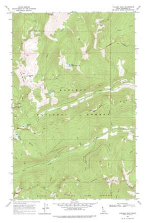
Pyramid Peak Topo Map Idaho
To zoom in, hover over the map of Pyramid Peak
USGS Topo Quad 48116g5 - 1:24,000 scale
| Topo Map Name: | Pyramid Peak |
| USGS Topo Quad ID: | 48116g5 |
| Print Size: | ca. 21 1/4" wide x 27" high |
| Southeast Coordinates: | 48.75° N latitude / 116.5° W longitude |
| Map Center Coordinates: | 48.8125° N latitude / 116.5625° W longitude |
| U.S. State: | ID |
| Filename: | o48116g5.jpg |
| Download Map JPG Image: | Pyramid Peak topo map 1:24,000 scale |
| Map Type: | Topographic |
| Topo Series: | 7.5´ |
| Map Scale: | 1:24,000 |
| Source of Map Images: | United States Geological Survey (USGS) |
| Alternate Map Versions: |
Pyramid Peak ID 1969, updated 1971 Download PDF Buy paper map Pyramid Peak ID 1969, updated 1978 Download PDF Buy paper map Pyramid Peak ID 1996, updated 2000 Download PDF Buy paper map Pyramid Peak ID 2011 Download PDF Buy paper map Pyramid Peak ID 2013 Download PDF Buy paper map |
| FStopo: | US Forest Service topo Pyramid Peak is available: Download FStopo PDF Download FStopo TIF |
1:24,000 Topo Quads surrounding Pyramid Peak
> Back to 48116e1 at 1:100,000 scale
> Back to 48116a1 at 1:250,000 scale
> Back to U.S. Topo Maps home
Pyramid Peak topo map: Gazetteer
Pyramid Peak: Gaps
Pyramid Pass elevation 2036m 6679′Pyramid Peak: Lakes
Ball Lakes elevation 2042m 6699′Big Fisher Lake elevation 2053m 6735′
Long Mountain Lake elevation 2045m 6709′
Parker Lake elevation 1922m 6305′
Pyramid Lake elevation 1847m 6059′
Trout Lake elevation 1936m 6351′
Pyramid Peak: Ridges
Cascade Ridge elevation 2123m 6965′Farnham Ridge elevation 2013m 6604′
Russell Ridge elevation 1943m 6374′
Pyramid Peak: Streams
Dutch Creek elevation 1356m 4448′English Creek elevation 1219m 3999′
Finn Creek elevation 1430m 4691′
French Creek elevation 1313m 4307′
Ham Creek elevation 1245m 4084′
Irish Creek elevation 1310m 4297′
Spanish Creek elevation 1362m 4468′
Swiss Creek elevation 1245m 4084′
Turk Creek elevation 1496m 4908′
Pyramid Peak: Summits
Fisher Peak elevation 2312m 7585′Long Mountain elevation 2198m 7211′
Parker Peak elevation 2332m 7650′
Pyramid Peak elevation 2231m 7319′
Russell Mountain elevation 2077m 6814′
Pyramid Peak digital topo map on disk
Buy this Pyramid Peak topo map showing relief, roads, GPS coordinates and other geographical features, as a high-resolution digital map file on DVD:


