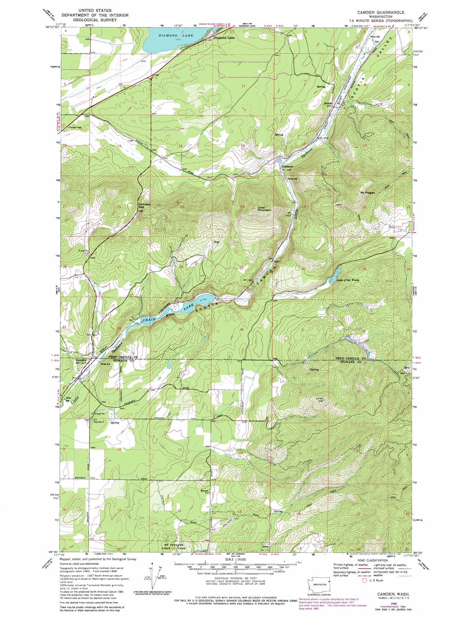
Camden Topo Map Washington
To zoom in, hover over the map of Camden
USGS Topo Quad 48117a2 - 1:24,000 scale
| Topo Map Name: | Camden |
| USGS Topo Quad ID: | 48117a2 |
| Print Size: | ca. 21 1/4" wide x 27" high |
| Southeast Coordinates: | 48° N latitude / 117.125° W longitude |
| Map Center Coordinates: | 48.0625° N latitude / 117.1875° W longitude |
| U.S. State: | WA |
| Filename: | o48117a2.jpg |
| Download Map JPG Image: | Camden topo map 1:24,000 scale |
| Map Type: | Topographic |
| Topo Series: | 7.5´ |
| Map Scale: | 1:24,000 |
| Source of Map Images: | United States Geological Survey (USGS) |
| Alternate Map Versions: |
Camden WA 1968, updated 1971 Download PDF Buy paper map Camden WA 1968, updated 1979 Download PDF Buy paper map Camden WA 1968, updated 1981 Download PDF Buy paper map Camden WA 1968, updated 1995 Download PDF Buy paper map Camden WA 2011 Download PDF Buy paper map Camden WA 2014 Download PDF Buy paper map |
1:24,000 Topo Quads surrounding Camden
Winchester Peak |
Cusick |
Skookum Creek |
Bead Lake |
Quartz Mountain |
Boyer Mountain |
Sacheen Lake |
Diamond Lake |
Newport |
Priest River |
Fan Lake |
Elk |
Camden |
Tweedie |
Blanchard |
Deer Park |
Chattaroy |
Mount Kit Carson |
Mount Spokane |
Spirit Lake West |
Dartford |
Mead |
Foothills |
Newman Lake |
Rathdrum |
> Back to 48117a1 at 1:100,000 scale
> Back to 48116a1 at 1:250,000 scale
> Back to U.S. Topo Maps home
Camden topo map: Gazetteer
Camden: Dams
Camden Dam elevation 806m 2644′Decie Lake Dam elevation 841m 2759′
Isabelle Lake Dam elevation 853m 2798′
Lynda Lake Dam elevation 854m 2801′
The Woods Lake Dam elevation 716m 2349′
Camden: Gaps
Campden Gap elevation 802m 2631′Camden: Populated Places
Camden elevation 600m 1968′Diamond Lake elevation 721m 2365′
Grahams elevation 632m 2073′
Scotia elevation 634m 2080′
Camden: Reservoirs
Chain Lake elevation 598m 1961′Decie Lake elevation 841m 2759′
Isabelle Lake elevation 853m 2798′
Lake of the Woods elevation 716m 2349′
Lynda Lake elevation 854m 2801′
Camden: Summits
Lone Mountain elevation 993m 3257′Mount Pisgah elevation 1097m 3599′
Camden: Valleys
Scotia Canyon elevation 586m 1922′Scotia Valley elevation 656m 2152′
Camden digital topo map on disk
Buy this Camden topo map showing relief, roads, GPS coordinates and other geographical features, as a high-resolution digital map file on DVD: