Valley Topo Map Washington
To zoom in, hover over the map of Valley
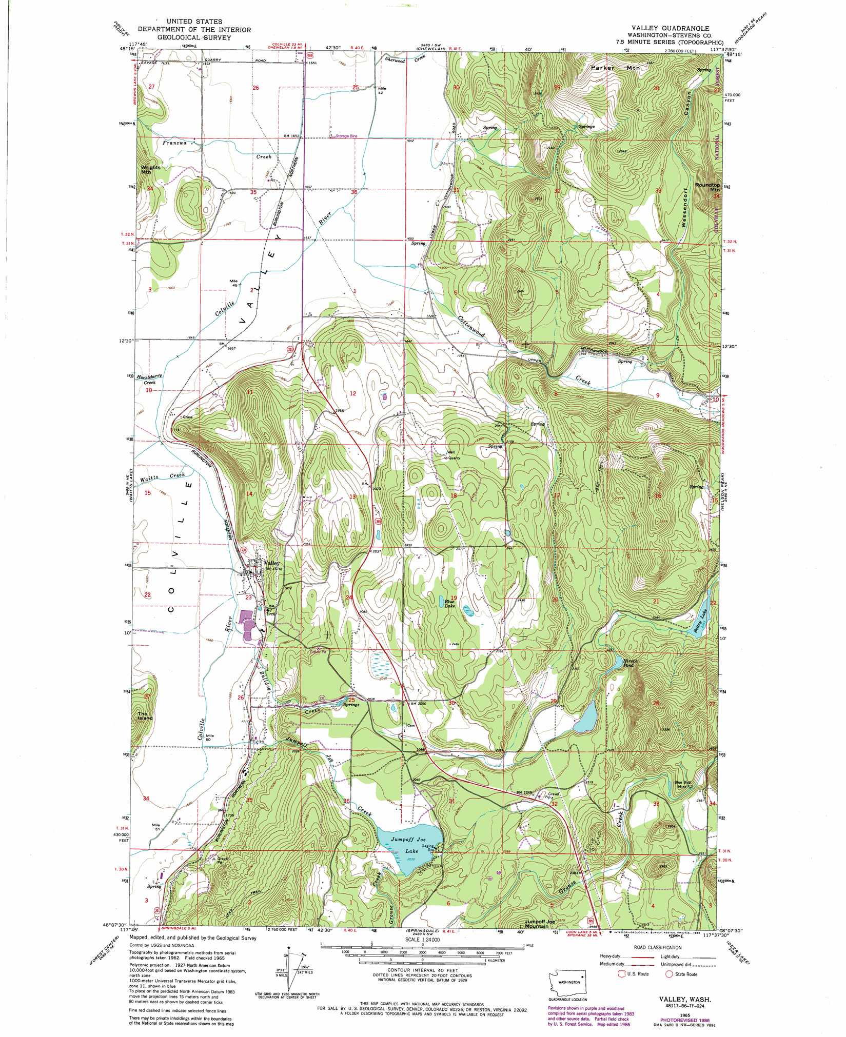
USGS Topo Quad 48117b6 - 1:24,000 scale
| Topo Map Name: | Valley |
| USGS Topo Quad ID: | 48117b6 |
| Print Size: | ca. 21 1/4" wide x 27" high |
| Southeast Coordinates: | 48.125° N latitude / 117.625° W longitude |
| Map Center Coordinates: | 48.1875° N latitude / 117.6875° W longitude |
| U.S. State: | WA |
| Filename: | o48117b6.jpg |
| Download Map JPG Image: | Valley topo map 1:24,000 scale |
| Map Type: | Topographic |
| Topo Series: | 7.5´ |
| Map Scale: | 1:24,000 |
| Source of Map Images: | United States Geological Survey (USGS) |
| Alternate Map Versions: |
Valley WA 1965, updated 1967 Download PDF Buy paper map Valley WA 1965, updated 1980 Download PDF Buy paper map Valley WA 1965, updated 1986 Download PDF Buy paper map Valley WA 1992, updated 1996 Download PDF Buy paper map Valley WA 2011 Download PDF Buy paper map Valley WA 2014 Download PDF Buy paper map |
| FStopo: | US Forest Service topo Valley is available: Download FStopo PDF Download FStopo TIF |
1:24,000 Topo Quads surrounding Valley
Arden |
Addy Mountain |
Cliff Ridge |
Calispell Peak |
Tacoma Peak |
Dunn Mountain |
Addy |
Chewelah |
Goddards Peak |
Winchester Peak |
Stensgar Mountain |
Waitts Lake |
Valley |
Nelson Peak |
Boyer Mountain |
Empey Mountain |
Forest Center |
Springdale |
Deer Lake |
Fan Lake |
Wellpinit |
Ford |
Tumtum |
Clayton |
Deer Park |
> Back to 48117a1 at 1:100,000 scale
> Back to 48116a1 at 1:250,000 scale
> Back to U.S. Topo Maps home
Valley topo map: Gazetteer
Valley: Dams
Beitey Lake Dam elevation 691m 2267′Jumpoff Jim Lake Dam elevation 652m 2139′
Valley: Flats
Fool Prairie elevation 508m 1666′Valley: Lakes
Blue Lake elevation 730m 2395′Hirsch Pond elevation 655m 2148′
Jumpoff Joe Lake elevation 620m 2034′
Valley: Mines
Blue Bird Mine elevation 755m 2477′Valley: Populated Places
Kulzer elevation 527m 1729′Valley elevation 517m 1696′
Valley: Reservoirs
Beitey Lake elevation 691m 2267′Jumpoff Jim Lake elevation 652m 2139′
Valley: Streams
Bulldog Creek elevation 506m 1660′Cottonwood Creek elevation 503m 1650′
Franzwa Creek elevation 503m 1650′
Grouse Creek elevation 620m 2034′
Huckleberry Creek elevation 505m 1656′
Jumpoff Joe Creek elevation 509m 1669′
Sherwood Creek elevation 503m 1650′
Waitts Creek elevation 506m 1660′
Valley: Summits
Inklers Point elevation 669m 2194′Inklers Point elevation 669m 2194′
Parker Mountain elevation 1044m 3425′
Valley: Valleys
Wessendorf Canyon elevation 587m 1925′Valley digital topo map on disk
Buy this Valley topo map showing relief, roads, GPS coordinates and other geographical features, as a high-resolution digital map file on DVD: