Skookum Creek Topo Map Washington
To zoom in, hover over the map of Skookum Creek
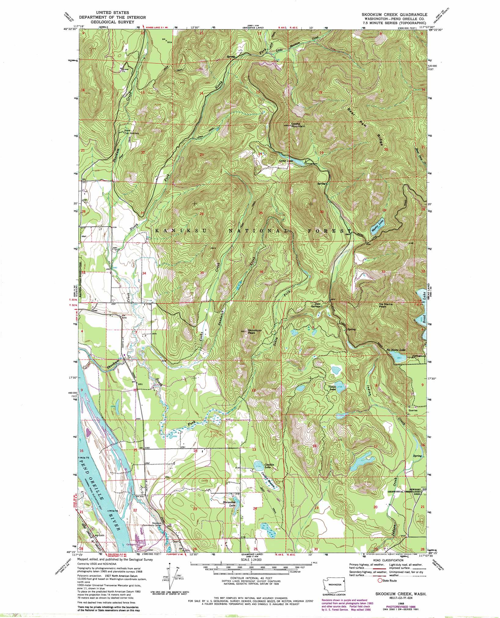
USGS Topo Quad 48117c2 - 1:24,000 scale
| Topo Map Name: | Skookum Creek |
| USGS Topo Quad ID: | 48117c2 |
| Print Size: | ca. 21 1/4" wide x 27" high |
| Southeast Coordinates: | 48.25° N latitude / 117.125° W longitude |
| Map Center Coordinates: | 48.3125° N latitude / 117.1875° W longitude |
| U.S. State: | WA |
| Filename: | o48117c2.jpg |
| Download Map JPG Image: | Skookum Creek topo map 1:24,000 scale |
| Map Type: | Topographic |
| Topo Series: | 7.5´ |
| Map Scale: | 1:24,000 |
| Source of Map Images: | United States Geological Survey (USGS) |
| Alternate Map Versions: |
Skookum Creek WA 1968, updated 1971 Download PDF Buy paper map Skookum Creek WA 1968, updated 1979 Download PDF Buy paper map Skookum Creek WA 1968, updated 1981 Download PDF Buy paper map Skookum Creek WA 1968, updated 1986 Download PDF Buy paper map Skookum Creek WA 1996, updated 2000 Download PDF Buy paper map Skookum Creek WA 2011 Download PDF Buy paper map Skookum Creek WA 2014 Download PDF Buy paper map |
| FStopo: | US Forest Service topo Skookum Creek is available: Download FStopo PDF Download FStopo TIF |
1:24,000 Topo Quads surrounding Skookum Creek
Timber Mountain |
Ruby |
North Baldy |
Gleason Mountain |
Priest Lake Sw |
Tacoma Peak |
Jared |
Browns Lake |
Galena Point |
Outlet Bay |
Winchester Peak |
Cusick |
Skookum Creek |
Bead Lake |
Quartz Mountain |
Boyer Mountain |
Sacheen Lake |
Diamond Lake |
Newport |
Priest River |
Fan Lake |
Elk |
Camden |
Tweedie |
Blanchard |
> Back to 48117a1 at 1:100,000 scale
> Back to 48116a1 at 1:250,000 scale
> Back to U.S. Topo Maps home
Skookum Creek topo map: Gazetteer
Skookum Creek: Flats
Conklin Meadow elevation 652m 2139′Skookum Creek: Lakes
Conklin Lake elevation 652m 2139′Cooks Lake elevation 937m 3074′
Horseshoe Lake elevation 652m 2139′
Mystic Lake elevation 905m 2969′
No Name Lake elevation 855m 2805′
Vances Lake elevation 842m 2762′
Skookum Creek: Reservoirs
Conger Pond elevation 652m 2139′Skookum Creek: Ridges
Bear Paw Ridge elevation 1477m 4845′Skookum Creek: Springs
Deer Springs elevation 901m 2956′Skookum Creek: Streams
Cooks Creek elevation 623m 2043′Little Skookum Creek elevation 867m 2844′
North Fork Skookum Creek elevation 631m 2070′
Sandwich Creek elevation 629m 2063′
South Fork Skookum Creek elevation 623m 2043′
Skookum Creek: Summits
Cooks Mountain elevation 1320m 4330′No Name Peak elevation 1261m 4137′
Skookum Peak elevation 990m 3248′
Skookum Creek digital topo map on disk
Buy this Skookum Creek topo map showing relief, roads, GPS coordinates and other geographical features, as a high-resolution digital map file on DVD: