Dunn Mountain Topo Map Washington
To zoom in, hover over the map of Dunn Mountain
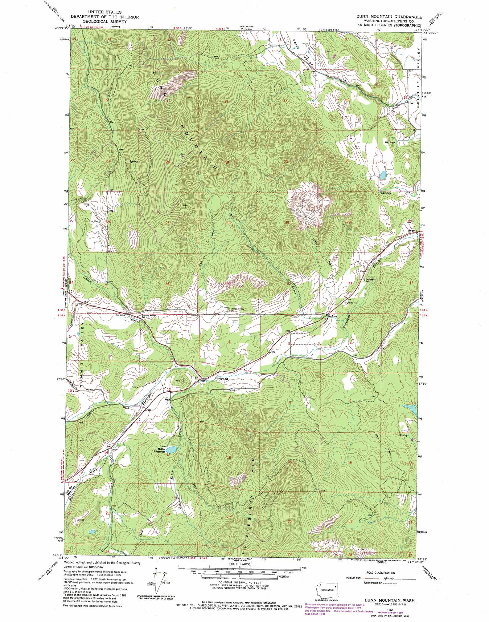
USGS Topo Quad 48117c8 - 1:24,000 scale
| Topo Map Name: | Dunn Mountain |
| USGS Topo Quad ID: | 48117c8 |
| Print Size: | ca. 21 1/4" wide x 27" high |
| Southeast Coordinates: | 48.25° N latitude / 117.875° W longitude |
| Map Center Coordinates: | 48.3125° N latitude / 117.9375° W longitude |
| U.S. State: | WA |
| Filename: | o48117c8.jpg |
| Download Map JPG Image: | Dunn Mountain topo map 1:24,000 scale |
| Map Type: | Topographic |
| Topo Series: | 7.5´ |
| Map Scale: | 1:24,000 |
| Source of Map Images: | United States Geological Survey (USGS) |
| Alternate Map Versions: |
Dunn Mountain WA 1965, updated 1967 Download PDF Buy paper map Dunn Mountain WA 1965, updated 1983 Download PDF Buy paper map Dunn Mountain WA 2011 Download PDF Buy paper map Dunn Mountain WA 2014 Download PDF Buy paper map |
1:24,000 Topo Quads surrounding Dunn Mountain
Bangs Mountain |
Kettle Falls |
Colville |
White Mud Lake |
Park Rapids |
Rice |
Kentry Ridge |
Arden |
Addy Mountain |
Cliff Ridge |
Inchelium |
Wellington Peak |
Dunn Mountain |
Addy |
Chewelah |
Cedonia |
Blackhorse Canyon |
Stensgar Mountain |
Waitts Lake |
Valley |
Hunters |
Adams Mountain |
Empey Mountain |
Forest Center |
Springdale |
> Back to 48117a1 at 1:100,000 scale
> Back to 48116a1 at 1:250,000 scale
> Back to U.S. Topo Maps home
Dunn Mountain topo map: Gazetteer
Dunn Mountain: Airports
Tango Ranch Airport elevation 636m 2086′Dunn Mountain: Dams
Miller Reservoir Dam elevation 834m 2736′Dunn Mountain: Populated Places
Schmidt (historical) elevation 758m 2486′Dunn Mountain: Reservoirs
Miller Reservoir elevation 834m 2736′Dunn Mountain: Streams
Cassner Creek elevation 643m 2109′Dunn Creek elevation 717m 2352′
Klein Creek elevation 703m 2306′
Smith Creek elevation 731m 2398′
Dunn Mountain: Summits
Dunn Mountain elevation 1624m 5328′Dunn Mountain: Valleys
Swiss Valley elevation 537m 1761′Dunn Mountain digital topo map on disk
Buy this Dunn Mountain topo map showing relief, roads, GPS coordinates and other geographical features, as a high-resolution digital map file on DVD: