Arden Topo Map Washington
To zoom in, hover over the map of Arden
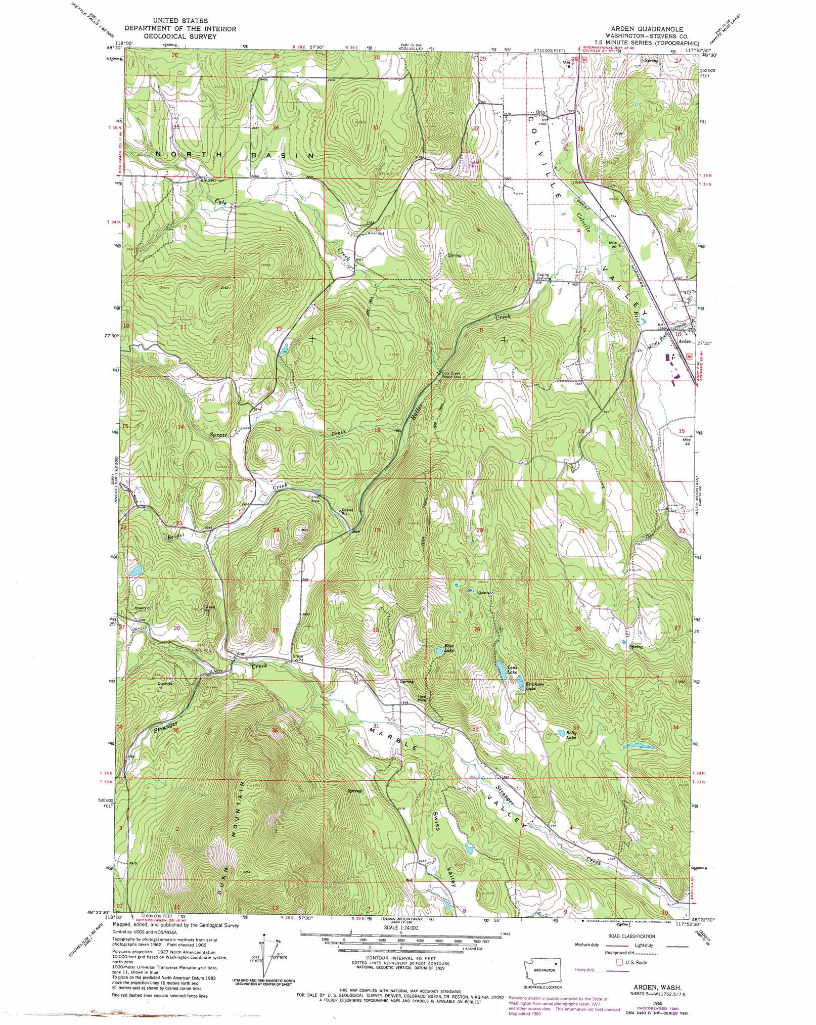
USGS Topo Quad 48117d8 - 1:24,000 scale
| Topo Map Name: | Arden |
| USGS Topo Quad ID: | 48117d8 |
| Print Size: | ca. 21 1/4" wide x 27" high |
| Southeast Coordinates: | 48.375° N latitude / 117.875° W longitude |
| Map Center Coordinates: | 48.4375° N latitude / 117.9375° W longitude |
| U.S. State: | WA |
| Filename: | o48117d8.jpg |
| Download Map JPG Image: | Arden topo map 1:24,000 scale |
| Map Type: | Topographic |
| Topo Series: | 7.5´ |
| Map Scale: | 1:24,000 |
| Source of Map Images: | United States Geological Survey (USGS) |
| Alternate Map Versions: |
Arden WA 1965, updated 1967 Download PDF Buy paper map Arden WA 1965, updated 1980 Download PDF Buy paper map Arden WA 1965, updated 1980 Download PDF Buy paper map Arden WA 2011 Download PDF Buy paper map Arden WA 2014 Download PDF Buy paper map |
1:24,000 Topo Quads surrounding Arden
Boyds |
Marcus |
Echo Valley |
Gillette Mountain |
Aladdin |
Bangs Mountain |
Kettle Falls |
Colville |
White Mud Lake |
Park Rapids |
Rice |
Kentry Ridge |
Arden |
Addy Mountain |
Cliff Ridge |
Inchelium |
Wellington Peak |
Dunn Mountain |
Addy |
Chewelah |
Cedonia |
Blackhorse Canyon |
Stensgar Mountain |
Waitts Lake |
Valley |
> Back to 48117a1 at 1:100,000 scale
> Back to 48116a1 at 1:250,000 scale
> Back to U.S. Topo Maps home
Arden topo map: Gazetteer
Arden: Basins
North Basin elevation 707m 2319′Arden: Lakes
Blue Lake elevation 765m 2509′Erickson Lake elevation 657m 2155′
Lenz Lake elevation 657m 2155′
Rolly Lake elevation 632m 2073′
Arden: Mines
Ham Mine elevation 654m 2145′Arden: Populated Places
Arden elevation 489m 1604′Orin elevation 478m 1568′
Arden: Streams
Cole Creek elevation 549m 1801′Haller Creek elevation 483m 1584′
Little Pend Oreille River elevation 485m 1591′
Reidel Creek elevation 625m 2050′
Spratt Creek elevation 576m 1889′
Arden: Valleys
Marble Valley elevation 508m 1666′Arden digital topo map on disk
Buy this Arden topo map showing relief, roads, GPS coordinates and other geographical features, as a high-resolution digital map file on DVD: