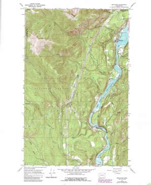
Metaline Topo Map Washington
To zoom in, hover over the map of Metaline
USGS Topo Quad 48117g4 - 1:24,000 scale
| Topo Map Name: | Metaline |
| USGS Topo Quad ID: | 48117g4 |
| Print Size: | ca. 21 1/4" wide x 27" high |
| Southeast Coordinates: | 48.75° N latitude / 117.375° W longitude |
| Map Center Coordinates: | 48.8125° N latitude / 117.4375° W longitude |
| U.S. State: | WA |
| Filename: | o48117g4.jpg |
| Download Map JPG Image: | Metaline topo map 1:24,000 scale |
| Map Type: | Topographic |
| Topo Series: | 7.5´ |
| Map Scale: | 1:24,000 |
| Source of Map Images: | United States Geological Survey (USGS) |
| Alternate Map Versions: |
Metaline WA 1967, updated 1971 Download PDF Buy paper map Metaline WA 1967, updated 1980 Download PDF Buy paper map Metaline WA 1967, updated 1986 Download PDF Buy paper map Metaline WA 1992, updated 1997 Download PDF Buy paper map Metaline WA 2011 Download PDF Buy paper map Metaline WA 2014 Download PDF Buy paper map |
| FStopo: | US Forest Service topo Metaline is available: Download FStopo PDF Download FStopo TIF |
1:24,000 Topo Quads surrounding Metaline
> Back to 48117e1 at 1:100,000 scale
> Back to 48116a1 at 1:250,000 scale
> Back to U.S. Topo Maps home
Metaline topo map: Gazetteer
Metaline: Dams
Box Canyon Dam elevation 621m 2037′Cedar Creek Reservoir Dam elevation 695m 2280′
Flume Creek Reservoir Dam elevation 726m 2381′
Pend Oreille County Pud Dam elevation 617m 2024′
Metaline: Flats
Cameron Meadow elevation 818m 2683′Thorson Meadow elevation 922m 3024′
Metaline: Lakes
Lost Lake elevation 949m 3113′Metaline: Mines
Bella May Mine elevation 768m 2519′Oriole Mine elevation 843m 2765′
Metaline: Populated Places
Metaline elevation 616m 2020′Metaline: Reservoirs
Box Canyon Reservoir elevation 621m 2037′Cedar Creek Reservoir elevation 695m 2280′
Flume Creek Reservoir elevation 726m 2381′
Metaline: Streams
Exposure Creek elevation 622m 2040′Jim Creek elevation 700m 2296′
Jordan Creek elevation 1335m 4379′
Linton Creek elevation 608m 1994′
Lost Creek elevation 608m 1994′
Lost Lake Creek elevation 836m 2742′
Lunch Creek elevation 744m 2440′
Mickey Creek elevation 620m 2034′
Pocahontas Creek elevation 609m 1998′
Sand Creek elevation 609m 1998′
South Fork Flume Creek elevation 726m 2381′
South Fork Jim Creek elevation 1250m 4101′
Sweet Creek elevation 608m 1994′
Wolf Creek elevation 610m 2001′
Metaline: Summits
Cement Mountain elevation 918m 3011′Deer Mountain elevation 1014m 3326′
Linton Mountain elevation 1880m 6167′
Metaline: Valleys
Box Canyon elevation 621m 2037′Metaline digital topo map on disk
Buy this Metaline topo map showing relief, roads, GPS coordinates and other geographical features, as a high-resolution digital map file on DVD:


