Onion Creek Topo Map Washington
To zoom in, hover over the map of Onion Creek
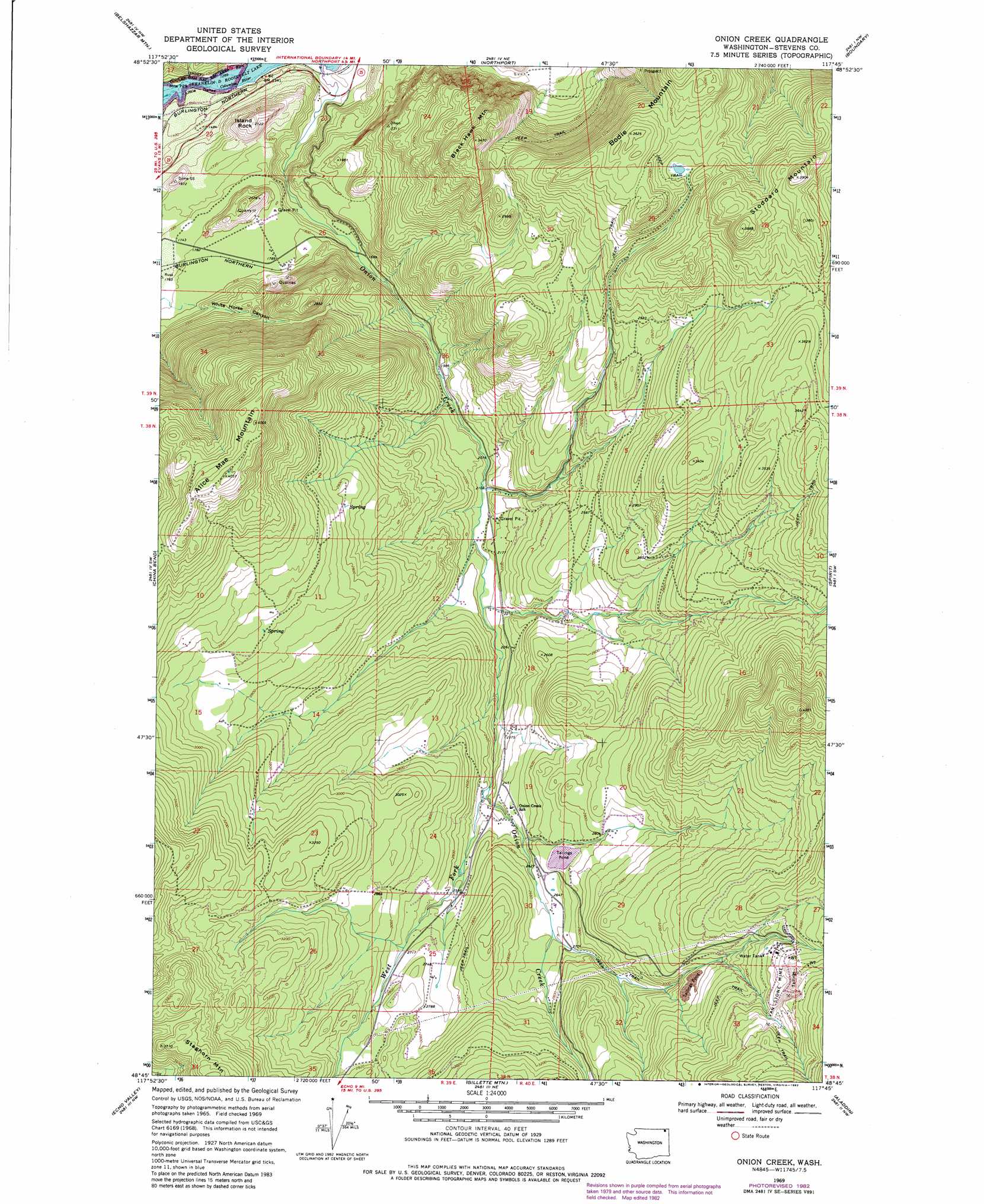
USGS Topo Quad 48117g7 - 1:24,000 scale
| Topo Map Name: | Onion Creek |
| USGS Topo Quad ID: | 48117g7 |
| Print Size: | ca. 21 1/4" wide x 27" high |
| Southeast Coordinates: | 48.75° N latitude / 117.75° W longitude |
| Map Center Coordinates: | 48.8125° N latitude / 117.8125° W longitude |
| U.S. State: | WA |
| Filename: | o48117g7.jpg |
| Download Map JPG Image: | Onion Creek topo map 1:24,000 scale |
| Map Type: | Topographic |
| Topo Series: | 7.5´ |
| Map Scale: | 1:24,000 |
| Source of Map Images: | United States Geological Survey (USGS) |
| Alternate Map Versions: |
Onion Creek WA 1969, updated 1971 Download PDF Buy paper map Onion Creek WA 1969, updated 1975 Download PDF Buy paper map Onion Creek WA 1969, updated 1982 Download PDF Buy paper map Onion Creek WA 2011 Download PDF Buy paper map Onion Creek WA 2014 Download PDF Buy paper map |
1:24,000 Topo Quads surrounding Onion Creek
Churchill Mountain |
Belshazzar Mountain |
Northport |
Boundary |
Leadpoint |
Bossburg |
China Bend |
Onion Creek |
Spirit |
Deep Lake |
Marcus |
Echo Valley |
Gillette Mountain |
Aladdin |
Aladdin Mountain |
Kettle Falls |
Colville |
White Mud Lake |
Park Rapids |
Lake Gillette |
> Back to 48117e1 at 1:100,000 scale
> Back to 48116a1 at 1:250,000 scale
> Back to U.S. Topo Maps home
Onion Creek topo map: Gazetteer
Onion Creek: Gaps
Little Dalles elevation 404m 1325′Onion Creek: Mines
Van Stone Mine elevation 1110m 3641′Onion Creek: Populated Places
Little Dalles (historical) elevation 534m 1751′Onion Creek elevation 749m 2457′
Onion Creek: Rapids
Little Dalles elevation 404m 1325′Onion Creek: Streams
Onion Creek elevation 397m 1302′West Fork Onion Creek elevation 720m 2362′
Onion Creek: Summits
Alice Mae Mountain elevation 1225m 4019′Black Hawk Mountain elevation 1050m 3444′
Bodie Mountain elevation 1151m 3776′
Island Rock elevation 641m 2103′
Onion Creek: Valleys
White Horse Canyon elevation 551m 1807′Onion Creek digital topo map on disk
Buy this Onion Creek topo map showing relief, roads, GPS coordinates and other geographical features, as a high-resolution digital map file on DVD: