Adams Mountain Topo Map Washington
To zoom in, hover over the map of Adams Mountain
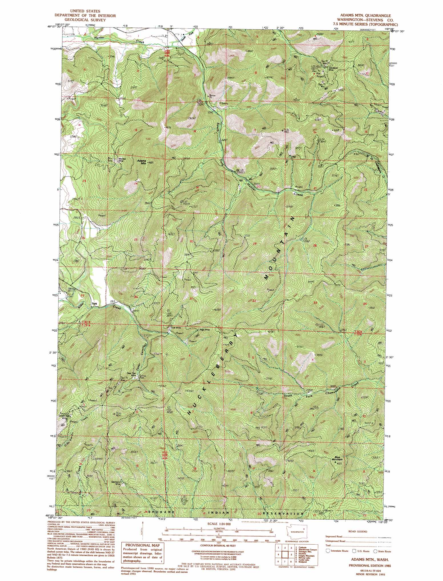
USGS Topo Quad 48118a1 - 1:24,000 scale
| Topo Map Name: | Adams Mountain |
| USGS Topo Quad ID: | 48118a1 |
| Print Size: | ca. 21 1/4" wide x 27" high |
| Southeast Coordinates: | 48° N latitude / 118° W longitude |
| Map Center Coordinates: | 48.0625° N latitude / 118.0625° W longitude |
| U.S. State: | WA |
| Filename: | o48118a1.jpg |
| Download Map JPG Image: | Adams Mountain topo map 1:24,000 scale |
| Map Type: | Topographic |
| Topo Series: | 7.5´ |
| Map Scale: | 1:24,000 |
| Source of Map Images: | United States Geological Survey (USGS) |
| Alternate Map Versions: |
Adams Mtn WA 1985, updated 1985 Download PDF Buy paper map Adams Mtn WA 1985, updated 1994 Download PDF Buy paper map Adams Mountain WA 2011 Download PDF Buy paper map Adams Mountain WA 2014 Download PDF Buy paper map |
1:24,000 Topo Quads surrounding Adams Mountain
Moon Mountain |
Inchelium |
Wellington Peak |
Dunn Mountain |
Addy |
Kewa |
Cedonia |
Blackhorse Canyon |
Stensgar Mountain |
Waitts Lake |
Miller Mountain |
Hunters |
Adams Mountain |
Empey Mountain |
Forest Center |
Fort Spokane |
Mccoy Lake |
Turtle Lake |
Wellpinit |
Ford |
Olsen Canyon |
Inkster Lake |
Benjamin Lake |
Little Falls |
Long Lake |
> Back to 48118a1 at 1:100,000 scale
> Back to 48118a1 at 1:250,000 scale
> Back to U.S. Topo Maps home
Adams Mountain topo map: Gazetteer
Adams Mountain: Mines
Cleveland Mine elevation 1038m 3405′Deer Trail Mine elevation 1074m 3523′
Germania Mine elevation 1063m 3487′
Monitor Mine elevation 1044m 3425′
Queen Seal Mine elevation 1223m 4012′
Togo Mine elevation 1153m 3782′
Turk Mine elevation 1027m 3369′
Adams Mountain: Populated Places
Deer Trail elevation 1192m 3910′Turk elevation 837m 2746′
Adams Mountain: Streams
North Fork Hunter Creek elevation 693m 2273′South Fork Hunter Creek elevation 693m 2273′
Adams Mountain: Summits
Adams Mountain elevation 1422m 4665′Blue Mountain elevation 1275m 4183′
Adams Mountain: Valleys
Cedar Canyon elevation 903m 2962′Adams Mountain digital topo map on disk
Buy this Adams Mountain topo map showing relief, roads, GPS coordinates and other geographical features, as a high-resolution digital map file on DVD: