Nespelem Topo Map Washington
To zoom in, hover over the map of Nespelem
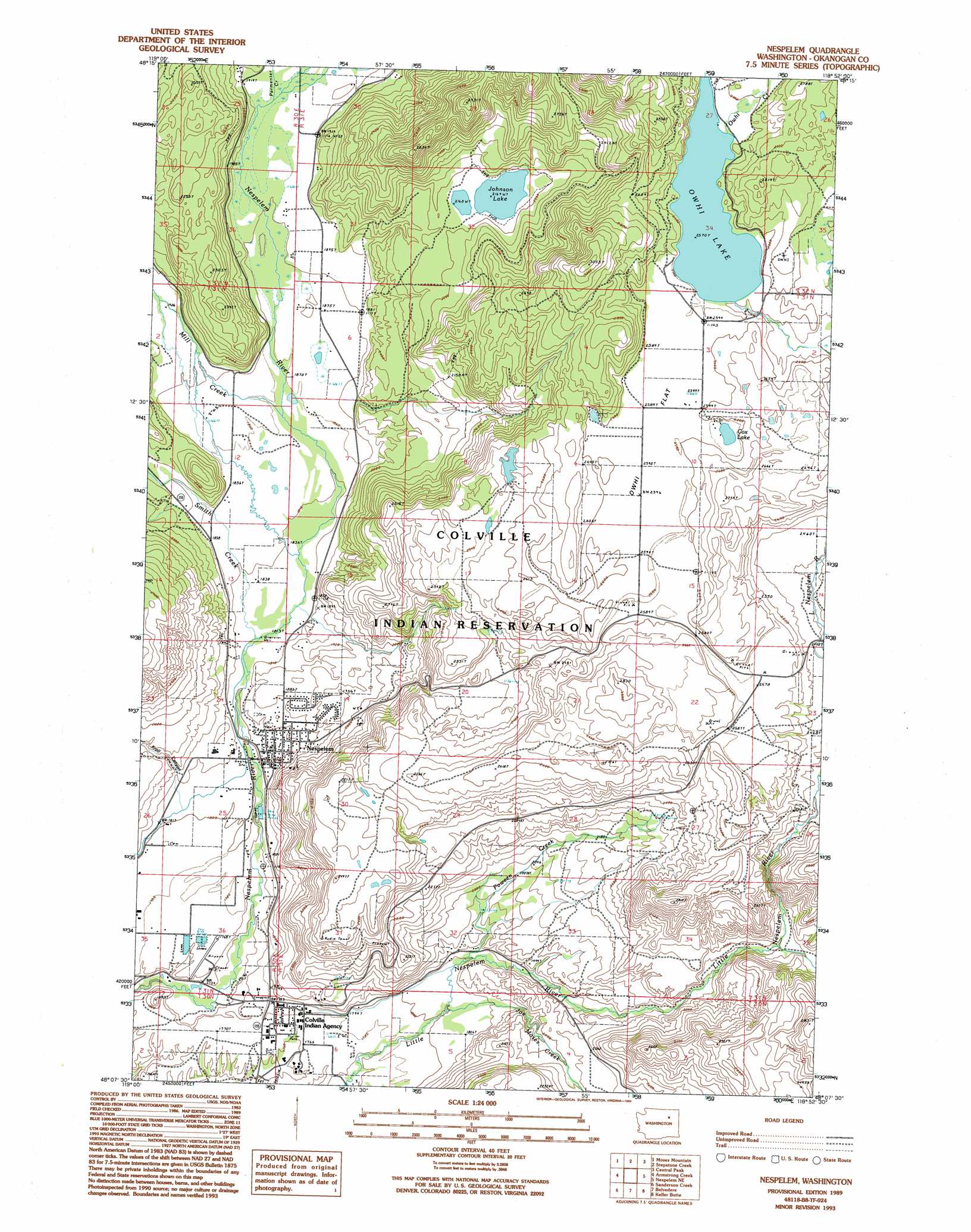
USGS Topo Quad 48118b8 - 1:24,000 scale
| Topo Map Name: | Nespelem |
| USGS Topo Quad ID: | 48118b8 |
| Print Size: | ca. 21 1/4" wide x 27" high |
| Southeast Coordinates: | 48.125° N latitude / 118.875° W longitude |
| Map Center Coordinates: | 48.1875° N latitude / 118.9375° W longitude |
| U.S. State: | WA |
| Filename: | o48118b8.jpg |
| Download Map JPG Image: | Nespelem topo map 1:24,000 scale |
| Map Type: | Topographic |
| Topo Series: | 7.5´ |
| Map Scale: | 1:24,000 |
| Source of Map Images: | United States Geological Survey (USGS) |
| Alternate Map Versions: |
Nespelem WA 1989, updated 1989 Download PDF Buy paper map Nespelem WA 1989, updated 1994 Download PDF Buy paper map Nespelem WA 2011 Download PDF Buy paper map Nespelem WA 2014 Download PDF Buy paper map |
1:24,000 Topo Quads surrounding Nespelem
Crawfish Lake |
Moses Meadows |
Strawberry Mountain |
Bald Knob |
Thirteenmile Creek |
Disautel |
Moses Mountain |
Stepstone Creek |
Central Peak |
Cody Butte |
Hopkins Canyon |
Armstrong Creek |
Nespelem |
Nespelem Ne |
Louie Creek |
Alameda Flat |
Sanderson Creek |
Belvedere |
Keller Butte |
Keller |
Barker Canyon |
Electric City |
Grand Coulee Dam |
Mica Mountain |
Keller Ferry |
> Back to 48118a1 at 1:100,000 scale
> Back to 48118a1 at 1:250,000 scale
> Back to U.S. Topo Maps home
Nespelem topo map: Gazetteer
Nespelem: Dams
Owhi Lake Dam elevation 781m 2562′Nespelem: Flats
Owhi Flat elevation 789m 2588′Nespelem: Lakes
Cox Lake elevation 785m 2575′Johnson Lake elevation 662m 2171′
Nespelem: Populated Places
Nespelem elevation 561m 1840′Nespelem: Reservoirs
Owhi Lake elevation 781m 2562′Nespelem: Streams
Joe Moses Creek elevation 549m 1801′Mill Creek elevation 566m 1856′
Owhi Creek elevation 785m 2575′
Parmenter Creek elevation 583m 1912′
Poween Creek elevation 563m 1847′
Smith Creek elevation 566m 1856′
Nespelem: Valleys
Kroll Canyon elevation 559m 1833′Nespelem digital topo map on disk
Buy this Nespelem topo map showing relief, roads, GPS coordinates and other geographical features, as a high-resolution digital map file on DVD: