Stepstone Creek Topo Map Washington
To zoom in, hover over the map of Stepstone Creek
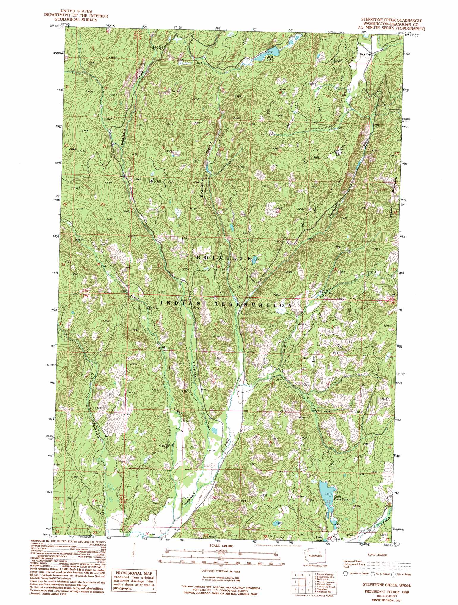
USGS Topo Quad 48118c8 - 1:24,000 scale
| Topo Map Name: | Stepstone Creek |
| USGS Topo Quad ID: | 48118c8 |
| Print Size: | ca. 21 1/4" wide x 27" high |
| Southeast Coordinates: | 48.25° N latitude / 118.875° W longitude |
| Map Center Coordinates: | 48.3125° N latitude / 118.9375° W longitude |
| U.S. State: | WA |
| Filename: | o48118c8.jpg |
| Download Map JPG Image: | Stepstone Creek topo map 1:24,000 scale |
| Map Type: | Topographic |
| Topo Series: | 7.5´ |
| Map Scale: | 1:24,000 |
| Source of Map Images: | United States Geological Survey (USGS) |
| Alternate Map Versions: |
Stepstone Creek WA 1989, updated 1989 Download PDF Buy paper map Stepstone Creek WA 1989, updated 1994 Download PDF Buy paper map Stepstone Creek WA 2011 Download PDF Buy paper map Stepstone Creek WA 2014 Download PDF Buy paper map |
1:24,000 Topo Quads surrounding Stepstone Creek
Tunk Mountain |
Bailey Creek |
Aeneas |
Swan Lake |
Bear Mountain |
Crawfish Lake |
Moses Meadows |
Strawberry Mountain |
Bald Knob |
Thirteenmile Creek |
Disautel |
Moses Mountain |
Stepstone Creek |
Central Peak |
Cody Butte |
Hopkins Canyon |
Armstrong Creek |
Nespelem |
Nespelem Ne |
Louie Creek |
Alameda Flat |
Sanderson Creek |
Belvedere |
Keller Butte |
Keller |
> Back to 48118a1 at 1:100,000 scale
> Back to 48118a1 at 1:250,000 scale
> Back to U.S. Topo Maps home
Stepstone Creek topo map: Gazetteer
Stepstone Creek: Lakes
Gold Lake elevation 899m 2949′Little Owhi Lake elevation 793m 2601′
Stepstone Creek: Streams
Kinkaid Creek elevation 611m 2004′North Star Creek elevation 584m 1916′
Stepstone Creek elevation 591m 1938′
Stepstone Creek digital topo map on disk
Buy this Stepstone Creek topo map showing relief, roads, GPS coordinates and other geographical features, as a high-resolution digital map file on DVD: