Bald Knob Topo Map Washington
To zoom in, hover over the map of Bald Knob
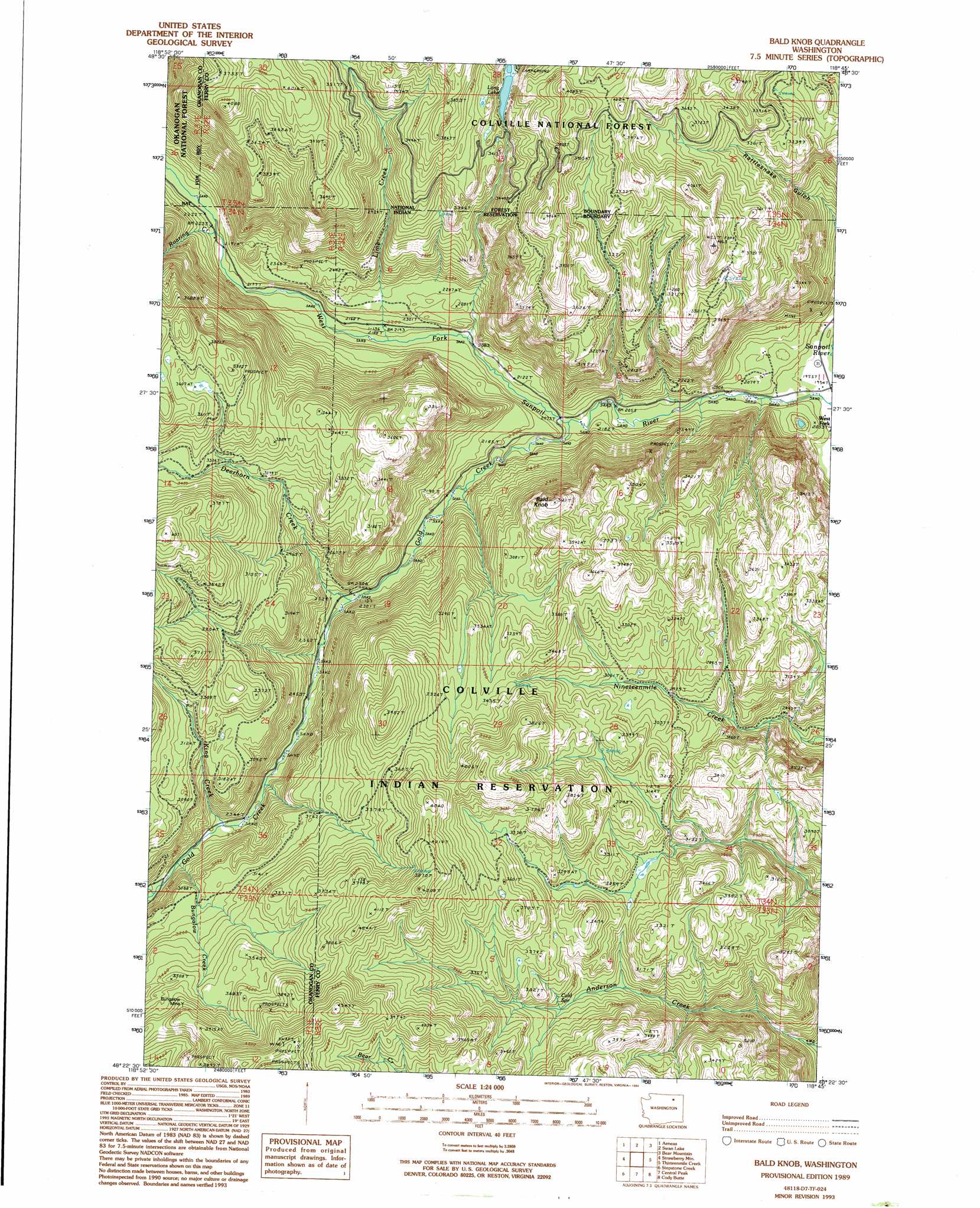
USGS Topo Quad 48118d7 - 1:24,000 scale
| Topo Map Name: | Bald Knob |
| USGS Topo Quad ID: | 48118d7 |
| Print Size: | ca. 21 1/4" wide x 27" high |
| Southeast Coordinates: | 48.375° N latitude / 118.75° W longitude |
| Map Center Coordinates: | 48.4375° N latitude / 118.8125° W longitude |
| U.S. State: | WA |
| Filename: | o48118d7.jpg |
| Download Map JPG Image: | Bald Knob topo map 1:24,000 scale |
| Map Type: | Topographic |
| Topo Series: | 7.5´ |
| Map Scale: | 1:24,000 |
| Source of Map Images: | United States Geological Survey (USGS) |
| Alternate Map Versions: |
Bald Knob WA 1989, updated 1989 Download PDF Buy paper map Bald Knob WA 1989, updated 1994 Download PDF Buy paper map Bald Knob WA 1992, updated 1996 Download PDF Buy paper map Bald Knob WA 2011 Download PDF Buy paper map Bald Knob WA 2014 Download PDF Buy paper map |
| FStopo: | US Forest Service topo Bald Knob is available: Download FStopo PDF Download FStopo TIF |
1:24,000 Topo Quads surrounding Bald Knob
Mount Annie |
Wauconda Summit |
Storm King Mountain |
Republic |
Cooke Mountain |
Bailey Creek |
Aeneas |
Swan Lake |
Bear Mountain |
Edds Mountain |
Moses Meadows |
Strawberry Mountain |
Bald Knob |
Thirteenmile Creek |
Seventeenmile Mountain |
Moses Mountain |
Stepstone Creek |
Central Peak |
Cody Butte |
Cody Lake |
Armstrong Creek |
Nespelem |
Nespelem Ne |
Louie Creek |
Frosty Meadows |
> Back to 48118a1 at 1:100,000 scale
> Back to 48118a1 at 1:250,000 scale
> Back to U.S. Topo Maps home
Bald Knob topo map: Gazetteer
Bald Knob: Lakes
Long Lake elevation 987m 3238′Bald Knob: Mines
Bungalow Mine elevation 1116m 3661′Bald Knob: Populated Places
West Fork elevation 591m 1938′Bald Knob: Springs
Cold Spring elevation 924m 3031′Bald Knob: Streams
Bungalow Creek elevation 802m 2631′Deerhorn Creek elevation 703m 2306′
Gold Creek elevation 630m 2066′
King Creek elevation 784m 2572′
Lime Creek elevation 645m 2116′
Roaring Creek elevation 671m 2201′
Bald Knob: Summits
Bald Knob elevation 1114m 3654′Bald Knob: Trails
Rattlesnake Road elevation 1061m 3480′Swan Lake Trail elevation 1016m 3333′
Bald Knob digital topo map on disk
Buy this Bald Knob topo map showing relief, roads, GPS coordinates and other geographical features, as a high-resolution digital map file on DVD: