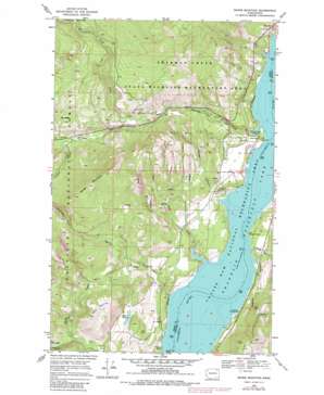
Bangs Mountain Topo Map Washington
To zoom in, hover over the map of Bangs Mountain
USGS Topo Quad 48118e2 - 1:24,000 scale
| Topo Map Name: | Bangs Mountain |
| USGS Topo Quad ID: | 48118e2 |
| Print Size: | ca. 21 1/4" wide x 27" high |
| Southeast Coordinates: | 48.5° N latitude / 118.125° W longitude |
| Map Center Coordinates: | 48.5625° N latitude / 118.1875° W longitude |
| U.S. State: | WA |
| Filename: | o48118e2.jpg |
| Download Map JPG Image: | Bangs Mountain topo map 1:24,000 scale |
| Map Type: | Topographic |
| Topo Series: | 7.5´ |
| Map Scale: | 1:24,000 |
| Source of Map Images: | United States Geological Survey (USGS) |
| Alternate Map Versions: |
Bangs Mountain WA 1969, updated 1972 Download PDF Buy paper map Bangs Mountain WA 1969, updated 1978 Download PDF Buy paper map Bangs Mountain WA 1969, updated 1982 Download PDF Buy paper map Bangs Mountain WA 1992, updated 1996 Download PDF Buy paper map Bangs Mountain WA 2011 Download PDF Buy paper map Bangs Mountain WA 2014 Download PDF Buy paper map |
| FStopo: | US Forest Service topo Bangs Mountain is available: Download FStopo PDF Download FStopo TIF |
1:24,000 Topo Quads surrounding Bangs Mountain
> Back to 48118e1 at 1:100,000 scale
> Back to 48118a1 at 1:250,000 scale
> Back to U.S. Topo Maps home
Bangs Mountain topo map: Gazetteer
Bangs Mountain: Bays
Haag Cove elevation 394m 1292′Bangs Mountain: Capes
French Point elevation 394m 1292′Rickey Point elevation 395m 1295′
Sherman Creek Point elevation 405m 1328′
Bangs Mountain: Falls
Rickey Rapids elevation 394m 1292′Bangs Mountain: Islands
French Point Rocks elevation 394m 1292′Bangs Mountain: Lakes
Mud Lake elevation 586m 1922′Bangs Mountain: Mines
Acme Mine elevation 746m 2447′Alma Mine elevation 806m 2644′
Bangs Mountain: Parks
Sherman Creek State Wildlife Recreation Area elevation 923m 3028′Bangs Mountain: Populated Places
Beulah (historical) elevation 394m 1292′Bangs Mountain: Springs
Bens Spring elevation 416m 1364′Bangs Mountain: Streams
Canyon Creek elevation 664m 2178′Martin Creek elevation 405m 1328′
Rickey Creek elevation 400m 1312′
Roper Creek elevation 396m 1299′
Sherman Creek elevation 446m 1463′
South Fork Roper Creek elevation 431m 1414′
Trout Creek elevation 592m 1942′
Bangs Mountain: Summits
Bald Hill elevation 944m 3097′Bangs Mountain elevation 1214m 3982′
Bangs Mountain: Valleys
Cougar Canyon elevation 414m 1358′Donaldson Draw elevation 870m 2854′
Rickey Canyon elevation 411m 1348′
Bangs Mountain digital topo map on disk
Buy this Bangs Mountain topo map showing relief, roads, GPS coordinates and other geographical features, as a high-resolution digital map file on DVD:


