South Huckleberry Mountain Topo Map Washington
To zoom in, hover over the map of South Huckleberry Mountain
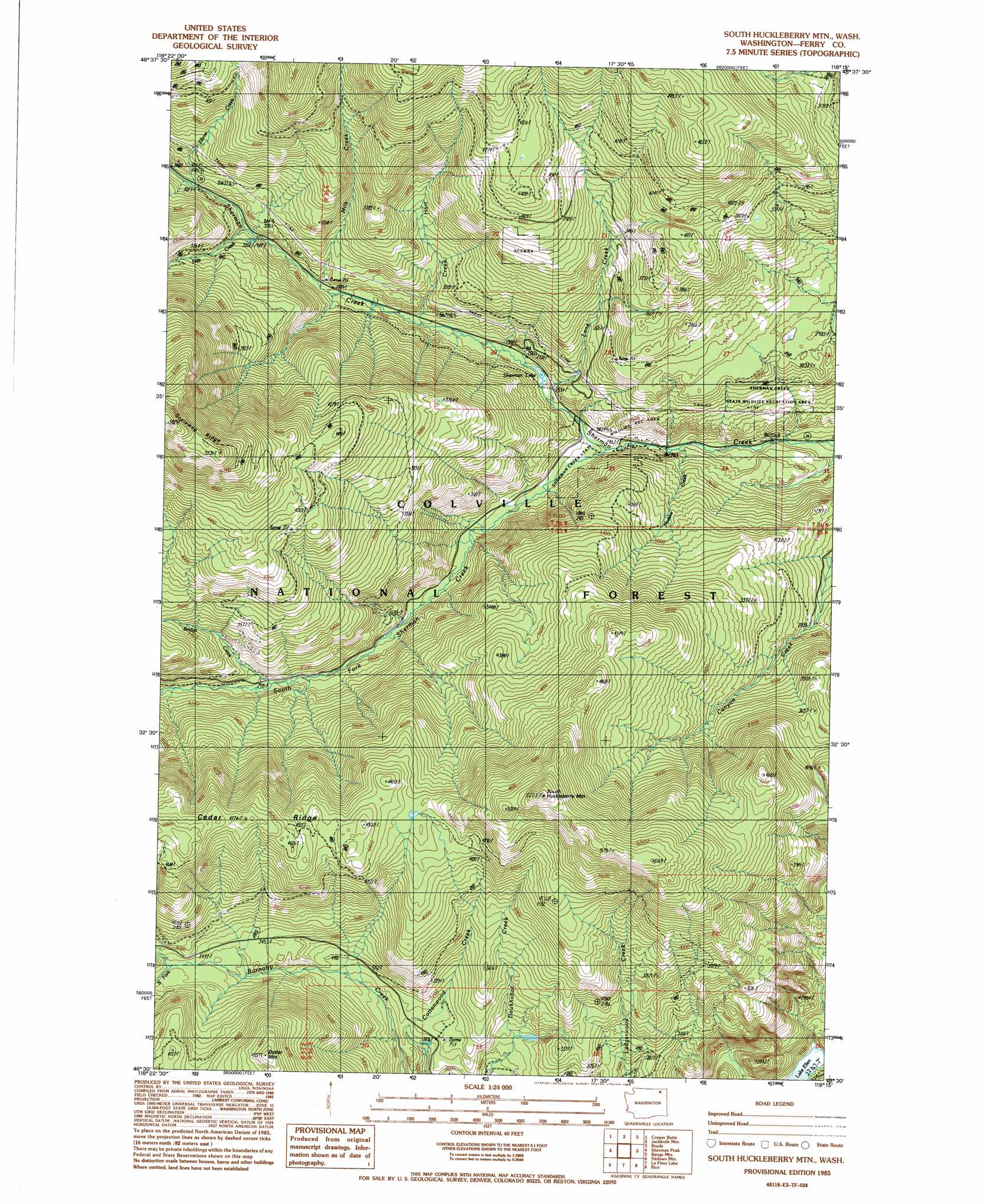
USGS Topo Quad 48118e3 - 1:24,000 scale
| Topo Map Name: | South Huckleberry Mountain |
| USGS Topo Quad ID: | 48118e3 |
| Print Size: | ca. 21 1/4" wide x 27" high |
| Southeast Coordinates: | 48.5° N latitude / 118.25° W longitude |
| Map Center Coordinates: | 48.5625° N latitude / 118.3125° W longitude |
| U.S. State: | WA |
| Filename: | o48118e3.jpg |
| Download Map JPG Image: | South Huckleberry Mountain topo map 1:24,000 scale |
| Map Type: | Topographic |
| Topo Series: | 7.5´ |
| Map Scale: | 1:24,000 |
| Source of Map Images: | United States Geological Survey (USGS) |
| Alternate Map Versions: |
South Huckleberry Mtn. WA 1985, updated 1985 Download PDF Buy paper map South Huckleberry Mtn. WA 1992, updated 1996 Download PDF Buy paper map South Huckleberry Mountain WA 2011 Download PDF Buy paper map South Huckleberry Mountain WA 2014 Download PDF Buy paper map |
| FStopo: | US Forest Service topo South Huckleberry Mountain is available: Download FStopo PDF Download FStopo TIF |
1:24,000 Topo Quads surrounding South Huckleberry Mountain
Malo |
Mount Leona |
Bulldog Mountain |
Orient |
Bossburg |
Cooke Mountain |
Copper Butte |
Jackknife Mountain |
Boyds |
Marcus |
Edds Mountain |
Sherman Peak |
South Huckleberry Mountain |
Bangs Mountain |
Kettle Falls |
Seventeenmile Mountain |
Sitdown Mountain |
La Fleur Lake |
Rice |
Kentry Ridge |
Cody Lake |
Twin Lakes |
Moon Mountain |
Inchelium |
Wellington Peak |
> Back to 48118e1 at 1:100,000 scale
> Back to 48118a1 at 1:250,000 scale
> Back to U.S. Topo Maps home
South Huckleberry Mountain topo map: Gazetteer
South Huckleberry Mountain: Falls
Sherman Creek Falls elevation 919m 3015′South Huckleberry Mountain: Lakes
Lake Ellen elevation 690m 2263′Sherman Lake elevation 779m 2555′
South Huckleberry Mountain: Ridges
Cedar Ridge elevation 1437m 4714′South Huckleberry Mountain: Streams
Bridge Creek elevation 883m 2896′Elbow Creek elevation 986m 3234′
Fritz Creek elevation 936m 3070′
Hart Creek elevation 816m 2677′
Lane Creek elevation 774m 2539′
Milk Creek elevation 869m 2851′
Nueske Creek elevation 728m 2388′
South Fork Barnaby Creek elevation 1057m 3467′
South Fork Sherman Creek elevation 744m 2440′
South Huckleberry Mountain: Summits
South Huckleberry Mountain elevation 1597m 5239′South Huckleberry Mountain digital topo map on disk
Buy this South Huckleberry Mountain topo map showing relief, roads, GPS coordinates and other geographical features, as a high-resolution digital map file on DVD: