Edds Mountain Topo Map Washington
To zoom in, hover over the map of Edds Mountain
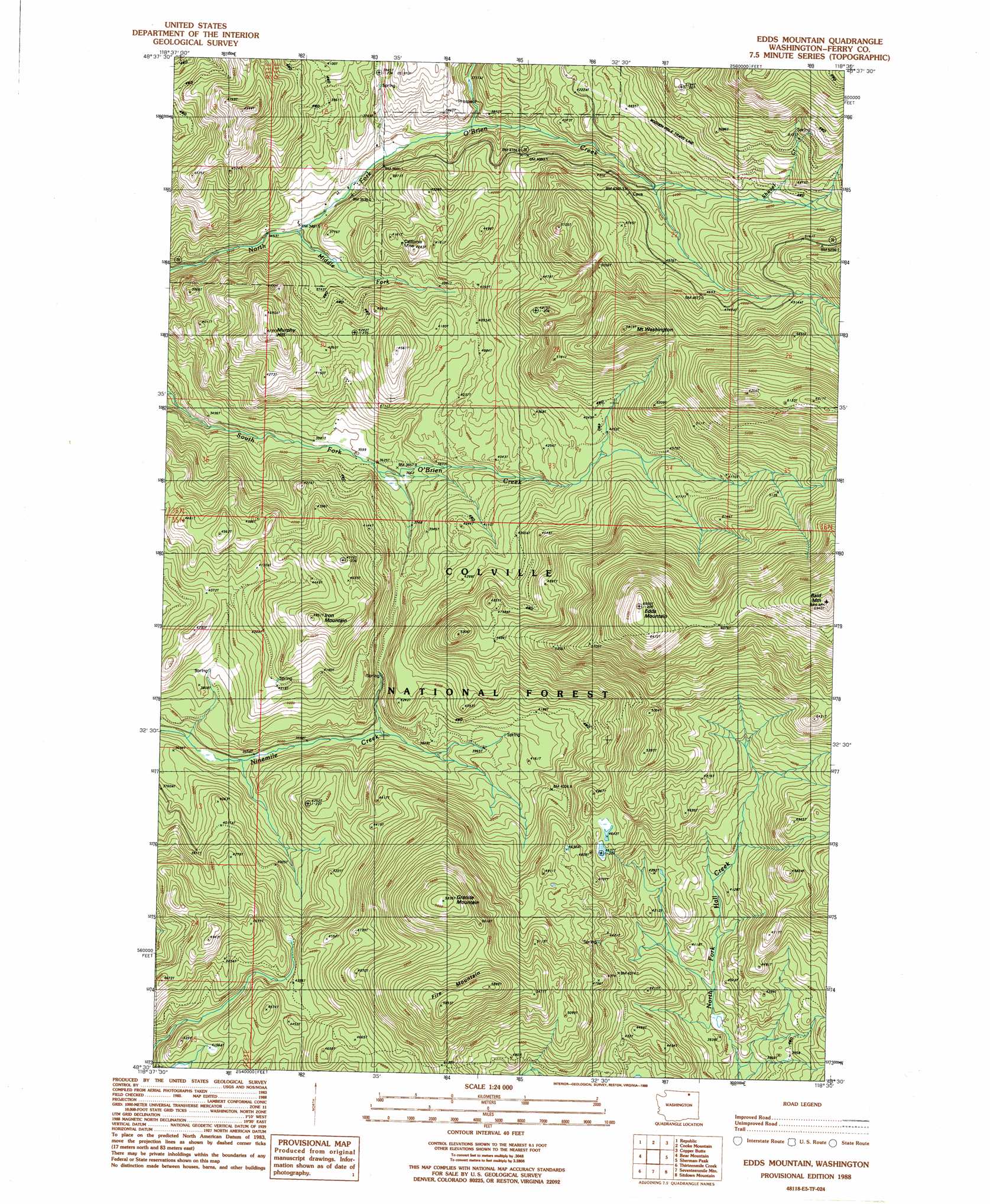
USGS Topo Quad 48118e5 - 1:24,000 scale
| Topo Map Name: | Edds Mountain |
| USGS Topo Quad ID: | 48118e5 |
| Print Size: | ca. 21 1/4" wide x 27" high |
| Southeast Coordinates: | 48.5° N latitude / 118.5° W longitude |
| Map Center Coordinates: | 48.5625° N latitude / 118.5625° W longitude |
| U.S. State: | WA |
| Filename: | o48118e5.jpg |
| Download Map JPG Image: | Edds Mountain topo map 1:24,000 scale |
| Map Type: | Topographic |
| Topo Series: | 7.5´ |
| Map Scale: | 1:24,000 |
| Source of Map Images: | United States Geological Survey (USGS) |
| Alternate Map Versions: |
Edds Mountain WA 1988, updated 1988 Download PDF Buy paper map Edds Mountain WA 1992, updated 1996 Download PDF Buy paper map Edds Mountain WA 2011 Download PDF Buy paper map Edds Mountain WA 2014 Download PDF Buy paper map |
| FStopo: | US Forest Service topo Edds Mountain is available: Download FStopo PDF Download FStopo TIF |
1:24,000 Topo Quads surrounding Edds Mountain
Bodie Mountain |
Karamin |
Malo |
Mount Leona |
Bulldog Mountain |
Storm King Mountain |
Republic |
Cooke Mountain |
Copper Butte |
Jackknife Mountain |
Swan Lake |
Bear Mountain |
Edds Mountain |
Sherman Peak |
South Huckleberry Mountain |
Bald Knob |
Thirteenmile Creek |
Seventeenmile Mountain |
Sitdown Mountain |
La Fleur Lake |
Central Peak |
Cody Butte |
Cody Lake |
Twin Lakes |
Moon Mountain |
> Back to 48118e1 at 1:100,000 scale
> Back to 48118a1 at 1:250,000 scale
> Back to U.S. Topo Maps home
Edds Mountain topo map: Gazetteer
Edds Mountain: Mines
California Mine elevation 1265m 4150′Edds Mountain: Streams
Middle Fork O'Brien Creek elevation 1063m 3487′Shovel Creek elevation 1387m 4550′
Edds Mountain: Summits
Bald Mountain elevation 2112m 6929′Edds Mountain elevation 1992m 6535′
Fire Mountain elevation 1775m 5823′
Granite Mountain elevation 1768m 5800′
Iron Mountain elevation 1464m 4803′
Mount Washington elevation 1748m 5734′
Murphy Hill elevation 1445m 4740′
Edds Mountain digital topo map on disk
Buy this Edds Mountain topo map showing relief, roads, GPS coordinates and other geographical features, as a high-resolution digital map file on DVD: