Malo Topo Map Washington
To zoom in, hover over the map of Malo
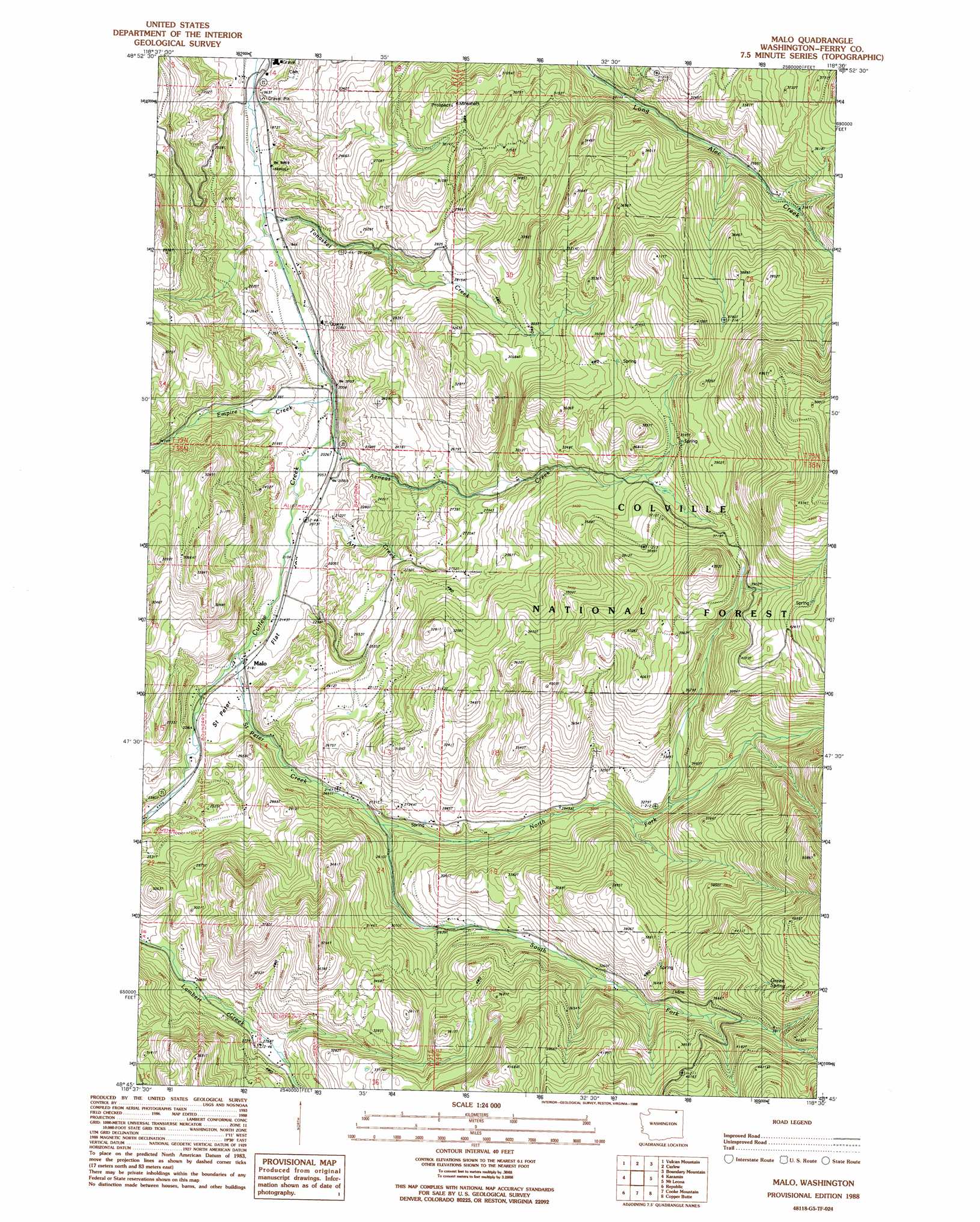
USGS Topo Quad 48118g5 - 1:24,000 scale
| Topo Map Name: | Malo |
| USGS Topo Quad ID: | 48118g5 |
| Print Size: | ca. 21 1/4" wide x 27" high |
| Southeast Coordinates: | 48.75° N latitude / 118.5° W longitude |
| Map Center Coordinates: | 48.8125° N latitude / 118.5625° W longitude |
| U.S. State: | WA |
| Filename: | o48118g5.jpg |
| Download Map JPG Image: | Malo topo map 1:24,000 scale |
| Map Type: | Topographic |
| Topo Series: | 7.5´ |
| Map Scale: | 1:24,000 |
| Source of Map Images: | United States Geological Survey (USGS) |
| Alternate Map Versions: |
Malo WA 1988, updated 1988 Download PDF Buy paper map Malo WA 1992, updated 1996 Download PDF Buy paper map Malo WA 2011 Download PDF Buy paper map Malo WA 2014 Download PDF Buy paper map |
| FStopo: | US Forest Service topo Malo is available: Download FStopo PDF Download FStopo TIF |
1:24,000 Topo Quads surrounding Malo
Toroda |
Vulcan Mountain |
Curlew |
Boundary Mountain |
Independent Mountain |
Bodie Mountain |
Karamin |
Malo |
Mount Leona |
Bulldog Mountain |
Storm King Mountain |
Republic |
Cooke Mountain |
Copper Butte |
Jackknife Mountain |
Swan Lake |
Bear Mountain |
Edds Mountain |
Sherman Peak |
South Huckleberry Mountain |
> Back to 48118e1 at 1:100,000 scale
> Back to 48118a1 at 1:250,000 scale
> Back to U.S. Topo Maps home
Malo topo map: Gazetteer
Malo: Flats
Saint Peter Flat elevation 681m 2234′Malo: Populated Places
Malo elevation 665m 2181′Malo: Springs
Green Spring elevation 1267m 4156′Malo: Streams
Aeneas Creek elevation 614m 2014′Art Creek elevation 624m 2047′
Empire Creek elevation 607m 1991′
North Fork Saint Peter Creek elevation 775m 2542′
Saint Peter Creek elevation 657m 2155′
South Fork Saint Peter Creek elevation 777m 2549′
Tonasket Creek elevation 575m 1886′
Malo digital topo map on disk
Buy this Malo topo map showing relief, roads, GPS coordinates and other geographical features, as a high-resolution digital map file on DVD: