Independent Mountain Topo Map Washington
To zoom in, hover over the map of Independent Mountain
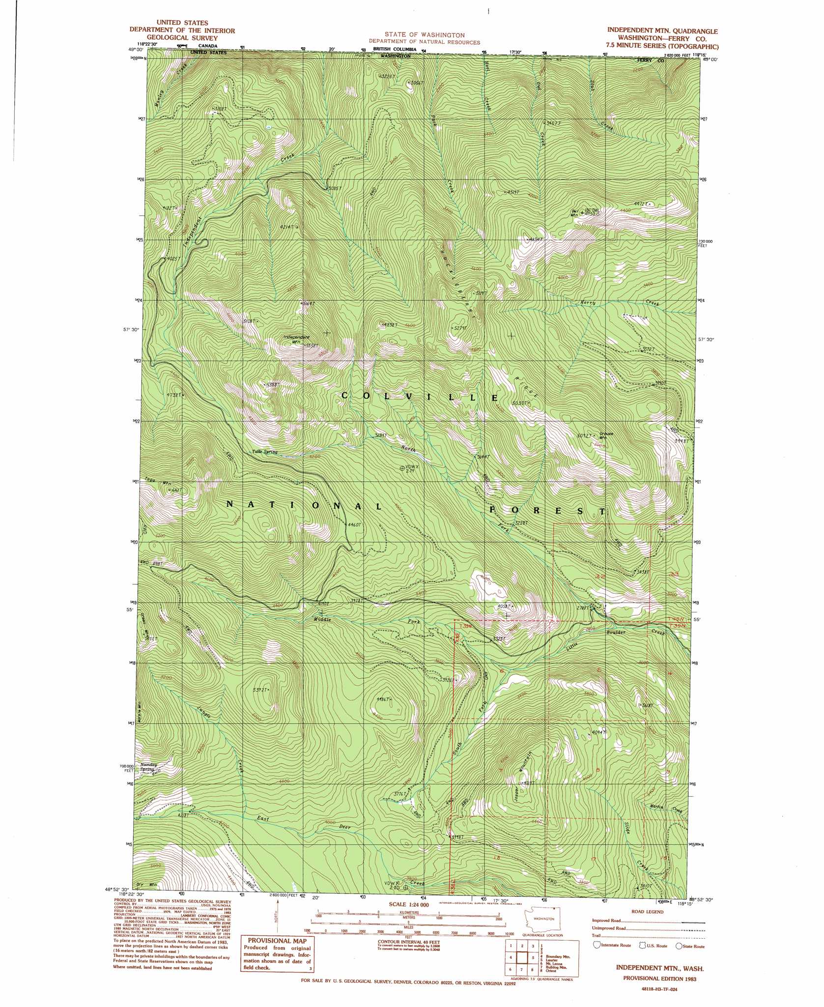
USGS Topo Quad 48118h3 - 1:24,000 scale
| Topo Map Name: | Independent Mountain |
| USGS Topo Quad ID: | 48118h3 |
| Print Size: | ca. 21 1/4" wide x 27" high |
| Southeast Coordinates: | 48.875° N latitude / 118.25° W longitude |
| Map Center Coordinates: | 48.9375° N latitude / 118.3125° W longitude |
| U.S. State: | WA |
| Filename: | o48118h3.jpg |
| Download Map JPG Image: | Independent Mountain topo map 1:24,000 scale |
| Map Type: | Topographic |
| Topo Series: | 7.5´ |
| Map Scale: | 1:24,000 |
| Source of Map Images: | United States Geological Survey (USGS) |
| Alternate Map Versions: |
Independent Mtn WA 1983, updated 1983 Download PDF Buy paper map Independent Mtn WA 1992, updated 1996 Download PDF Buy paper map Independent Mountain WA 2011 Download PDF Buy paper map Independent Mountain WA 2014 Download PDF Buy paper map |
| FStopo: | US Forest Service topo Independent Mountain is available: Download FStopo PDF Download FStopo TIF |
1:24,000 Topo Quads surrounding Independent Mountain
Curlew |
Boundary Mountain |
Independent Mountain |
Laurier |
Churchill Mountain |
Malo |
Mount Leona |
Bulldog Mountain |
Orient |
Bossburg |
Cooke Mountain |
Copper Butte |
Jackknife Mountain |
Boyds |
Marcus |
> Back to 48118e1 at 1:100,000 scale
> Back to 48118a1 at 1:250,000 scale
> Back to U.S. Topo Maps home
Independent Mountain topo map: Gazetteer
Independent Mountain: Ridges
Huckleberry Ridge elevation 1600m 5249′Independent Mountain: Springs
Table Spring elevation 1388m 4553′Independent Mountain: Streams
Jungle Creek elevation 1262m 4140′Manley Creek elevation 779m 2555′
Middle Fork Little Boulder Creek elevation 955m 3133′
North Fork Little Boulder Creek elevation 809m 2654′
Onion Creek elevation 995m 3264′
South Fork Little Boulder Creek elevation 952m 3123′
Independent Mountain: Summits
Green Mountain elevation 1740m 5708′Grouse Mountain elevation 1537m 5042′
Independent Mountain elevation 1667m 5469′
Jasper Mountain elevation 1429m 4688′
Owl Mountain elevation 1441m 4727′
Togo Mountain elevation 1853m 6079′
Independent Mountain digital topo map on disk
Buy this Independent Mountain topo map showing relief, roads, GPS coordinates and other geographical features, as a high-resolution digital map file on DVD: