Toroda Topo Map Washington
To zoom in, hover over the map of Toroda
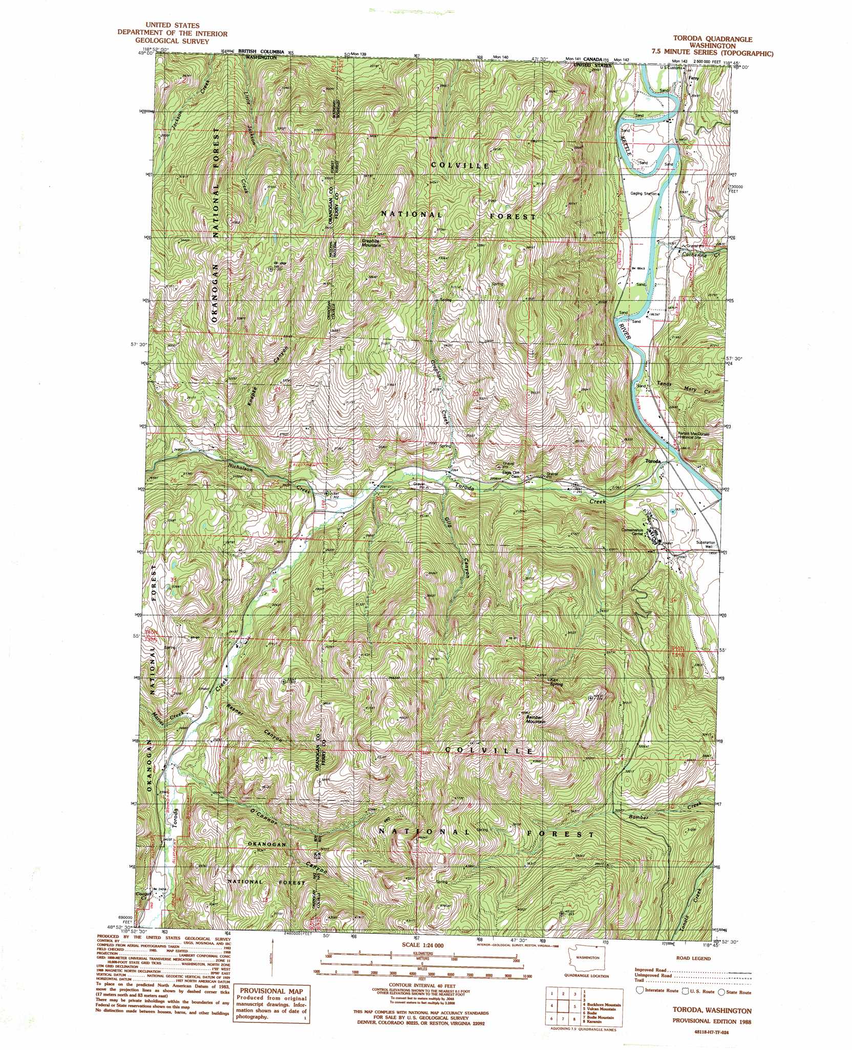
USGS Topo Quad 48118h7 - 1:24,000 scale
| Topo Map Name: | Toroda |
| USGS Topo Quad ID: | 48118h7 |
| Print Size: | ca. 21 1/4" wide x 27" high |
| Southeast Coordinates: | 48.875° N latitude / 118.75° W longitude |
| Map Center Coordinates: | 48.9375° N latitude / 118.8125° W longitude |
| U.S. State: | WA |
| Filename: | o48118h7.jpg |
| Download Map JPG Image: | Toroda topo map 1:24,000 scale |
| Map Type: | Topographic |
| Topo Series: | 7.5´ |
| Map Scale: | 1:24,000 |
| Source of Map Images: | United States Geological Survey (USGS) |
| Alternate Map Versions: |
Toroda WA 1988, updated 1988 Download PDF Buy paper map Toroda WA 1992, updated 1996 Download PDF Buy paper map Toroda WA 2011 Download PDF Buy paper map Toroda WA 2014 Download PDF Buy paper map |
| FStopo: | US Forest Service topo Toroda is available: Download FStopo PDF Download FStopo TIF |
1:24,000 Topo Quads surrounding Toroda
Chesaw |
Buckhorn Mountain |
Toroda |
Vulcan Mountain |
Curlew |
Mount Bonaparte |
Bodie |
Bodie Mountain |
Karamin |
Malo |
Mount Annie |
Wauconda Summit |
Storm King Mountain |
Republic |
Cooke Mountain |
> Back to 48118e1 at 1:100,000 scale
> Back to 48118a1 at 1:250,000 scale
> Back to U.S. Topo Maps home
Toroda topo map: Gazetteer
Toroda: Forests
Colville National Forest elevation 1102m 3615′Toroda: Lakes
Wheaton Lake elevation 1026m 3366′Toroda: Populated Places
Toroda elevation 563m 1847′Toroda: Springs
Ken Spring elevation 1264m 4146′Toroda: Streams
Catherine Creek elevation 572m 1876′Coogan Creek elevation 728m 2388′
Graphite Creek elevation 625m 2050′
Marias Creek elevation 711m 2332′
Nicholson Creek elevation 644m 2112′
Tenas Mary Creek elevation 561m 1840′
Toroda Creek elevation 570m 1870′
Toroda: Summits
Bamber Mountain elevation 1357m 4452′Graphite Mountain elevation 1308m 4291′
Toroda: Valleys
Gilg Canyon elevation 627m 2057′Koepke Canyon elevation 754m 2473′
O'Connor Canyon elevation 731m 2398′
Resner Canyon elevation 723m 2372′
Toroda digital topo map on disk
Buy this Toroda topo map showing relief, roads, GPS coordinates and other geographical features, as a high-resolution digital map file on DVD: