Buckhorn Mountain Topo Map Washington
To zoom in, hover over the map of Buckhorn Mountain
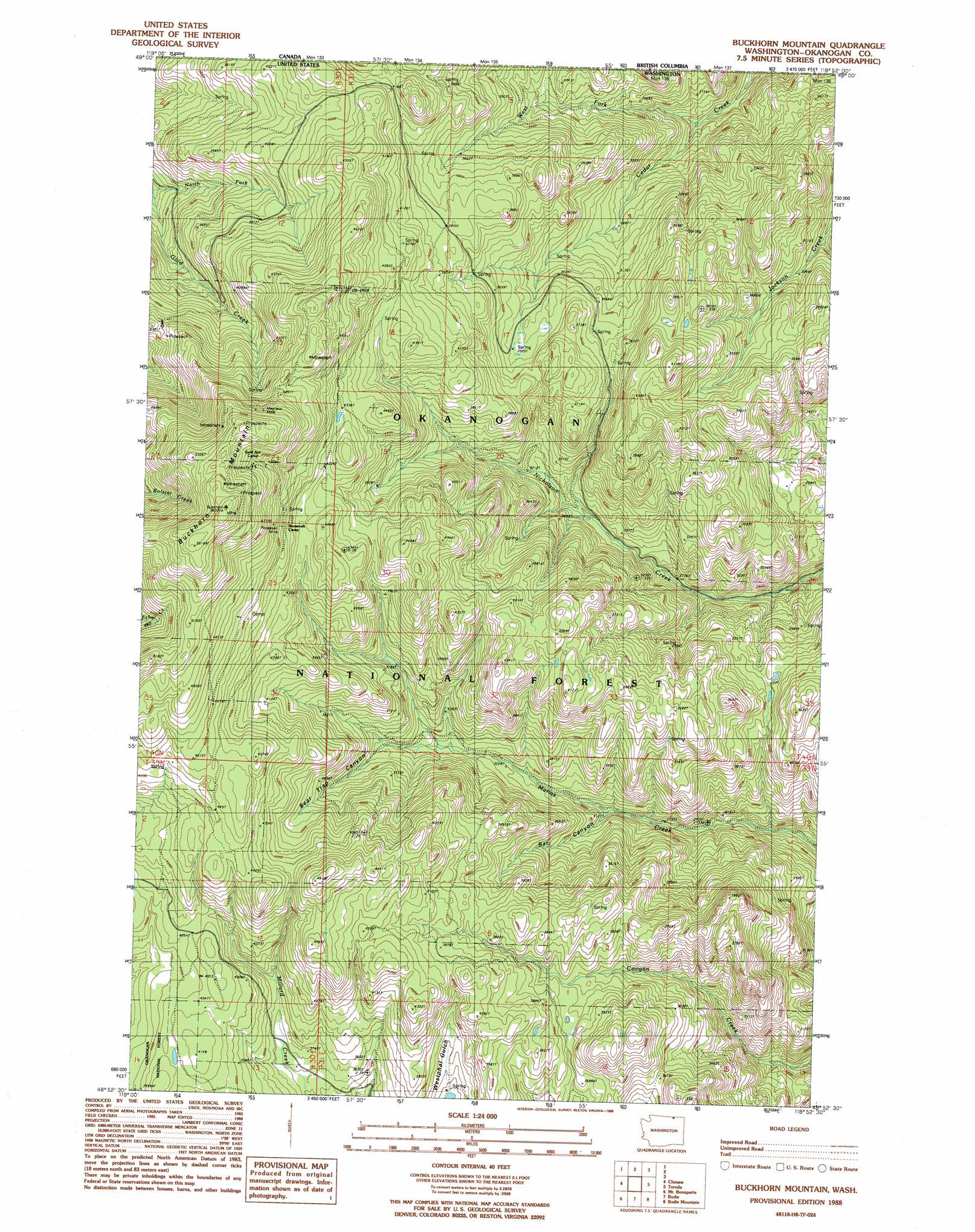
USGS Topo Quad 48118h8 - 1:24,000 scale
| Topo Map Name: | Buckhorn Mountain |
| USGS Topo Quad ID: | 48118h8 |
| Print Size: | ca. 21 1/4" wide x 27" high |
| Southeast Coordinates: | 48.875° N latitude / 118.875° W longitude |
| Map Center Coordinates: | 48.9375° N latitude / 118.9375° W longitude |
| U.S. State: | WA |
| Filename: | o48118h8.jpg |
| Download Map JPG Image: | Buckhorn Mountain topo map 1:24,000 scale |
| Map Type: | Topographic |
| Topo Series: | 7.5´ |
| Map Scale: | 1:24,000 |
| Source of Map Images: | United States Geological Survey (USGS) |
| Alternate Map Versions: |
Buckhorn Mountain WA 1988, updated 1988 Download PDF Buy paper map Buckhorn Mountain WA 2001, updated 2004 Download PDF Buy paper map Buckhorn Mountain WA 2011 Download PDF Buy paper map Buckhorn Mountain WA 2014 Download PDF Buy paper map |
| FStopo: | US Forest Service topo Buckhorn Mountain is available: Download FStopo PDF Download FStopo TIF |
1:24,000 Topo Quads surrounding Buckhorn Mountain
Molson |
Chesaw |
Buckhorn Mountain |
Toroda |
Vulcan Mountain |
Havillah |
Mount Bonaparte |
Bodie |
Bodie Mountain |
Karamin |
Cayuse Mountain |
Mount Annie |
Wauconda Summit |
Storm King Mountain |
Republic |
> Back to 48118e1 at 1:100,000 scale
> Back to 48118a1 at 1:250,000 scale
> Back to U.S. Topo Maps home
Buckhorn Mountain topo map: Gazetteer
Buckhorn Mountain: Mines
Magnetic Mine elevation 1499m 4917′Buckhorn Mountain: Springs
Jackson Spring elevation 920m 3018′Buckhorn Mountain: Streams
Cedar Creek elevation 748m 2454′West Fork Cedar Creek elevation 762m 2500′
Buckhorn Mountain: Summits
Buckhorn Mountain elevation 1703m 5587′Buckhorn Mountain: Trails
Denney Trail elevation 1192m 3910′Fawns Mill Trail elevation 830m 2723′
Marias Creek Trail elevation 985m 3231′
Buckhorn Mountain: Valleys
Bat Canyon elevation 883m 2896′Bear Trap Canyon elevation 1058m 3471′
Buckhorn Mountain digital topo map on disk
Buy this Buckhorn Mountain topo map showing relief, roads, GPS coordinates and other geographical features, as a high-resolution digital map file on DVD: