Joe Lake Topo Map Washington
To zoom in, hover over the map of Joe Lake
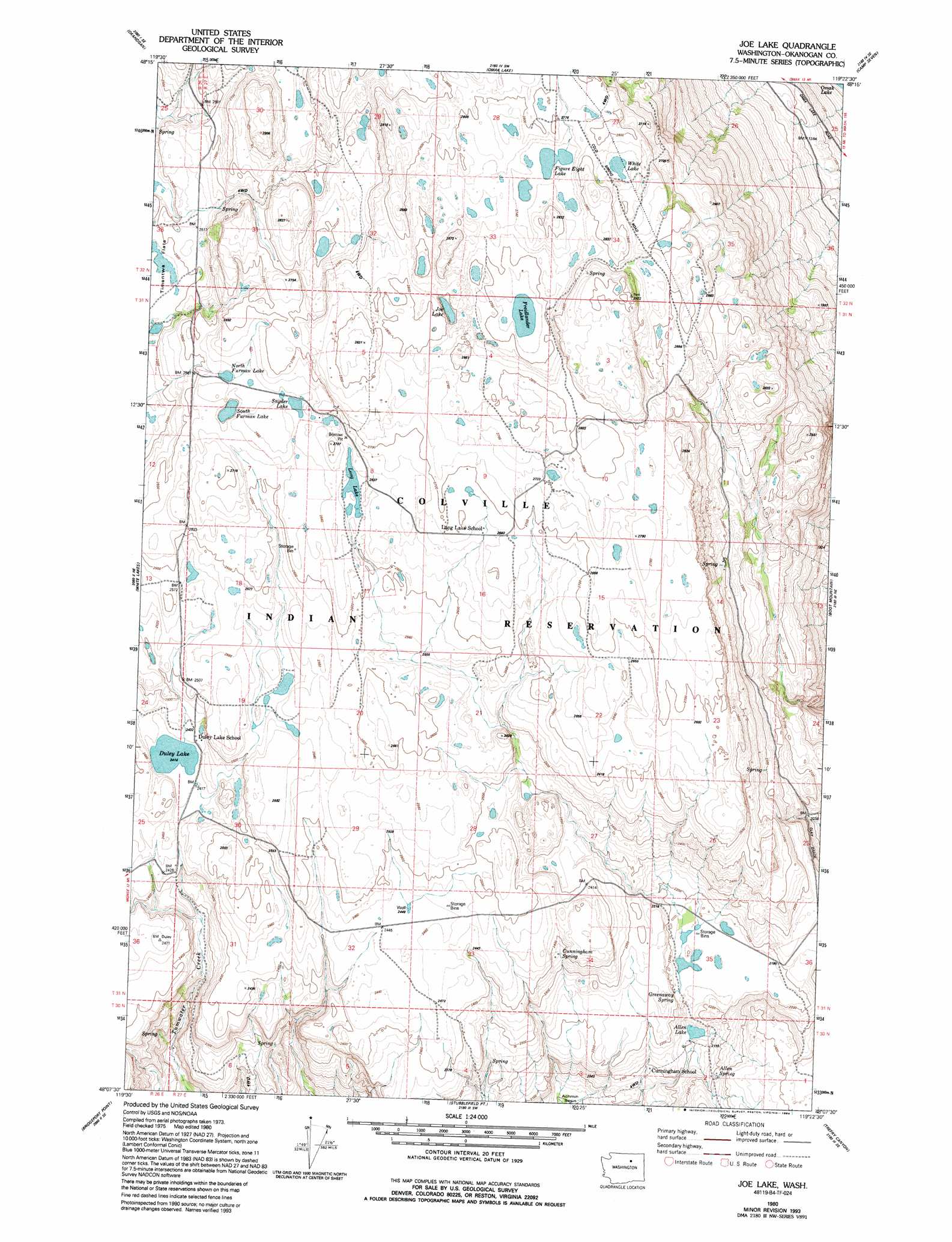
USGS Topo Quad 48119b4 - 1:24,000 scale
| Topo Map Name: | Joe Lake |
| USGS Topo Quad ID: | 48119b4 |
| Print Size: | ca. 21 1/4" wide x 27" high |
| Southeast Coordinates: | 48.125° N latitude / 119.375° W longitude |
| Map Center Coordinates: | 48.1875° N latitude / 119.4375° W longitude |
| U.S. State: | WA |
| Filename: | o48119b4.jpg |
| Download Map JPG Image: | Joe Lake topo map 1:24,000 scale |
| Map Type: | Topographic |
| Topo Series: | 7.5´ |
| Map Scale: | 1:24,000 |
| Source of Map Images: | United States Geological Survey (USGS) |
| Alternate Map Versions: |
Joe Lake WA 1980, updated 1981 Download PDF Buy paper map Joe Lake WA 1980, updated 1994 Download PDF Buy paper map Joe Lake WA 2011 Download PDF Buy paper map Joe Lake WA 2014 Download PDF Buy paper map |
1:24,000 Topo Quads surrounding Joe Lake
Ruby Hill |
Omak |
The Pothole |
Omak Mountain |
Crawfish Lake |
Malott |
Okanogan |
Omak Lake |
Camp Seven |
Disautel |
Monse |
White Lakes |
Joe Lake |
Boot Mountain |
Hopkins Canyon |
Bridgeport |
Bridgeport Point |
Stubblefield Point |
Trefry Canyon |
Alameda Flat |
Chief Joseph Dam |
Coleman Hill |
Leahy |
Foster Coulee |
Barker Canyon |
> Back to 48119a1 at 1:100,000 scale
> Back to 48118a1 at 1:250,000 scale
> Back to U.S. Topo Maps home
Joe Lake topo map: Gazetteer
Joe Lake: Lakes
Duley Lake elevation 737m 2417′Figure Eight Lake elevation 831m 2726′
North Furman Lake elevation 794m 2604′
Snyder Lake elevation 803m 2634′
South Furman Lake elevation 790m 2591′
White Lake elevation 837m 2746′
Joe Lake: Springs
Allen Spring elevation 673m 2208′Cunningham Spring elevation 720m 2362′
Greenaway Spring elevation 683m 2240′
Joe Lake digital topo map on disk
Buy this Joe Lake topo map showing relief, roads, GPS coordinates and other geographical features, as a high-resolution digital map file on DVD: