Rat Lake Topo Map Washington
To zoom in, hover over the map of Rat Lake
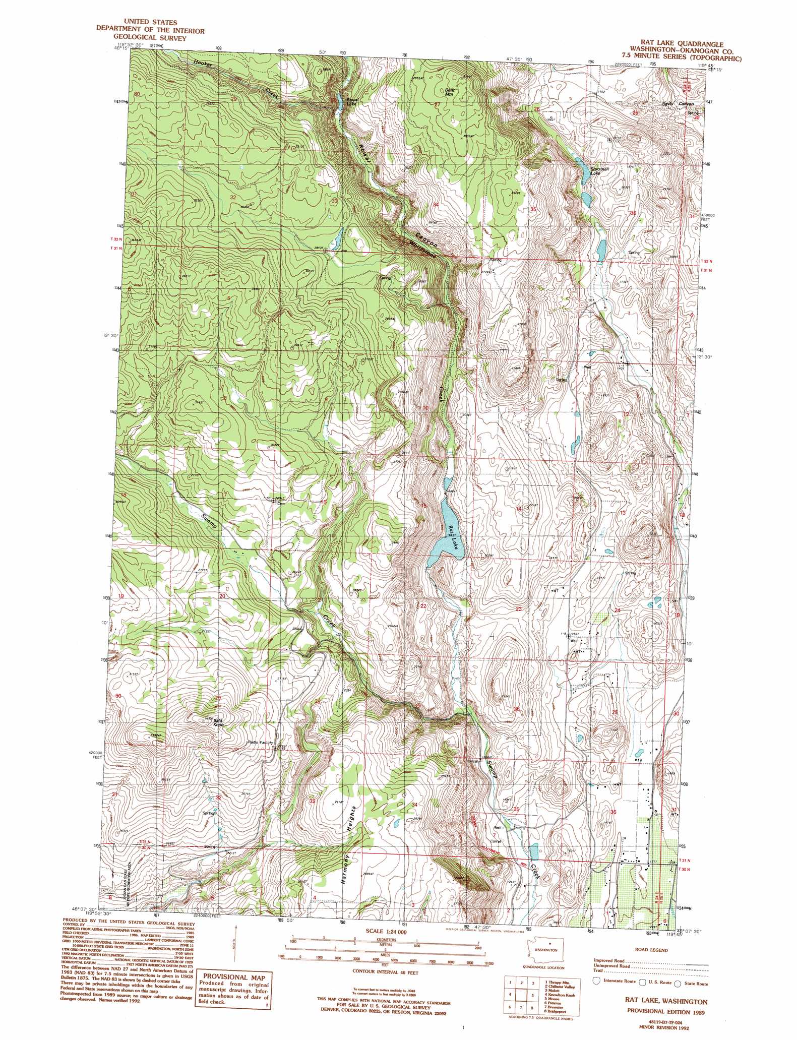
USGS Topo Quad 48119b7 - 1:24,000 scale
| Topo Map Name: | Rat Lake |
| USGS Topo Quad ID: | 48119b7 |
| Print Size: | ca. 21 1/4" wide x 27" high |
| Southeast Coordinates: | 48.125° N latitude / 119.75° W longitude |
| Map Center Coordinates: | 48.1875° N latitude / 119.8125° W longitude |
| U.S. State: | WA |
| Filename: | o48119b7.jpg |
| Download Map JPG Image: | Rat Lake topo map 1:24,000 scale |
| Map Type: | Topographic |
| Topo Series: | 7.5´ |
| Map Scale: | 1:24,000 |
| Source of Map Images: | United States Geological Survey (USGS) |
| Alternate Map Versions: |
Rat Lake WA 1989, updated 1989 Download PDF Buy paper map Rat Lake WA 1989, updated 1993 Download PDF Buy paper map Rat Lake WA 2011 Download PDF Buy paper map Rat Lake WA 2014 Download PDF Buy paper map |
1:24,000 Topo Quads surrounding Rat Lake
Blue Buck Mountain |
Loup Loup Summit |
Buck Mountain |
Ruby Hill |
Omak |
Twisp East |
Thrapp Mountain |
Chiliwist Valley |
Malott |
Okanogan |
Methow |
Knowton Knob |
Rat Lake |
Monse |
White Lakes |
Cooper Mountain |
Pateros |
Brewster |
Bridgeport |
Bridgeport Point |
Cooper Ridge |
Azwell |
Wells Dam |
Chief Joseph Dam |
Coleman Hill |
> Back to 48119a1 at 1:100,000 scale
> Back to 48118a1 at 1:250,000 scale
> Back to U.S. Topo Maps home
Rat Lake topo map: Gazetteer
Rat Lake: Dams
Rat Lake Dam elevation 512m 1679′Rat Lake: Lakes
Rowel Lake elevation 645m 2116′Starzman Lake elevation 507m 1663′
Rat Lake: Reservoirs
Rat Lake elevation 512m 1679′Rat Lake: Streams
Hooker Creek elevation 646m 2119′Whitestone Creek elevation 436m 1430′
Rat Lake: Summits
Bald Knob elevation 1054m 3458′Dent Mountain elevation 948m 3110′
Harmony Heights elevation 876m 2874′
Rat Lake: Valleys
Rowel Canyon elevation 436m 1430′Rat Lake digital topo map on disk
Buy this Rat Lake topo map showing relief, roads, GPS coordinates and other geographical features, as a high-resolution digital map file on DVD: