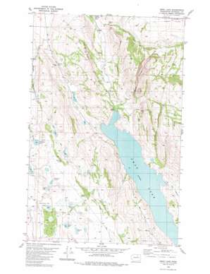
Omak Lake Topo Map Washington
To zoom in, hover over the map of Omak Lake
USGS Topo Quad 48119c4 - 1:24,000 scale
| Topo Map Name: | Omak Lake |
| USGS Topo Quad ID: | 48119c4 |
| Print Size: | ca. 21 1/4" wide x 27" high |
| Southeast Coordinates: | 48.25° N latitude / 119.375° W longitude |
| Map Center Coordinates: | 48.3125° N latitude / 119.4375° W longitude |
| U.S. State: | WA |
| Filename: | o48119c4.jpg |
| Download Map JPG Image: | Omak Lake topo map 1:24,000 scale |
| Map Type: | Topographic |
| Topo Series: | 7.5´ |
| Map Scale: | 1:24,000 |
| Source of Map Images: | United States Geological Survey (USGS) |
| Alternate Map Versions: |
Omak Lake WA 2011 Download PDF Buy paper map Omak Lake WA 2014 Download PDF Buy paper map |
1:24,000 Topo Quads surrounding Omak Lake
> Back to 48119a1 at 1:100,000 scale
> Back to 48118a1 at 1:250,000 scale
> Back to U.S. Topo Maps home
Omak Lake topo map: Gazetteer
Omak Lake: Basins
Matthew Bill Basin elevation 831m 2726′West Basin elevation 927m 3041′
Omak Lake: Cliffs
Eagle Cliffs elevation 360m 1181′Omak Lake: Falls
Mission Falls elevation 418m 1371′Omak Lake: Flats
Bull Pasture elevation 298m 977′Omak Lake: Gaps
Antoine Pass elevation 460m 1509′Omak Lake: Lakes
Deep Lake elevation 890m 2919′Little Lake elevation 775m 2542′
Mirror Lake elevation 867m 2844′
Murray Lake elevation 815m 2673′
Omak Lake elevation 292m 958′
Patterson Lake elevation 825m 2706′
Stewart Lake elevation 808m 2650′
Stink Lake elevation 827m 2713′
Omak Lake: Springs
Deadman Spring elevation 858m 2814′Patterson Spring elevation 852m 2795′
Rust Spring elevation 803m 2634′
Omak Lake: Streams
Beaverhouse Creek elevation 294m 964′No Name Creek elevation 292m 958′
Omak Lake: Valleys
Deep Canyon elevation 407m 1335′Omak Lake digital topo map on disk
Buy this Omak Lake topo map showing relief, roads, GPS coordinates and other geographical features, as a high-resolution digital map file on DVD:


