Tonasket Topo Map Washington
To zoom in, hover over the map of Tonasket
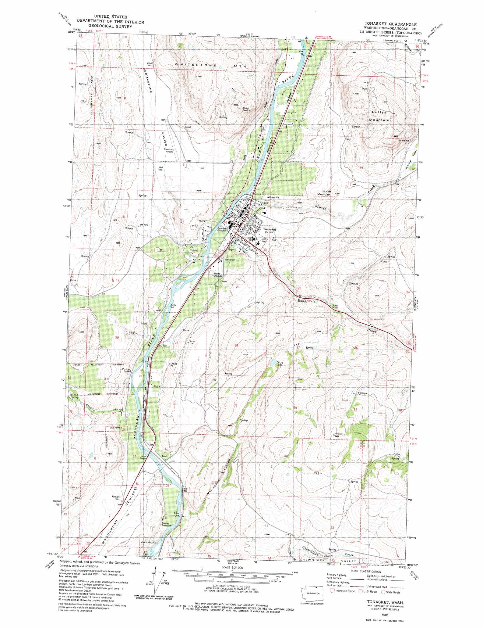
USGS Topo Quad 48119f4 - 1:24,000 scale
| Topo Map Name: | Tonasket |
| USGS Topo Quad ID: | 48119f4 |
| Print Size: | ca. 21 1/4" wide x 27" high |
| Southeast Coordinates: | 48.625° N latitude / 119.375° W longitude |
| Map Center Coordinates: | 48.6875° N latitude / 119.4375° W longitude |
| U.S. State: | WA |
| Filename: | o48119f4.jpg |
| Download Map JPG Image: | Tonasket topo map 1:24,000 scale |
| Map Type: | Topographic |
| Topo Series: | 7.5´ |
| Map Scale: | 1:24,000 |
| Source of Map Images: | United States Geological Survey (USGS) |
| Alternate Map Versions: |
Tonasket WA 1981, updated 1981 Download PDF Buy paper map Tonasket WA 2011 Download PDF Buy paper map Tonasket WA 2014 Download PDF Buy paper map |
1:24,000 Topo Quads surrounding Tonasket
Nighthawk |
Bullfrog Mountain |
Oroville |
Mount Hull |
Molson |
Loomis |
Enterprise |
Ellisforde |
Burge Mountain |
Havillah |
Blue Goat Mountain |
Aeneas Lake |
Tonasket |
Barker Mountain |
Cayuse Mountain |
Conconully East |
Riverside |
Keystone |
Synarep |
Tunk Mountain |
Ruby Hill |
Omak |
The Pothole |
Omak Mountain |
Crawfish Lake |
> Back to 48119e1 at 1:100,000 scale
> Back to 48118a1 at 1:250,000 scale
> Back to U.S. Topo Maps home
Tonasket topo map: Gazetteer
Tonasket: Bridges
Janis Bridge elevation 267m 875′Tonasket: Lakes
Perry Lake elevation 508m 1666′Tonasket: Populated Places
Janis elevation 271m 889′Tonasket elevation 280m 918′
Tonasket: Rapids
Janis Rapids elevation 272m 892′Tonasket: Streams
Aeneas Creek elevation 270m 885′Bonaparte Creek elevation 269m 882′
Chewiliken Creek elevation 264m 866′
Siwash Creek elevation 269m 882′
Tonasket: Summits
Duffys Mountain elevation 719m 2358′Horse Mountain elevation 454m 1489′
Tonasket: Valleys
Antoine Valley elevation 438m 1437′McLoughlin Canyon elevation 311m 1020′
Whitestone Coulee elevation 305m 1000′
Tonasket digital topo map on disk
Buy this Tonasket topo map showing relief, roads, GPS coordinates and other geographical features, as a high-resolution digital map file on DVD: