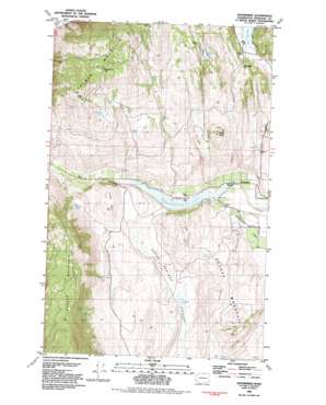
Enterprise Topo Map Washington
To zoom in, hover over the map of Enterprise
USGS Topo Quad 48119g5 - 1:24,000 scale
| Topo Map Name: | Enterprise |
| USGS Topo Quad ID: | 48119g5 |
| Print Size: | ca. 21 1/4" wide x 27" high |
| Southeast Coordinates: | 48.75° N latitude / 119.5° W longitude |
| Map Center Coordinates: | 48.8125° N latitude / 119.5625° W longitude |
| U.S. State: | WA |
| Filename: | o48119g5.jpg |
| Download Map JPG Image: | Enterprise topo map 1:24,000 scale |
| Map Type: | Topographic |
| Topo Series: | 7.5´ |
| Map Scale: | 1:24,000 |
| Source of Map Images: | United States Geological Survey (USGS) |
| Alternate Map Versions: |
Enterprise WA 1982, updated 1982 Download PDF Buy paper map Enterprise WA 2011 Download PDF Buy paper map Enterprise WA 2014 Download PDF Buy paper map |
1:24,000 Topo Quads surrounding Enterprise
> Back to 48119e1 at 1:100,000 scale
> Back to 48118a1 at 1:250,000 scale
> Back to U.S. Topo Maps home
Enterprise topo map: Gazetteer
Enterprise: Canals
Whitestone Ditch elevation 467m 1532′Enterprise: Dams
Horse Spring Coulee Dam elevation 471m 1545′Spectacle Lake Dike Dam elevation 419m 1374′
Enterprise: Lakes
Catlin Lake elevation 560m 1837′Rainbow Lake elevation 788m 2585′
Stevens Lake elevation 503m 1650′
Washburn Lake elevation 938m 3077′
Enterprise: Mines
Alice Mine elevation 1192m 3910′Chicago Mine elevation 586m 1922′
Copper World Mine elevation 1113m 3651′
Ivanhoe Mine elevation 1122m 3681′
John Judge Mine elevation 865m 2837′
Pinnacle Mine elevation 657m 2155′
Rainbow Mine elevation 853m 2798′
Enterprise: Reservoirs
Spectacle Lake elevation 419m 1374′Enterprise: Springs
Big Spring elevation 753m 2470′Brown Spring elevation 669m 2194′
Burbery Spring elevation 555m 1820′
Garret Spring elevation 786m 2578′
Hariman Spring elevation 710m 2329′
Enterprise: Streams
Horse Creek elevation 470m 1541′Enterprise: Summits
Cayuse Mountain elevation 470m 1541′Jones Hill elevation 634m 2080′
Palmer Mountain elevation 1308m 4291′
White Rock elevation 945m 3100′
Enterprise digital topo map on disk
Buy this Enterprise topo map showing relief, roads, GPS coordinates and other geographical features, as a high-resolution digital map file on DVD:


