Mount Hull Topo Map Washington
To zoom in, hover over the map of Mount Hull
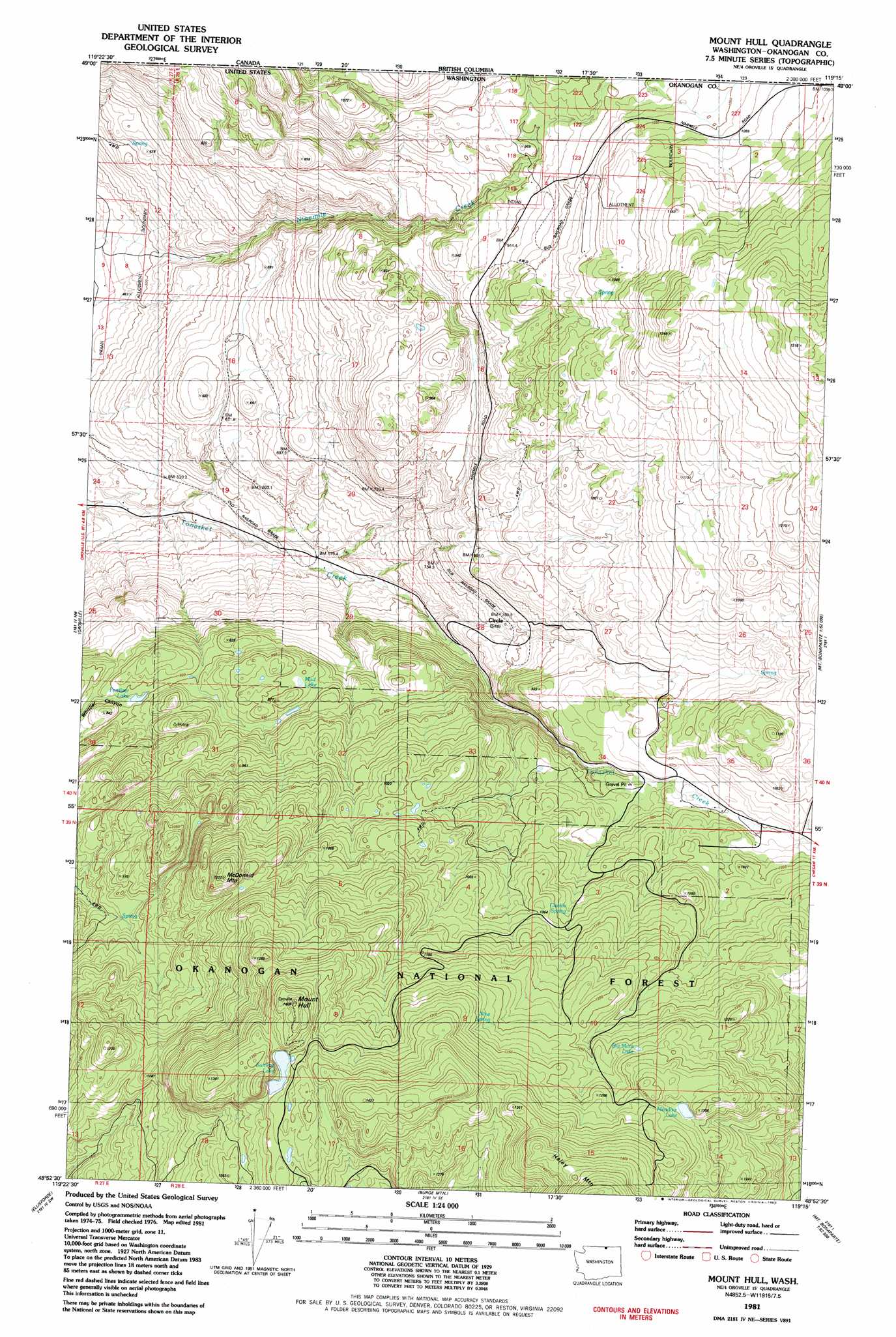
USGS Topo Quad 48119h3 - 1:24,000 scale
| Topo Map Name: | Mount Hull |
| USGS Topo Quad ID: | 48119h3 |
| Print Size: | ca. 21 1/4" wide x 27" high |
| Southeast Coordinates: | 48.875° N latitude / 119.25° W longitude |
| Map Center Coordinates: | 48.9375° N latitude / 119.3125° W longitude |
| U.S. State: | WA |
| Filename: | o48119h3.jpg |
| Download Map JPG Image: | Mount Hull topo map 1:24,000 scale |
| Map Type: | Topographic |
| Topo Series: | 7.5´ |
| Map Scale: | 1:24,000 |
| Source of Map Images: | United States Geological Survey (USGS) |
| Alternate Map Versions: |
Mount Hull WA 1981, updated 1982 Download PDF Buy paper map Mount Hull WA 2001, updated 2004 Download PDF Buy paper map Mount Hull WA 2011 Download PDF Buy paper map Mount Hull WA 2014 Download PDF Buy paper map |
| FStopo: | US Forest Service topo Mount Hull is available: Download FStopo PDF Download FStopo TIF |
1:24,000 Topo Quads surrounding Mount Hull
Bullfrog Mountain |
Oroville |
Mount Hull |
Molson |
Chesaw |
Enterprise |
Ellisforde |
Burge Mountain |
Havillah |
Mount Bonaparte |
Aeneas Lake |
Tonasket |
Barker Mountain |
Cayuse Mountain |
Mount Annie |
> Back to 48119e1 at 1:100,000 scale
> Back to 48118a1 at 1:250,000 scale
> Back to U.S. Topo Maps home
Mount Hull topo map: Gazetteer
Mount Hull: Lakes
Big Mack Lake elevation 1228m 4028′Fertilizer Lake elevation 789m 2588′
Meadow Lake elevation 1256m 4120′
Mud Lake elevation 847m 2778′
Summit Lake elevation 1300m 4265′
Mount Hull: Springs
Cockle Spring elevation 1028m 3372′Nine Spring elevation 1215m 3986′
Mount Hull: Streams
North Ninemile Creek elevation 951m 3120′Mount Hull: Summits
McDonald Mountain elevation 1210m 3969′McDonald Mountain elevation 1210m 3969′
Mount Hull elevation 1387m 4550′
Mount Hull: Valleys
Whister Canyon elevation 787m 2582′Mount Hull digital topo map on disk
Buy this Mount Hull topo map showing relief, roads, GPS coordinates and other geographical features, as a high-resolution digital map file on DVD: