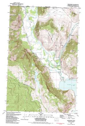
Nighthawk Topo Map Washington
To zoom in, hover over the map of Nighthawk
USGS Topo Quad 48119h6 - 1:24,000 scale
| Topo Map Name: | Nighthawk |
| USGS Topo Quad ID: | 48119h6 |
| Print Size: | ca. 21 1/4" wide x 27" high |
| Southeast Coordinates: | 48.875° N latitude / 119.625° W longitude |
| Map Center Coordinates: | 48.9375° N latitude / 119.6875° W longitude |
| U.S. State: | WA |
| Filename: | o48119h6.jpg |
| Download Map JPG Image: | Nighthawk topo map 1:24,000 scale |
| Map Type: | Topographic |
| Topo Series: | 7.5´ |
| Map Scale: | 1:24,000 |
| Source of Map Images: | United States Geological Survey (USGS) |
| Alternate Map Versions: |
Nighthawk WA 1981, updated 1982 Download PDF Buy paper map Nighthawk WA 2011 Download PDF Buy paper map Nighthawk WA 2014 Download PDF Buy paper map |
1:24,000 Topo Quads surrounding Nighthawk
Horseshoe Basin |
Hurley Peak |
Nighthawk |
Bullfrog Mountain |
Oroville |
Corral Butte |
Duncan Ridge |
Loomis |
Enterprise |
Ellisforde |
Tiffany Mountain |
Coxit Mountain |
Blue Goat Mountain |
Aeneas Lake |
Tonasket |
> Back to 48119e1 at 1:100,000 scale
> Back to 48118a1 at 1:250,000 scale
> Back to U.S. Topo Maps home
Nighthawk topo map: Gazetteer
Nighthawk: Flats
Alkali flat elevation 406m 1332′Lenton Flat elevation 418m 1371′
Nighthawk: Gaps
Olie Pass elevation 1318m 4324′Nighthawk: Lakes
Bowers Lake elevation 956m 3136′Chopaka Lake elevation 887m 2910′
Lenton Lake elevation 408m 1338′
The Salt Lakes elevation 690m 2263′
Nighthawk: Mines
Alice Mine elevation 495m 1624′Favorite Mine elevation 366m 1200′
Four Metals Mine elevation 352m 1154′
Golden Zone Mine elevation 493m 1617′
Kabba Texas Mine elevation 444m 1456′
King Solomon Mine elevation 876m 2874′
Mountain Sheep Mine elevation 419m 1374′
Nighthawk Mine elevation 393m 1289′
Prize Mine elevation 904m 2965′
Ruby Mine elevation 416m 1364′
Tenderfoot Mine elevation 1262m 4140′
Wyandotte Mine elevation 376m 1233′
Nighthawk: Populated Places
Chopaka elevation 361m 1184′Nighthawk elevation 352m 1154′
Nighthawk: Streams
Anderson Creek elevation 358m 1174′Champneys Slough Stream elevation 350m 1148′
Edwards Slough elevation 351m 1151′
Hurley Creek elevation 378m 1240′
Jewett Creek elevation 357m 1171′
Palmer Creek elevation 351m 1151′
Sheep Creek elevation 357m 1171′
Sinlahekin Creek elevation 352m 1154′
Nighthawk: Summits
American Butte elevation 722m 2368′Barber Mountain elevation 840m 2755′
Grandview Mountain elevation 1032m 3385′
Little Chopaka Mountain elevation 973m 3192′
Nighthawk: Valleys
Chopaka Valley elevation 357m 1171′Sinlahekin Valley elevation 351m 1151′
Nighthawk digital topo map on disk
Buy this Nighthawk topo map showing relief, roads, GPS coordinates and other geographical features, as a high-resolution digital map file on DVD:


