Horseshoe Basin Topo Map Washington
To zoom in, hover over the map of Horseshoe Basin
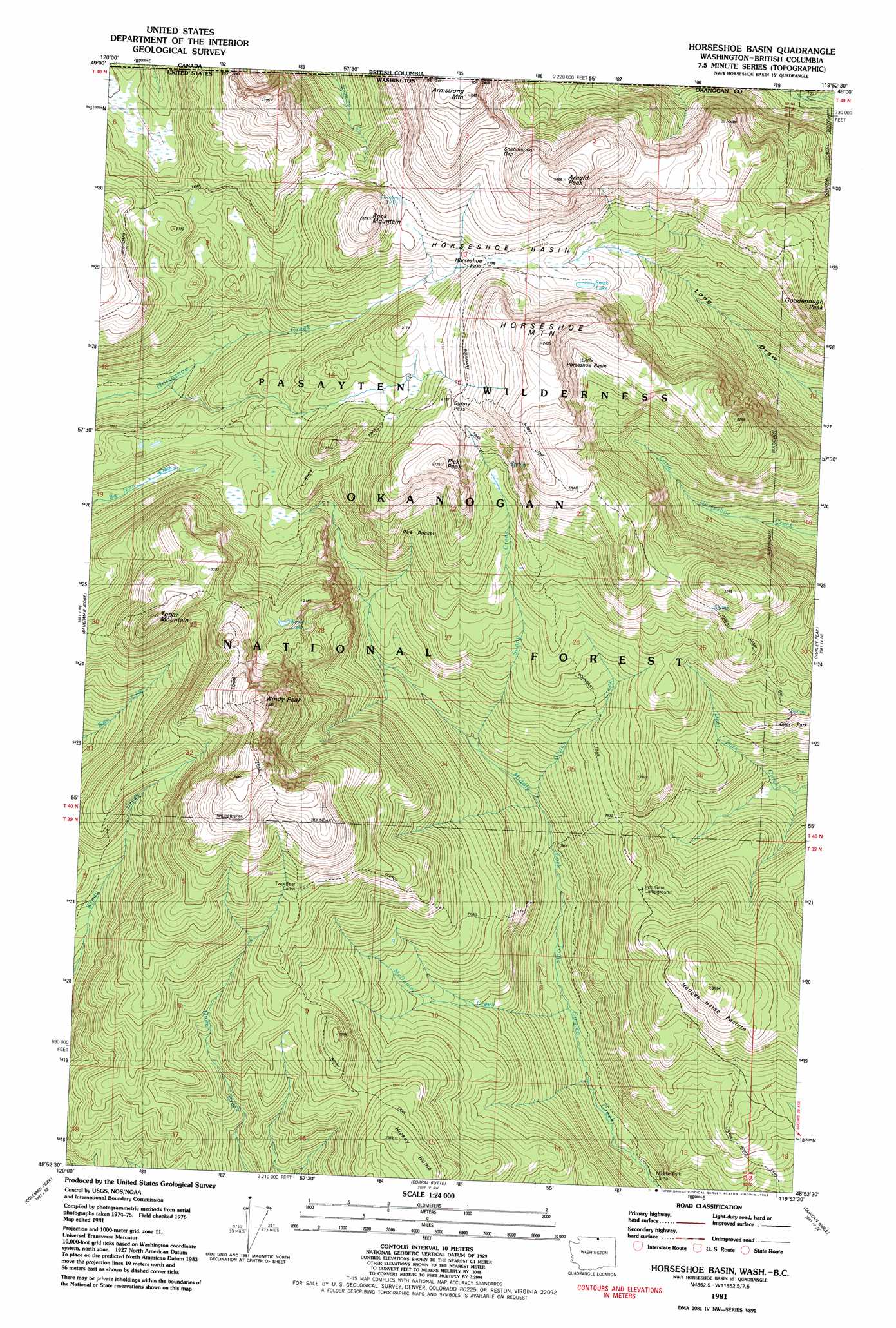
USGS Topo Quad 48119h8 - 1:24,000 scale
| Topo Map Name: | Horseshoe Basin |
| USGS Topo Quad ID: | 48119h8 |
| Print Size: | ca. 21 1/4" wide x 27" high |
| Southeast Coordinates: | 48.875° N latitude / 119.875° W longitude |
| Map Center Coordinates: | 48.9375° N latitude / 119.9375° W longitude |
| U.S. State: | WA |
| Filename: | o48119h8.jpg |
| Download Map JPG Image: | Horseshoe Basin topo map 1:24,000 scale |
| Map Type: | Topographic |
| Topo Series: | 7.5´ |
| Map Scale: | 1:24,000 |
| Source of Map Images: | United States Geological Survey (USGS) |
| Alternate Map Versions: |
Horseshoe Basin WA 1981, updated 1982 Download PDF Buy paper map Horseshoe Basin WA 1981, updated 1982 Download PDF Buy paper map Horseshoe Basin WA 2001, updated 2004 Download PDF Buy paper map Horseshoe Basin WA 2011 Download PDF Buy paper map Horseshoe Basin WA 2014 Download PDF Buy paper map |
| FStopo: | US Forest Service topo Horseshoe Basin is available: Download FStopo PDF Download FStopo TIF |
1:24,000 Topo Quads surrounding Horseshoe Basin
Remmel Mountain |
Bauerman Ridge |
Horseshoe Basin |
Hurley Peak |
Nighthawk |
Mount Barney |
Coleman Peak |
Corral Butte |
Duncan Ridge |
Loomis |
Doe Mountain |
Spur Peak |
Tiffany Mountain |
Coxit Mountain |
Blue Goat Mountain |
> Back to 48119e1 at 1:100,000 scale
> Back to 48118a1 at 1:250,000 scale
> Back to U.S. Topo Maps home
Horseshoe Basin topo map: Gazetteer
Horseshoe Basin: Basins
Horsehoe Basin elevation 2139m 7017′Pick Pocket elevation 1963m 6440′
Horseshoe Basin: Flats
Hodges Horse Pasture elevation 1924m 6312′Horseshoe Basin: Gaps
Horseshoe Pass elevation 2146m 7040′Horseshoe Basin: Lakes
Louden Lake elevation 2156m 7073′Smith Lake elevation 2126m 6975′
Horseshoe Basin: Parks
Deer Park elevation 1838m 6030′Horseshoe Basin: Streams
Clutch Creek elevation 1650m 5413′Sunny Creek elevation 1691m 5547′
Horseshoe Basin: Summits
Arnold Peak elevation 2462m 8077′Goodenough Peak elevation 2254m 7395′
Hickey Hump elevation 2034m 6673′
Horseshoe Mountain elevation 2108m 6916′
Pick Peak elevation 2305m 7562′
Rock Mountain elevation 2322m 7618′
Topaz Mountain elevation 2369m 7772′
Windy Peak elevation 2522m 8274′
Horseshoe Basin: Trails
Albert Camp Trail elevation 2038m 6686′Clutch Trail elevation 1881m 6171′
Deer Park Trail elevation 1810m 5938′
Four Point Trail elevation 1710m 5610′
Long Draw Trail elevation 2059m 6755′
Windy Trail elevation 2183m 7162′
Horseshoe Basin digital topo map on disk
Buy this Horseshoe Basin topo map showing relief, roads, GPS coordinates and other geographical features, as a high-resolution digital map file on DVD: