Pyramid Mountain Topo Map Washington
To zoom in, hover over the map of Pyramid Mountain
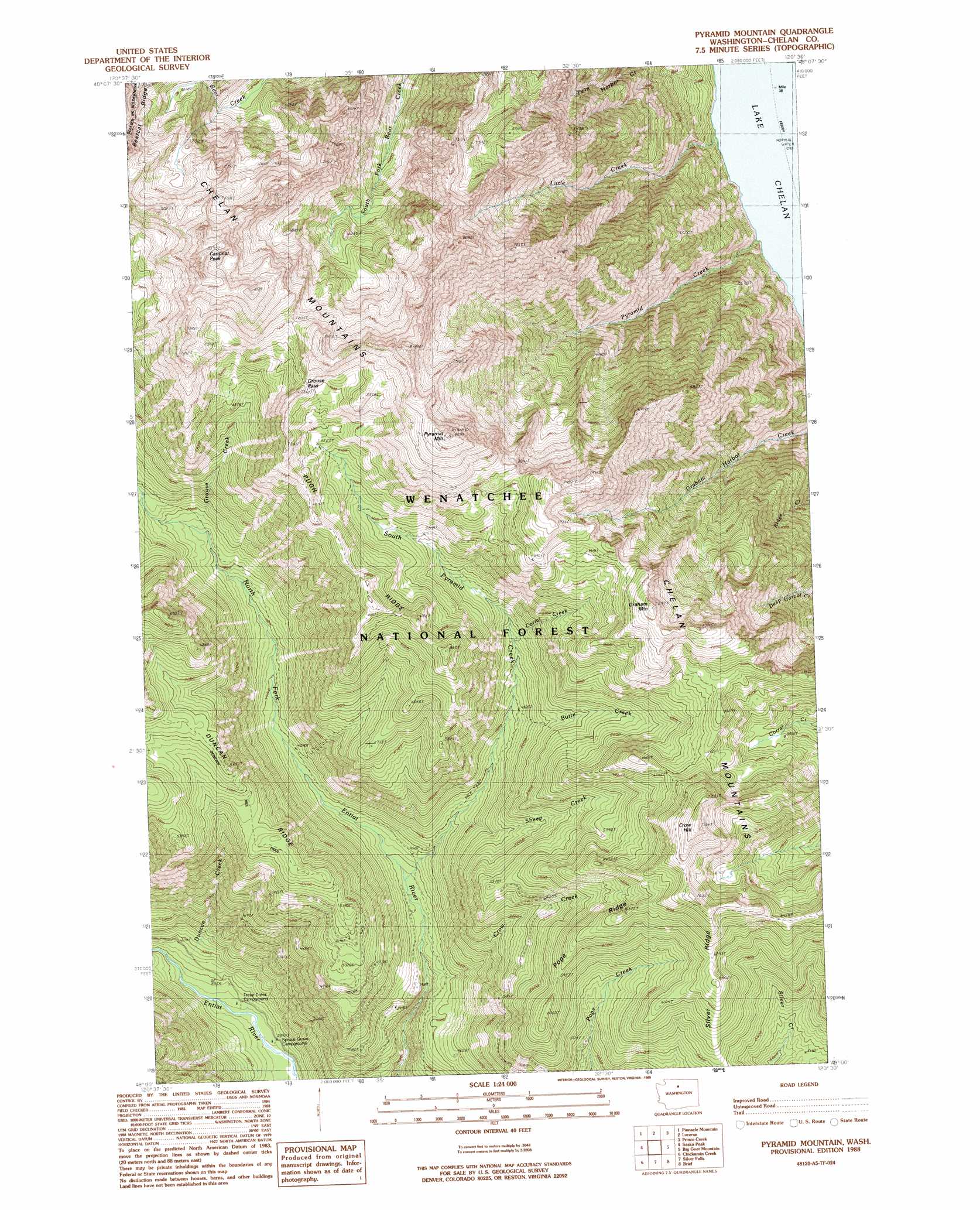
USGS Topo Quad 48120a5 - 1:24,000 scale
| Topo Map Name: | Pyramid Mountain |
| USGS Topo Quad ID: | 48120a5 |
| Print Size: | ca. 21 1/4" wide x 27" high |
| Southeast Coordinates: | 48° N latitude / 120.5° W longitude |
| Map Center Coordinates: | 48.0625° N latitude / 120.5625° W longitude |
| U.S. State: | WA |
| Filename: | o48120a5.jpg |
| Download Map JPG Image: | Pyramid Mountain topo map 1:24,000 scale |
| Map Type: | Topographic |
| Topo Series: | 7.5´ |
| Map Scale: | 1:24,000 |
| Source of Map Images: | United States Geological Survey (USGS) |
| Alternate Map Versions: |
Pyramid Mountain WA 1988, updated 1988 Download PDF Buy paper map Pyramid Mountain WA 2004, updated 2008 Download PDF Buy paper map Pyramid Mountain WA 2011 Download PDF Buy paper map Pyramid Mountain WA 2014 Download PDF Buy paper map |
| FStopo: | US Forest Service topo Pyramid Mountain is available: Download FStopo PDF Download FStopo TIF |
1:24,000 Topo Quads surrounding Pyramid Mountain
Mount Lyall |
Stehekin |
Sun Mountain |
Oval Peak |
Hoodoo Peak |
Holden |
Pinnacle Mountain |
Lucerne |
Prince Creek |
Martin Peak |
Trinity |
Saska Peak |
Pyramid Mountain |
Big Goat Mountain |
South Navarre Peak |
Schaefer Lake |
Chikamin Creek |
Silver Falls |
Brief |
Stormy Mountain |
Lake Wenatchee |
Plain |
Sugarloaf Peak |
Tyee Mountain |
Baldy Mountain |
> Back to 48120a1 at 1:100,000 scale
> Back to 48120a1 at 1:250,000 scale
> Back to U.S. Topo Maps home
Pyramid Mountain topo map: Gazetteer
Pyramid Mountain: Gaps
Grouse Pass elevation 2191m 7188′Pyramid Mountain: Ranges
Chelan Mountains elevation 2132m 6994′Pyramid Mountain: Ridges
Pope Ridge elevation 1963m 6440′Pugh Ridge elevation 2069m 6788′
Pyramid Mountain: Streams
Butte Creek elevation 1449m 4753′Corral Creek elevation 1568m 5144′
Crow Creek elevation 1131m 3710′
Duncan Creek elevation 892m 2926′
Grouse Creek elevation 1484m 4868′
Little Creek elevation 336m 1102′
Pyramid Creek elevation 342m 1122′
Sheep Creek elevation 1325m 4347′
South Pyramid Creek elevation 1204m 3950′
Pyramid Mountain: Summits
Cardinal Peak elevation 2608m 8556′Crow Hill elevation 2245m 7365′
Graham Mountain elevation 2208m 7244′
Pyramid Mountain elevation 2518m 8261′
Pyramid Mountain digital topo map on disk
Buy this Pyramid Mountain topo map showing relief, roads, GPS coordinates and other geographical features, as a high-resolution digital map file on DVD: