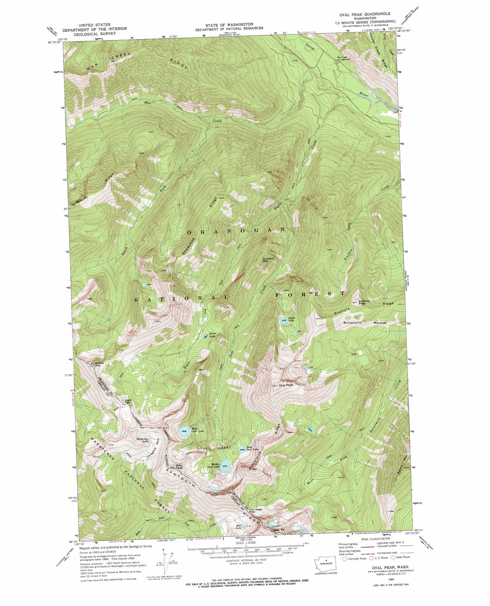
Oval Peak Topo Map Washington
To zoom in, hover over the map of Oval Peak
USGS Topo Quad 48120c4 - 1:24,000 scale
| Topo Map Name: | Oval Peak |
| USGS Topo Quad ID: | 48120c4 |
| Print Size: | ca. 21 1/4" wide x 27" high |
| Southeast Coordinates: | 48.25° N latitude / 120.375° W longitude |
| Map Center Coordinates: | 48.3125° N latitude / 120.4375° W longitude |
| U.S. State: | WA |
| Filename: | o48120c4.jpg |
| Download Map JPG Image: | Oval Peak topo map 1:24,000 scale |
| Map Type: | Topographic |
| Topo Series: | 7.5´ |
| Map Scale: | 1:24,000 |
| Source of Map Images: | United States Geological Survey (USGS) |
| Alternate Map Versions: |
Oval Peak WA 1969, updated 1973 Download PDF Buy paper map Oval Peak WA 1969, updated 1973 Download PDF Buy paper map Oval Peak WA 2002, updated 2006 Download PDF Buy paper map Oval Peak WA 2011 Download PDF Buy paper map Oval Peak WA 2014 Download PDF Buy paper map |
| FStopo: | US Forest Service topo Oval Peak is available: Download FStopo PDF Download FStopo TIF |
1:24,000 Topo Quads surrounding Oval Peak
Washington Pass |
Silver Star Mountain |
Mazama |
Rendevous Mountain |
Lewis Butte |
Mcalester Mountain |
Gilbert |
Midnight Mountain |
Thompson Ridge |
Winthrop |
Stehekin |
Sun Mountain |
Oval Peak |
Hoodoo Peak |
Twisp West |
Pinnacle Mountain |
Lucerne |
Prince Creek |
Martin Peak |
Hungry Mountain |
Saska Peak |
Pyramid Mountain |
Big Goat Mountain |
South Navarre Peak |
Oss Peak |
> Back to 48120a1 at 1:100,000 scale
> Back to 48120a1 at 1:250,000 scale
> Back to U.S. Topo Maps home
Oval Peak topo map: Gazetteer
Oval Peak: Basins
Horseshoe Basin elevation 2219m 7280′Oval Peak: Flats
Buttermilk Meadow elevation 2022m 6633′Oval Peak: Gaps
Eagle Pass elevation 2214m 7263′Fish Creek Pass elevation 2286m 7500′
Oval Peak: Lakes
Duffy Lake elevation 1934m 6345′East Oval Lake elevation 2034m 6673′
Middle Oval Lake elevation 2042m 6699′
Oval Lakes elevation 2004m 6574′
Silver Lake elevation 1779m 5836′
Star Lake elevation 2192m 7191′
Tuckaway Lake elevation 2244m 7362′
West Oval Lake elevation 2092m 6863′
Oval Peak: Ridges
Buttermilk Ridge elevation 2518m 8261′Snowshoe Ridge elevation 1999m 6558′
Oval Peak: Streams
Eagle Creek elevation 731m 2398′Oval Creek elevation 1139m 3736′
South Fork War Creek elevation 1066m 3497′
War Creek elevation 728m 2388′
Oval Peak: Summits
Battle Mountain elevation 2346m 7696′Courtney Peak elevation 2535m 8316′
Duckbill Mountain elevation 1845m 6053′
Gray Peak elevation 2461m 8074′
Oval Peak elevation 2665m 8743′
Scaffold Peak elevation 2263m 7424′
Spirit Mountain elevation 2396m 7860′
Spirit Peak elevation 2396m 7860′
Star Peak elevation 2644m 8674′
Oval Peak digital topo map on disk
Buy this Oval Peak topo map showing relief, roads, GPS coordinates and other geographical features, as a high-resolution digital map file on DVD: