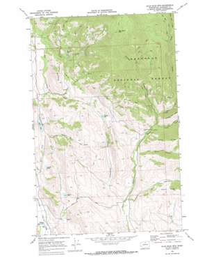
Blue Buck Mountain Topo Map Washington
To zoom in, hover over the map of Blue Buck Mountain
USGS Topo Quad 48120d1 - 1:24,000 scale
| Topo Map Name: | Blue Buck Mountain |
| USGS Topo Quad ID: | 48120d1 |
| Print Size: | ca. 21 1/4" wide x 27" high |
| Southeast Coordinates: | 48.375° N latitude / 120° W longitude |
| Map Center Coordinates: | 48.4375° N latitude / 120.0625° W longitude |
| U.S. State: | WA |
| Filename: | o48120d1.jpg |
| Download Map JPG Image: | Blue Buck Mountain topo map 1:24,000 scale |
| Map Type: | Topographic |
| Topo Series: | 7.5´ |
| Map Scale: | 1:24,000 |
| Source of Map Images: | United States Geological Survey (USGS) |
| Alternate Map Versions: |
Blue Buck Mtn WA 1969, updated 1973 Download PDF Buy paper map Blue Buck Mountain WA 2001, updated 2004 Download PDF Buy paper map Blue Buck Mountain WA 2011 Download PDF Buy paper map Blue Buck Mountain WA 2014 Download PDF Buy paper map |
| FStopo: | US Forest Service topo Blue Buck Mountain is available: Download FStopo PDF Download FStopo TIF |
1:24,000 Topo Quads surrounding Blue Buck Mountain
> Back to 48120a1 at 1:100,000 scale
> Back to 48120a1 at 1:250,000 scale
> Back to U.S. Topo Maps home
Blue Buck Mountain topo map: Gazetteer
Blue Buck Mountain: Dams
Davis Lake Dam elevation 665m 2181′Blue Buck Mountain: Flats
Cougar Flat elevation 950m 3116′Blue Buck Mountain: Lakes
Bonner Lake elevation 692m 2270′Campbell Lake elevation 858m 2814′
Cougar Lake elevation 979m 3211′
Lamotte Pond elevation 631m 2070′
Blue Buck Mountain: Parks
Methow Wildlife Recreation Area elevation 931m 3054′Blue Buck Mountain: Reservoirs
Davis Lake elevation 665m 2181′Blue Buck Mountain: Ridges
Coyote Ridge elevation 1161m 3809′Blue Buck Mountain: Streams
Blue Buck Creek elevation 1229m 4032′Bowen Creek elevation 704m 2309′
Cougar Creek elevation 786m 2578′
Davis Creek elevation 553m 1814′
Johnson Creek elevation 798m 2618′
North Fork Beaver Creek elevation 839m 2752′
Piper Creek elevation 773m 2536′
South Fork Beaver Creek elevation 839m 2752′
Storer Creek elevation 656m 2152′
Storer Creek elevation 657m 2155′
Volstead Creek elevation 875m 2870′
Blue Buck Mountain: Summits
Blue Buck Mountain elevation 1894m 6213′Bowen Mountain elevation 1134m 3720′
Blue Buck Mountain: Valleys
Burns Canyon elevation 793m 2601′Fuzzy Canyon elevation 684m 2244′
Pipestone Canyon elevation 658m 2158′
Wolf Canyon elevation 675m 2214′
Blue Buck Mountain digital topo map on disk
Buy this Blue Buck Mountain topo map showing relief, roads, GPS coordinates and other geographical features, as a high-resolution digital map file on DVD:


