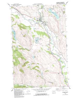
Winthrop Topo Map Washington
To zoom in, hover over the map of Winthrop
USGS Topo Quad 48120d2 - 1:24,000 scale
| Topo Map Name: | Winthrop |
| USGS Topo Quad ID: | 48120d2 |
| Print Size: | ca. 21 1/4" wide x 27" high |
| Southeast Coordinates: | 48.375° N latitude / 120.125° W longitude |
| Map Center Coordinates: | 48.4375° N latitude / 120.1875° W longitude |
| U.S. State: | WA |
| Filename: | o48120d2.jpg |
| Download Map JPG Image: | Winthrop topo map 1:24,000 scale |
| Map Type: | Topographic |
| Topo Series: | 7.5´ |
| Map Scale: | 1:24,000 |
| Source of Map Images: | United States Geological Survey (USGS) |
| Alternate Map Versions: |
Winthrop WA 1969, updated 1973 Download PDF Buy paper map Winthrop WA 1969, updated 1991 Download PDF Buy paper map Winthrop WA 2002, updated 2006 Download PDF Buy paper map Winthrop WA 2011 Download PDF Buy paper map Winthrop WA 2014 Download PDF Buy paper map |
| FStopo: | US Forest Service topo Winthrop is available: Download FStopo PDF Download FStopo TIF |
1:24,000 Topo Quads surrounding Winthrop
> Back to 48120a1 at 1:100,000 scale
> Back to 48120a1 at 1:250,000 scale
> Back to U.S. Topo Maps home
Winthrop topo map: Gazetteer
Winthrop: Airports
Methow Valley State Airport elevation 516m 1692′Winthrop: Canals
Chewuch Canal elevation 571m 1873′Winthrop: Dams
Moccasin Lake Dam elevation 683m 2240′Peters Reservoir Number One Dam elevation 614m 2014′
Peters Reservoir Number Two Dam elevation 618m 2027′
Winthrop: Lakes
Aspen Lake elevation 885m 2903′Barnsley Lake elevation 558m 1830′
Big Twin Lake elevation 550m 1804′
Dead Horse Lake elevation 695m 2280′
Dibble Lake elevation 562m 1843′
Little Twin Lake elevation 549m 1801′
Twin Lakes elevation 550m 1804′
Winthrop: Parks
Pearrygin Lake State Park elevation 639m 2096′Winthrop: Populated Places
Winthrop elevation 539m 1768′Winthrop: Reservoirs
Moccasin Lake elevation 683m 2240′Pearrygin Lake elevation 586m 1922′
Peters Puddles elevation 618m 2027′
Winthrop: Streams
Bear Creek elevation 520m 1706′Chewuch River elevation 533m 1748′
Lake Creek elevation 548m 1797′
Pearrygin Creek elevation 588m 1929′
Rader Creek elevation 729m 2391′
Thompson Creek elevation 601m 1971′
Wolf Creek elevation 544m 1784′
Winthrop: Summits
Patterson Mountain elevation 1064m 3490′Winthrop: Valleys
Elbow Coulee elevation 610m 2001′Winthrop digital topo map on disk
Buy this Winthrop topo map showing relief, roads, GPS coordinates and other geographical features, as a high-resolution digital map file on DVD:


