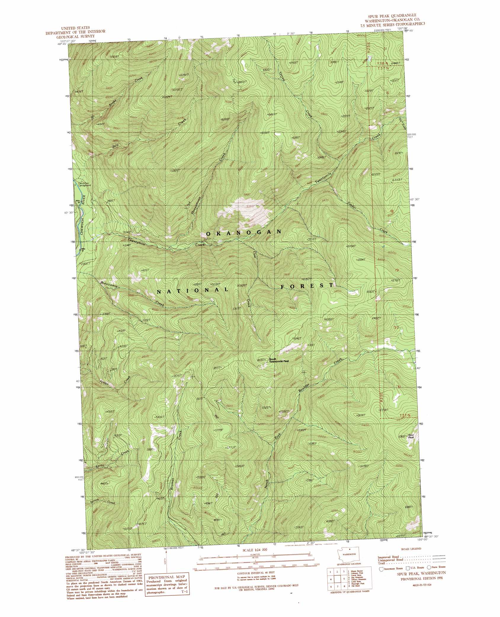
Spur Peak Topo Map Washington
To zoom in, hover over the map of Spur Peak
USGS Topo Quad 48120f1 - 1:24,000 scale
| Topo Map Name: | Spur Peak |
| USGS Topo Quad ID: | 48120f1 |
| Print Size: | ca. 21 1/4" wide x 27" high |
| Southeast Coordinates: | 48.625° N latitude / 120° W longitude |
| Map Center Coordinates: | 48.6875° N latitude / 120.0625° W longitude |
| U.S. State: | WA |
| Filename: | o48120f1.jpg |
| Download Map JPG Image: | Spur Peak topo map 1:24,000 scale |
| Map Type: | Topographic |
| Topo Series: | 7.5´ |
| Map Scale: | 1:24,000 |
| Source of Map Images: | United States Geological Survey (USGS) |
| Alternate Map Versions: |
Spur Peak WA 1991, updated 1991 Download PDF Buy paper map Spur Peak WA 2001, updated 2004 Download PDF Buy paper map Spur Peak WA 2011 Download PDF Buy paper map Spur Peak WA 2014 Download PDF Buy paper map |
| FStopo: | US Forest Service topo Spur Peak is available: Download FStopo PDF Download FStopo TIF |
1:24,000 Topo Quads surrounding Spur Peak
Ashnola Pass |
Remmel Mountain |
Bauerman Ridge |
Horseshoe Basin |
Hurley Peak |
Billy Goat Mountain |
Mount Barney |
Coleman Peak |
Corral Butte |
Duncan Ridge |
Sweetgrass Butte |
Doe Mountain |
Spur Peak |
Tiffany Mountain |
Coxit Mountain |
Rendevous Mountain |
Lewis Butte |
Pearrygin Peak |
Old Baldy |
Conconully West |
Thompson Ridge |
Winthrop |
Blue Buck Mountain |
Loup Loup Summit |
Buck Mountain |
> Back to 48120e1 at 1:100,000 scale
> Back to 48120a1 at 1:250,000 scale
> Back to U.S. Topo Maps home
Spur Peak topo map: Gazetteer
Spur Peak: Streams
Claw Creek elevation 1122m 3681′Fly Creek elevation 1569m 5147′
Honeymoon Creek elevation 949m 3113′
July Creek elevation 727m 2385′
Timber Creek elevation 1344m 4409′
Twentymile Creek elevation 709m 2326′
Yarrow Creek elevation 1427m 4681′
Spur Peak: Summits
South Twentymile Peak elevation 2020m 6627′Spur Peak elevation 2096m 6876′
Spur Peak: Trails
North Fork Twentymile Trail elevation 1005m 3297′North Fork Twentymile Trail elevation 1690m 5544′
South Twentymile Trail elevation 1965m 6446′
Twentymile Trail elevation 1319m 4327′
Spur Peak digital topo map on disk
Buy this Spur Peak topo map showing relief, roads, GPS coordinates and other geographical features, as a high-resolution digital map file on DVD: