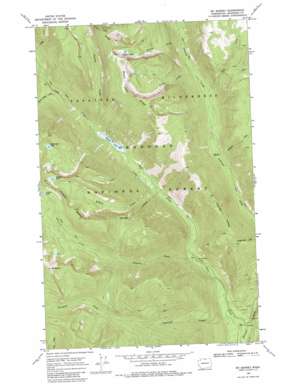
Mount Barney Topo Map Washington
To zoom in, hover over the map of Mount Barney
USGS Topo Quad 48120g2 - 1:24,000 scale
| Topo Map Name: | Mount Barney |
| USGS Topo Quad ID: | 48120g2 |
| Print Size: | ca. 21 1/4" wide x 27" high |
| Southeast Coordinates: | 48.75° N latitude / 120.125° W longitude |
| Map Center Coordinates: | 48.8125° N latitude / 120.1875° W longitude |
| U.S. State: | WA |
| Filename: | o48120g2.jpg |
| Download Map JPG Image: | Mount Barney topo map 1:24,000 scale |
| Map Type: | Topographic |
| Topo Series: | 7.5´ |
| Map Scale: | 1:24,000 |
| Source of Map Images: | United States Geological Survey (USGS) |
| Alternate Map Versions: |
Mt. Barney WA 1969, updated 1972 Download PDF Buy paper map Mt Barney WA 1969, updated 1985 Download PDF Buy paper map Mount Barney WA 2002, updated 2006 Download PDF Buy paper map Mount Barney WA 2011 Download PDF Buy paper map Mount Barney WA 2014 Download PDF Buy paper map |
| FStopo: | US Forest Service topo Mount Barney is available: Download FStopo PDF Download FStopo TIF |
1:24,000 Topo Quads surrounding Mount Barney
> Back to 48120e1 at 1:100,000 scale
> Back to 48120a1 at 1:250,000 scale
> Back to U.S. Topo Maps home
Mount Barney topo map: Gazetteer
Mount Barney: Lakes
Black Lake elevation 1215m 3986′Crystal Lake elevation 2170m 7119′
Dutton Lakes elevation 2118m 6948′
Halfmoon Lake elevation 2047m 6715′
Kidney Lake elevation 2205m 7234′
Mount Barney: Ridges
Black Lake Ridge elevation 2282m 7486′Preston Ridge elevation 2330m 7644′
Mount Barney: Streams
Blizzard Creek elevation 1304m 4278′Cold Creek elevation 1097m 3599′
Disaster Creek elevation 968m 3175′
Dutton Creek elevation 1464m 4803′
Farewell Creek elevation 832m 2729′
Kidney Creek elevation 1102m 3615′
Lake Creek elevation 795m 2608′
Perry Creek elevation 1408m 4619′
Preston Creek elevation 1219m 3999′
Ram Creek elevation 1388m 4553′
Three Prong Creek elevation 1321m 4333′
Mount Barney: Summits
Mount Barney elevation 2379m 7805′Mount Barney digital topo map on disk
Buy this Mount Barney topo map showing relief, roads, GPS coordinates and other geographical features, as a high-resolution digital map file on DVD:


