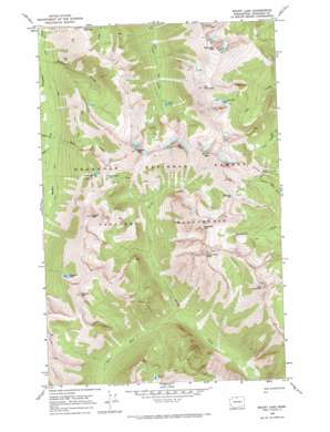
Mount Lago Topo Map Washington
To zoom in, hover over the map of Mount Lago
USGS Topo Quad 48120g5 - 1:24,000 scale
| Topo Map Name: | Mount Lago |
| USGS Topo Quad ID: | 48120g5 |
| Print Size: | ca. 21 1/4" wide x 27" high |
| Southeast Coordinates: | 48.75° N latitude / 120.5° W longitude |
| Map Center Coordinates: | 48.8125° N latitude / 120.5625° W longitude |
| U.S. State: | WA |
| Filename: | o48120g5.jpg |
| Download Map JPG Image: | Mount Lago topo map 1:24,000 scale |
| Map Type: | Topographic |
| Topo Series: | 7.5´ |
| Map Scale: | 1:24,000 |
| Source of Map Images: | United States Geological Survey (USGS) |
| Alternate Map Versions: |
Mount Lago WA 1969, updated 1973 Download PDF Buy paper map Mount Lago WA 2002, updated 2006 Download PDF Buy paper map Mount Lago WA 2011 Download PDF Buy paper map Mount Lago WA 2014 Download PDF Buy paper map |
| FStopo: | US Forest Service topo Mount Lago is available: Download FStopo PDF Download FStopo TIF |
1:24,000 Topo Quads surrounding Mount Lago
> Back to 48120e1 at 1:100,000 scale
> Back to 48120a1 at 1:250,000 scale
> Back to U.S. Topo Maps home
Mount Lago topo map: Gazetteer
Mount Lago: Gaps
Butte Pass elevation 2102m 6896′Shellrock Pass elevation 2256m 7401′
Mount Lago: Lakes
Dot Lakes elevation 2173m 7129′Eureka Lake elevation 1996m 6548′
Ferguson Lake elevation 2029m 6656′
Freds Lake elevation 1986m 6515′
Lake Doris elevation 2057m 6748′
Lease Lake elevation 1716m 5629′
Mount Lago: Streams
Berk Creek elevation 1443m 4734′Dorchester Creek elevation 2131m 6991′
Point Creek elevation 1446m 4744′
Shack Creek elevation 1451m 4760′
South Fork Eureka Creek elevation 1303m 4274′
Mount Lago: Summits
Blackcap Mountain elevation 2524m 8280′Dot Mountain elevation 2481m 8139′
Lake Mountain elevation 2525m 8284′
Monument Peak elevation 2612m 8569′
Mount Lago elevation 2655m 8710′
Mount Rolo elevation 2399m 7870′
Mountain Carru elevation 2519m 8264′
Osceola Peak elevation 2581m 8467′
Ptarmigan Peak elevation 2602m 8536′
Wildcat Mountain elevation 2341m 7680′
Mount Lago: Valleys
Pleasant Valley elevation 1466m 4809′Mount Lago digital topo map on disk
Buy this Mount Lago topo map showing relief, roads, GPS coordinates and other geographical features, as a high-resolution digital map file on DVD:


