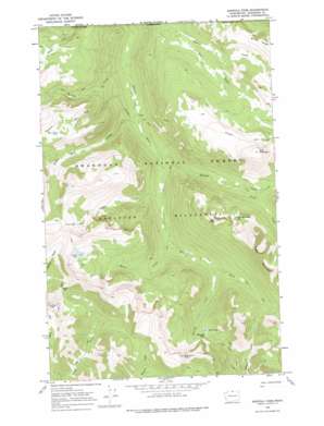
Ashnola Pass Topo Map Washington
To zoom in, hover over the map of Ashnola Pass
USGS Topo Quad 48120h3 - 1:24,000 scale
| Topo Map Name: | Ashnola Pass |
| USGS Topo Quad ID: | 48120h3 |
| Print Size: | ca. 21 1/4" wide x 27" high |
| Southeast Coordinates: | 48.875° N latitude / 120.25° W longitude |
| Map Center Coordinates: | 48.9375° N latitude / 120.3125° W longitude |
| U.S. State: | WA |
| Filename: | o48120h3.jpg |
| Download Map JPG Image: | Ashnola Pass topo map 1:24,000 scale |
| Map Type: | Topographic |
| Topo Series: | 7.5´ |
| Map Scale: | 1:24,000 |
| Source of Map Images: | United States Geological Survey (USGS) |
| Alternate Map Versions: |
Ashnola Pass WA 1969, updated 1973 Download PDF Buy paper map Ashnola Pass WA 1969, updated 1977 Download PDF Buy paper map Ashnola Pass WA 2002, updated 2006 Download PDF Buy paper map Ashnola Pass WA 2011 Download PDF Buy paper map Ashnola Pass WA 2014 Download PDF Buy paper map |
| FStopo: | US Forest Service topo Ashnola Pass is available: Download FStopo PDF Download FStopo TIF |
1:24,000 Topo Quads surrounding Ashnola Pass
> Back to 48120e1 at 1:100,000 scale
> Back to 48120a1 at 1:250,000 scale
> Back to U.S. Topo Maps home
Ashnola Pass topo map: Gazetteer
Ashnola Pass: Capes
Diamond Point elevation 2409m 7903′Ashnola Pass: Gaps
Ashnola Pass elevation 1898m 6227′Larch Pass elevation 2180m 7152′
Ashnola Pass: Lakes
Corral Lake elevation 2181m 7155′Crow Lake elevation 2118m 6948′
Fawn Lake elevation 1900m 6233′
Freds Mountain Lake elevation 2096m 6876′
Ashnola Pass: Streams
Beaver Creek elevation 1850m 6069′Bob Creek elevation 1849m 6066′
Gabril Creek elevation 1613m 5291′
Glory Creek elevation 1761m 5777′
Martina Creek elevation 1501m 4924′
Raven Creek elevation 1672m 5485′
Spanish Creek elevation 1573m 5160′
Spotted Creek elevation 1764m 5787′
Timber Wolf Creek elevation 1536m 5039′
Ashnola Pass: Summits
Bald Mountain elevation 2419m 7936′Freds Mountain elevation 2432m 7979′
Van Peak elevation 2334m 7657′
Ashnola Pass digital topo map on disk
Buy this Ashnola Pass topo map showing relief, roads, GPS coordinates and other geographical features, as a high-resolution digital map file on DVD:


