Riley Lake Topo Map Washington
To zoom in, hover over the map of Riley Lake
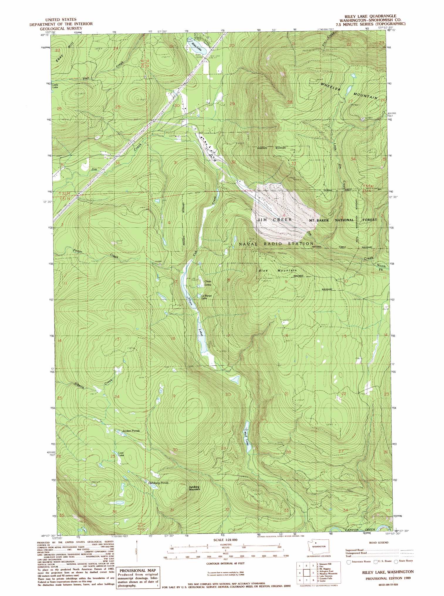
USGS Topo Quad 48121b8 - 1:24,000 scale
| Topo Map Name: | Riley Lake |
| USGS Topo Quad ID: | 48121b8 |
| Print Size: | ca. 21 1/4" wide x 27" high |
| Southeast Coordinates: | 48.125° N latitude / 121.875° W longitude |
| Map Center Coordinates: | 48.1875° N latitude / 121.9375° W longitude |
| U.S. State: | WA |
| Filename: | o48121b8.jpg |
| Download Map JPG Image: | Riley Lake topo map 1:24,000 scale |
| Map Type: | Topographic |
| Topo Series: | 7.5´ |
| Map Scale: | 1:24,000 |
| Source of Map Images: | United States Geological Survey (USGS) |
| Alternate Map Versions: |
Riley Lake WA 1989, updated 1989 Download PDF Buy paper map Riley Lake WA 2011 Download PDF Buy paper map Riley Lake WA 2014 Download PDF Buy paper map |
| FStopo: | US Forest Service topo Riley Lake is available: Download FStopo PDF Download FStopo TIF |
1:24,000 Topo Quads surrounding Riley Lake
Sedro-Woolley South |
Haystack Mountain |
Day Lake |
Gee Point |
Finney Peak |
Mcmurray |
Stimson Hill |
Oso |
Mount Higgins |
Fortson |
Arlington West |
Arlington East |
Riley Lake |
Meadow Mountain |
Whitehorse Mountain |
Marysville |
Lake Stevens |
Granite Falls |
Verlot |
Mallardy Ridge |
Everett |
Snohomish |
Lake Roesiger |
Lake Chaplain |
Wallace Lake |
> Back to 48121a1 at 1:100,000 scale
> Back to 48120a1 at 1:250,000 scale
> Back to U.S. Topo Maps home
Riley Lake topo map: Gazetteer
Riley Lake: Lakes
Chain Lakes elevation 296m 971′Dahlbero Ponds elevation 473m 1551′
Jordan Ponds elevation 486m 1594′
La Barge Lake elevation 287m 941′
Lost Lake elevation 512m 1679′
Mud Lake elevation 223m 731′
Riley Lake elevation 166m 544′
Twin Lakes elevation 225m 738′
Riley Lake: Streams
Big Jim Creek elevation 350m 1148′Cub Creek elevation 154m 505′
Little Jim Creek elevation 337m 1105′
Riley Lake: Summits
Blue Mountain elevation 923m 3028′Dahlbero Mountain elevation 582m 1909′
Wheeler Mountain elevation 1088m 3569′
Riley Lake digital topo map on disk
Buy this Riley Lake topo map showing relief, roads, GPS coordinates and other geographical features, as a high-resolution digital map file on DVD: