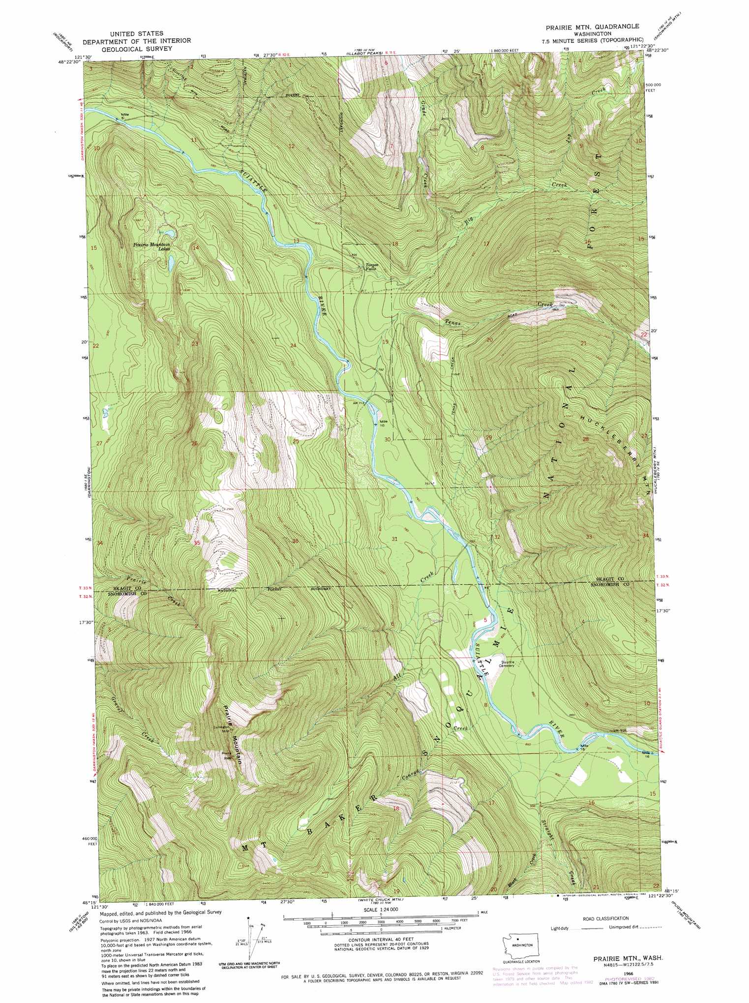
Prairie Mountain Topo Map Washington
To zoom in, hover over the map of Prairie Mountain
USGS Topo Quad 48121c4 - 1:24,000 scale
| Topo Map Name: | Prairie Mountain |
| USGS Topo Quad ID: | 48121c4 |
| Print Size: | ca. 21 1/4" wide x 27" high |
| Southeast Coordinates: | 48.25° N latitude / 121.375° W longitude |
| Map Center Coordinates: | 48.3125° N latitude / 121.4375° W longitude |
| U.S. State: | WA |
| Filename: | o48121c4.jpg |
| Download Map JPG Image: | Prairie Mountain topo map 1:24,000 scale |
| Map Type: | Topographic |
| Topo Series: | 7.5´ |
| Map Scale: | 1:24,000 |
| Source of Map Images: | United States Geological Survey (USGS) |
| Alternate Map Versions: |
Prairie Mtn. WA 1966, updated 1968 Download PDF Buy paper map Prairie Mtn. WA 1966, updated 1982 Download PDF Buy paper map Prairie Mountain WA 2011 Download PDF Buy paper map Prairie Mountain WA 2014 Download PDF Buy paper map |
| FStopo: | US Forest Service topo Prairie Mountain is available: Download FStopo PDF Download FStopo TIF |
1:24,000 Topo Quads surrounding Prairie Mountain
Lake Shannon |
Sauk Mountain |
Marblemount |
Big Devil Peak |
Eldorado Peak |
Finney Peak |
Rockport |
Illabot Peaks |
Snowking Mountain |
Sonny Boy Lakes |
Fortson |
Darrington |
Prairie Mountain |
Huckleberry Mountain |
Downey Mountain |
Whitehorse Mountain |
Helena Ridge |
White Chuck Mountain |
Pugh Mountain |
Lime Mountain |
Mallardy Ridge |
Silverton |
Bedal |
Sloan Peak |
Glacier Peak West |
> Back to 48121a1 at 1:100,000 scale
> Back to 48120a1 at 1:250,000 scale
> Back to U.S. Topo Maps home
Prairie Mountain topo map: Gazetteer
Prairie Mountain: Falls
Teepee Falls elevation 247m 810′Prairie Mountain: Lakes
Prairie Mountain Lakes elevation 426m 1397′Target Lake elevation 1038m 3405′
Prairie Mountain: Streams
All Creek elevation 226m 741′Big Creek elevation 193m 633′
Black Creek elevation 335m 1099′
Conrad Creek elevation 251m 823′
Grade Creek elevation 377m 1236′
Jug Creek elevation 496m 1627′
Straight Creek elevation 263m 862′
Tenas Creek elevation 211m 692′
Prairie Mountain: Summits
Prairie Mountain elevation 1724m 5656′Prairie Mountain digital topo map on disk
Buy this Prairie Mountain topo map showing relief, roads, GPS coordinates and other geographical features, as a high-resolution digital map file on DVD: